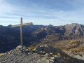
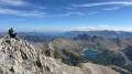
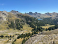
Roche Cline, starting from Villard Bas

Alternative route to the summit of Roche Cline starting from Villard Bas.

Details

n°23714406
Creation:
Last update:
Last review:
  • Walking
    Activity: Walking
  • ↔
    Distance: 5.17 mi
  • ◔
    Average duration: 4h 40 
  • ▲
    Difficulty: Moderate

  • ⚐
    Back to start: Yes
  • ↗
    Ascent: + 2,621 ft
  • ↘
    Descent: - 2,651 ft

  • ▲
    Highest point: 7,854 ft
  • ▼
    Lowest point: 5,404 ft

Description of the walk

Park in Villard Bas on the Route du Lac, 150 m past the bend.

(S/E) Walk back down the Route du Lac and, at the bend, take the Chemin du Baile opposite. Follow the yellow ‘Roche Cline’ signposts.
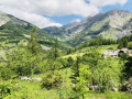
At the end of the tarmac road, continue straight ahead. The path crosses a meadow with cows. You will need to cross the electric fence several times.
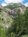
The descent towards the Ravin des Faisses is steep – take care.

(1) Cross the stream by keeping to the right and head up towards the Bois de l’Herbe Blanche.

(2) At the junction with the path coming from Allos, carry on straight ahead towards Roche Cline.

(3) Near the La Perrière Haute farm, turn left into the woods. Follow the yellow markings for Roche Cline.

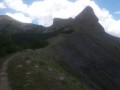
(4) As you approach the Cabane de l’Herbe Blanche, set amidst a beautiful meadow in bloom during the summer, ignore the path on the right and continue straight ahead towards Roche Cline. The path climbs gradually through the Bois de l’Herbe Blanche before winding its way through a stony area. Look ahead to see the impressive ridge of Roche Cline

(5) Once you reach the foot of Roche Cline, climb to the summit (20 mins there and back) – it’s an easy walk.

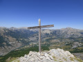
(6) At the summit (2,415 m), take in the 360° view, particularly the Val d’Allos to the west. Descend back down to the foot of Roche Cline. For the more adventurous, it is possible to continue on to the summit of Les Graus (2,549 m). Alternatively, retrace your steps along the route you took on the way up, heading towards Allos and Villard Bas (S/E).


Waypoints

  1. S/E : mi 0 - alt. 5,535 ft - Villard Bas Route du Lac
  2. 1 : mi 0.33 - alt. 5,407 ft - Torrent
  3. 2 : mi 0.86 - alt. 5,640 ft - Allos junction
  4. 3 : mi 0.91 - alt. 5,663 ft - Path to La Perrière Haute
  5. 4 : mi 1.35 - alt. 6,135 ft - Herbe Blanche Hut
  6. 5 : mi 2.47 - alt. 7,707 ft - Below Roche Cline
  7. 6 : mi 2.55 - alt. 7,854 ft - Roche Cline summit
  8. S/E : mi 5.17 - alt. 5,535 ft - Villard Bas Route du Lac

Reviews and comments

3.6 / 5
Based on 3 reviews

Reliability of the description
3.7 / 5
Ease of following the route
3 / 5
Route interest
4 / 5
Curious1
Curious1

Overall rating : 4.7 / 5

Date of your route : Jul 31, 2023
Reliability of the description : ★★★★★ Very good
Ease of following the route : ★★★★☆ Good
Route interest : ★★★★★ Very good
Very busy route : No

A lovely walk
The view at the end, taking in the whole valley, is well worth the effort of the climb.

Machine-translated

LMCC2018
LMCC2018

Overall rating : 2 / 5

Date of your route : Jul 10, 2023
Reliability of the description : ★★☆☆☆ Disappointing
Ease of following the route : ★★☆☆☆ Disappointing
Route interest : ★★☆☆☆ Disappointing
Very busy route : No

not maintained at all, low-hanging branches
path washed away by floods, poorly signposted
I didn’t finish the walk

Machine-translated

lesignal
lesignal

Overall rating : 4 / 5

Date of your route : Sep 12, 2022
Reliability of the description : ★★★★☆ Good
Ease of following the route : ★★★☆☆ Average
Route interest : ★★★★★ Very good
Very busy route : No

A lovely route, though a bit challenging towards the end, which can take you by surprise when you come face to face with Rochecline. But you just need to go round it, and from there it’s simply magnificent, with that little grassy section leading you to within 100 metres of the summit
As for the path just after Point 1, when you come out of the ravine climb, the guidebook takes you on a long circular route to the right, whereas the yellow markings (recent, I think) on the ground take you straight on to Point 2
Otherwise, a lovely walk.

Machine-translated

Other walks in the area

For more walks, use our search engine .

The GPS track and description are the property of this route's author. Please do not copy them without permission.