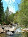
Rochecline, setting off from Val d’Allos le Village

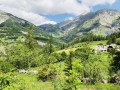
Discover the iconic peak of Val d’Allos.

Details

48840058
Creation:
Last update:
Last review:
  • Walking
    Activity: Walking
  • ↔
    Distance: 5.52 mi
  • ◔
    Average duration: 4h 55 
  • ▲
    Difficulty: Difficult

  • ⚐
    Back to start: Yes
  • ↗
    Ascent: + 2,720 ft
  • ↘
    Descent: - 2,726 ft

  • ▲
    Highest point: 7,887 ft
  • ▼
    Lowest point: 5,400 ft

Photos

Description of the walk

From Val d’Allos le Village, you’ll need to head to the hamlet of Villars Bas, which you’ll reach via a small mountain road leading to the car parks for the Mercantour National Park walks.

(S/E) The route starts at the hamlet of Villars Bas, near the hamlet of Sainte-Brigitte, which you’ll need to pass on your right to reach the Bois de l’Herbe Blanche and its ravine.

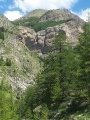
(1) The path climbs fairly steadily through the forest alongside the ravine. Continue towards the Bois de l’Herbe Blanche.

(2) Carry on straight ahead along the path through the larch forest towards the Cabane de l’Herbe Blanche.

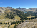
(3) It is situated at an altitude of approximately 1,867 metres. You’ll find it on your left; keep following the path through the forest. You’ll then leave the forest behind for a much rockier section of the walk, and you’ll begin to catch sight of the summit of Rochecline.

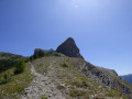
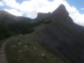
(4) Carry on along the path and admire the superb panoramic view of Rochecline. Continue along the path; it winds round the summit and passes to the left. You’ll reach a fairly challenging climb.

(5) This involves a series of short hairpin bends leading towards the summit.

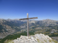
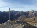
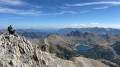
(6) After all that effort, you’ll finally reach the summit of Rochecline – take the opportunity to have a break and admire the view. The return journey follows the same route. (S/E)

Waypoints

  1. S/E : mi 0 - alt. 5,515 ft - The hamlet of Villars Bas
  2. 1 : mi 0.28 - alt. 5,463 ft - Herbe Blanche Ravine
  3. 2 : mi 0.82 - alt. 5,643 ft - Bois de l’Herbe Blanche
  4. 3 : mi 1.33 - alt. 6,125 ft - Herbe Blanche Hut
  5. 4 : mi 1.78 - alt. 6,673 ft - View of Rochecline
  6. 5 : mi 2.57 - alt. 7,703 ft - A challenging climb
  7. 6 : mi 2.69 - alt. 7,851 ft - Rochecline summit
  8. S/E : mi 5.52 - alt. 5,518 ft - The hamlet of Villars Bas

Notes

There is space to park 4–5 cars at the start.
Bring drinking water and a packed lunch.
At certain times of year, a herd may be present in these pastures.

Worth a visit

In the summer season, do take the time to stop off at the village of Allos with its bars and restaurants.
For activities, enjoy the leisure park, archery, tennis, the equestrian centre, paragliding…
And, of course, there are plenty of other walking trails.
Enquiries: Val d’Allos Tourist Office 04 92 83 02 81
www.valdallos.com

Reviews and comments

4.2 / 5
Based on 3 reviews

Reliability of the description
4.3 / 5
Ease of following the route
3.7 / 5
Route interest
4.7 / 5
Remi_22
Remi_22

Overall rating : 4 / 5

Date of your route : Dec 13, 2025
Reliability of the description : ★★★★☆ Good
Ease of following the route : ★★★☆☆ Average
Route interest : ★★★★★ Very good
Very busy route : No

Superb snowshoe hike with crampons at the end. It's a bit difficult to find the path at the beginning just after crossing the snow-covered stream in winter, but then there are tracks and you find your way. A very beautiful hike with varied views in winter and not crowded at all! I was alone on a Saturday morning and had to make my own trail in the snow at the end. It's truly magical and the views of Allos and the valley are breathtaking. You need crampons and an ice axe for the last part of the climb in winter and you should check that the snow has refrozen, so go early in the morning. I loved it, thank you for this beautiful wild hike!

Machine-translated

Val d'Allos
Val d'Allos

Hello PPJJMM,
Thank you for your valuable feedback. We will pass this information on to the trails committee.
Have a great day

Machine-translated

PPJJMM
PPJJMM

Overall rating : 3.7 / 5

Date of your route : Oct 13, 2025
Reliability of the description : ★★★★☆ Good
Ease of following the route : ★★★☆☆ Average
Route interest : ★★★★☆ Good
Very busy route : No

At the start, when crossing the stream in the small ravine, the direction is not obvious; the floods have washed everything away. Otherwise, the route is clear, and at the end of the trail, the slope is very steep

Machine-translated

Val d'Allos
Val d'Allos

Hello kiou2,
Thank you for your feedback. Rochecline is one of the iconic peaks of Val d'Allos.
Have a lovely day

Machine-translated

kiou2
kiou2
• Edited:

Overall rating : 5 / 5

Date of your route : Sep 08, 2025
Reliability of the description : ★★★★★ Very good
Ease of following the route : ★★★★★ Very good
Route interest : ★★★★★ Very good
Very busy route : No

Please note: this is a challenging hike. But it's well worth the effort! The route is well marked and varied (forest, fields, ridges, mountains).
Not very busy.

Machine-translated

Other walks in the area

For more walks, use our search engine .

The GPS track and description are the property of this route's author. Please do not copy them without permission.