Refine your search for walks in Lac d'Allos
Lac d'Allos walks
 Mont Pelat and Lac d'Allos

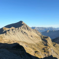
It is renowned as the easiest 3,000-metre peak in the Southern Alps. To the north, it overlooks the glacial site of Lac d'Allos, the largest high-altitude lake in Europe at 2,227 metres: Mont Pelat, in the Mercantour National Park, is the highest point in the Haut Verdon.
 Two-day circular to Mont Pelat and Le Cimet

A magnificent, challenging and breathtaking two-day circular route in the heart of the Mercantour National Park, starting from the village of Allos. The route passes by Lac d'Allos and its refuge, Mont Pelat, Lac du Trou de l'Aigle, Le Cimet and its many waterfalls, including Cascade du Pich, and the Bois de Vacheresse. You will set out to climb two peaks over 3,000 metres high: Mont Pelat (3,051 metres) and Le Cimet (3,020 metres), from which you will enjoy 360° panoramic views of the national park.
 Allos - Mont Pelat

The first part of this two-day circular is challenging and breathtaking, taking you through the heart of Mercantour National Park from the village of Allos, via Lac d'Allos and its refuge, Mont Pelat, Lac du Trou de l'Aigle, Le Cimet and its many waterfalls, including Cascade du Pich and Les Bois de Vacheresse.
Walks near Lac d'Allos
 Mont Pelat - Allos via Le Cimet

Second part of the circular. This second stage will take you to the village of Allos, starting from Mont Pelat, via the Trou de l'Aigle, the Cimet and its many waterfalls, including the Cascade du Pich and the Bois de Vacheresse.
 From Restefond to Sestrière via Cime de la Plate and Col de la Braïssa

A very beautiful high-mountain hike at the foot of Cime de la Bonette between the Alpes Maritimes and Alpes de Haute Provence. Very little traffic. Magnificent, rocky landscape. The upper Braissette lake is a very beautiful spot for bivouacking.
 Camp des Fourches - Ferrere Refuge

This first stage of the Tour du Mont Aiga starts from Camp des Fourches on the Bonette road and, via the Col des Fourches, descends into the large Salso Moreno valley, which you climb back up to the Col de Pouriac. From the Col de Pouriac, you quickly reach Bassa di Colombart and then, after a long descent through the mountain pastures, the charming village of Ferrere. You may encounter flocks of sheep in Salso Moreno and, at night, the wolves that prey on them.
 From Pra Loup 1600 via Coste Belle to La Dalle en Pente
A good walk to work up an appetite! Set off from Pra Loup to the La Dalle en Pente restaurant and return via the Chappe chairlift.
 Saint-Étienne-de-Tinée - Rabuons Refuge

This first stage will take you to the Rabuons refuge, on the shores of the largest lake in the Alpes Maritimes.
The landscape is very rocky. You will meet many Italians, as there are several refuges just across the border offering beautiful routes via the nearby Pas de l'Ischiator.
