Country:

 City:
City:


Start from the Favars town hall car park.
(S/E) Join the D130 and turn right towards Les Alleux. Take the first left, towards the cemetery. Continue along a path not shown on the map. Head down into the forest, join another path and follow it to the left.
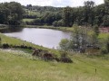
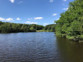
(1) At the Étang des Pradeaux, take the road on the left. Pass a house called La Garenne. At the Fork in the road shortly afterwards, follow the left-hand road for about 50 metres.
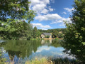
(2) Then take a path that descends to the left. Walk past a house and head down along the edge of the fields to the Moulin Bas pond. Cross the stream and head back up the road. At the junction, take the road on the right and continue uphill.
(3) Carry on along the road until you reach the Fork in the road just ahead.
(4) Then take the road leading down to the right. Carry on straight ahead, leaving the road towards Champagnac on your right.
(5) At the next junction, turn right towards Le Canal (the sign may be obscured by a bin). After about fifty metres, take the first path on the left, which descends slightly through the forest to a road. Follow this road to the left.
(6) Immediately afterwards, and before the sign for “Le Monet Vieux”, take the path on the left at an acute angle, which climbs into the woods. Further on, the path descends gently to Femblat.
(7) Take the road that descends opposite the track, towards La Gane. Walk past the houses on your left.
(8) After a wide bend to the left, take the path on the left which runs above the stream. When you reach the road, follow it to the right downhill.
(9) About a hundred metres past the junction and after crossing a stream, turn left and head uphill along a path that isn’t shown on the map at first.
(10) When you see a corrugated iron building on the left, take the path leading down to the right. Follow this path along the hillside until you reach the D1 road.
(11) Follow the D1 uphill to the left. At the junction, carry on straight ahead, still on the D1, towards Venarsal. Pass through the hamlet of Les Veyssières.
(12) Leave the road leading down towards Les Vidales on your right and, immediately afterwards, take a path that climbs up to the left. Carry on almost as far as the forest and, at the 407-metre mark, turn right and follow a barely marked track between the fields which passes above the houses. Continue, leaving a track that climbs to your left, and descend to the hamlet of Jourzat (the track does not follow the map’s route exactly).
(13) Join the D1 road and follow it downhill to the left. At the start of a wide right-hand bend, leave the road and take the path climbing up to the left. Cross a road and continue straight on along the path. Pass two paths not shown on the map on your left. Cross a stream and you’ll immediately come to a crossroads.
(14) Take the path on the left. You’ll come out onto a road (elevation 388) and follow it to the left. Carry on straight ahead, passing the hamlets of Les Gouttes and Les Pouges.
(15) At the junction, take the road on the right towards Lavert. At the next junction (elevation 415), turn left. Pass through Lavert and arrive at a junction you passed on the way there.
(4) Follow the road to the right for about fifty metres.
(3) Take the first path on the right that leads up into the forest (again, the map is inaccurate here). Pass a path on the right that isn’t shown on the map, then a path on the left that is shown.
(16) Follow the D130 road to the left towards Favars.
(17) After a right-hand bend going downhill, take a path on the left that runs alongside the road. You’ll come out onto another road; follow it to the left for just under a hundred metres.
(18) Take a small road on the left, then the first path on the left, and you’ll reach the miraculous fountain. Retrace your steps.
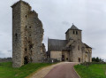
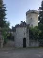
(18) Continue left along the road and, immediately opposite the castle, turn right and head up the Route du Château, ignoring the side streets on the right. Carry on along the D130 until you reach the Favars town hall car park on the right (S/E).


 Visorando Member
 Easy
Easy