Around Saint-Germain-les-Vergnes

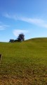
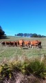
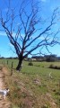
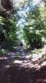
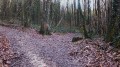
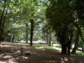
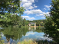
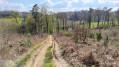
A short, twenty-minute walk from Malemort-sur-Corrèze, which is pleasant as it is partly shaded and partly sunny. There are a few sections on roads, but there are lovely woodlands and meadows.

Details

374416
Creation:
Last update:
Last review:
  • Walking
    Activity: Walking
  • ↔
    Distance: 4.36 mi
  • ◔
    Average duration: 2h 20 
  • ▲
    Difficulty: Easy

  • ⚐
    Back to start: Yes
  • ↗
    Ascent: + 374 ft
  • ↘
    Descent: - 381 ft

  • ▲
    Highest point: 1,355 ft
  • ▼
    Lowest point: 1,076 ft

Photos

Description of the walk

Access: To reach the starting point from Brive/Malemort, take the D44 at the roundabout after McDonald’s, pass Sainte-Féréole and turn left at the second roundabout towards Saint-Germain-les-Vergnes. Take the road opposite the roundabout at the village entrance and park in the Place de la Mairie (former vicarage).

(S/E) With your back to the town hall, take the road straight ahead and turn right immediately, then follow the road past the school and carry on to the next junction.

(1) Turn right onto a road (D9) with a wide pavement, which you follow until you reach the edge of the village.

(2) As soon as the pavement ends, turn right between a house and a Green Cross set on a stone (partly hidden by vegetation). Continue along this path through the woodland, which ends at a tarmac road near a large building – the hamlet of Le Giroir – on your right. Carry on along this road, then, as the road curves to the left, turn right onto a small road (for about 50 metres) which seems to lead to a white house. Be careful not to go all the way to the next junction (20 metres), which you’ll take on the way back.

(3) Go round the back of the house along the path that continues to the right.
Carry on along this path, which passes through a farm; walk past the sheds on the left and rejoin the path across the meadows.

(4) The path becomes tarmac at the crossroads. Turn left into the hamlet. On leaving, follow the wide path straight ahead which descends towards the motorway (which you can hear very clearly!). Continue along this path, which curves slightly to the left through the woods and takes you to the hamlet of Les Vergnes.

(3) Back at the white house, take the small road opposite to the crossroads and turn right, then immediately left onto a larger road (D170) which leads you to a roundabout.

(5) Go round the roundabout on the right, heading towards Sain-Pardoux and Sadroc (D156), then past the stadium and on to Chadebec. Follow the road to Chadebec.

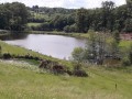
(6) Turn left between a white house and a barn/stable. Follow a path that descends into a small valley. After the first pond, leave the path on your right and continue straight ahead. Pass a (dry) pond on your right. You’ll rejoin the tarmac road as you enter Saint-Germain-les-Vergnes.

(1) Cross the D9 to rejoin Rue de l’École, then arrive at the town hall (S/E).

Waypoints

  1. S/E : mi 0 - alt. 1,240 ft - Place de la Mairie (former presbytery)
  2. 1 : mi 0.15 - alt. 1,220 ft - Crossroads, turn right
  3. 2 : mi 0.36 - alt. 1,207 ft - La Jugie
  4. 3 : mi 1.06 - alt. 1,237 ft - Junction for the circular loop
  5. 4 : mi 1.8 - alt. 1,309 ft - To the left
  6. 5 : mi 2.87 - alt. 1,184 ft - Roundabout
  7. 6 : mi 3.36 - alt. 1,168 ft - To the left
  8. S/E : mi 4.36 - alt. 1,243 ft - Place de la Mairie (former presbytery)

Notes

Walk completed in 1 hour 45 minutes at a fairly slow pace.

Reviews and comments

4 / 5
Based on 4 reviews

Reliability of the description
4.8 / 5
Ease of following the route
4 / 5
Route interest
3.3 / 5
User 3147286

Overall rating : 4 / 5

Date of your route : Jul 13, 2026
Reliability of the description : ★★★★★ Very good
Ease of following the route : ★★★★☆ Good
Route interest : ★★★☆☆ Average
Very busy route : No

Route familiale, facile

Machine-translated

User 28451208

Overall rating : 4.3 / 5

Date of your route : Feb 09, 2026
Reliability of the description : ★★★★★ Very good
Ease of following the route : ★★★★☆ Good
Route interest : ★★★★☆ Good
Very busy route : No

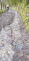
A very difficult muddy section in Chadebec. Otherwise, a great route.

Machine-translated

aneva19/63
aneva19/63

Overall rating : 4 / 5

Date of your route : Jun 08, 2020
Reliability of the description : ★★★★★ Very good
Ease of following the route : ★★★★☆ Good
Route interest : ★★★☆☆ Average
Very busy route : No

An easy, pleasant and well-signposted walk. The only downside is at the start: with your back to the town hall, it depends on where you stand. From the town hall, head straight towards the school; after that, everything is signposted in yellow. It takes about 2 hours at a normal walking pace.

Machine-translated

LAVCOR1319mazeyr
LAVCOR1319mazeyr

Overall rating : 3.7 / 5

Date of your route : Nov 26, 2017
Reliability of the description : ★★★★☆ Good
Ease of following the route : ★★★★☆ Good
Route interest : ★★★☆☆ Average

Confusion in the meadows on the way from Le Giroir to Villiéras.
The final section of the route is the most interesting (finish at Chadebec).

Machine-translated

Other walks in the area

For more walks, use our search engine .

The GPS track and description are the property of this route's author. Please do not copy them without permission.