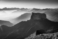
But de Nève

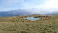
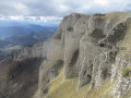
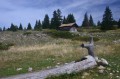
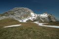
Situated at the southernmost tip of the Montagne de Nève, the But de Nève offers an exceptional panoramic view of the Drôme valley.

Details

3759358
Creation:
Last update:
Last review:
  • Walking
    Activity: Walking
  • ↔
    Distance: 4.68 mi
  • ◔
    Average duration: 3h 20 
  • ▲
    Difficulty: Moderate

  • ⚐
    Back to start: Yes
  • ↗
    Ascent: + 1,398 ft
  • ↘
    Descent: - 1,401 ft

  • ▲
    Highest point: 5,420 ft
  • ▼
    Lowest point: 4,019 ft

Photos

Description of the walk

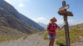
On the road (D76) between the Col du Rousset and Vassieux-en-Vercors, park at the Col Saint-Alexis.

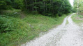
(S/E) Take the track opposite the car park and follow it to a three-way junction.

(1) Take the path that starts on the left. This turns into a dry riverbed.

(2) At the three-way junction, follow the left-hand branch and head towards marker 58 (red).

(3) Shortly afterwards, turn onto a dirt track for cars coming from the Col de Chironne. Continue the climb until you reach the edge of the woodland.

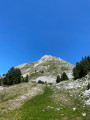
(4) Carry on across the upper part of the mountain pasture and reach the summit.
As you approach the summit, on emerging from the forest, in summer it is not uncommon to come across a Patou (a herd protection dog) guarding the flock of goats and sheep. It will certainly bark, as that is its role as a guardian; do not appear threatening, and simply walk around it calmly.

(5) From the summit of But de Nève, retrace your steps to the edge of the forest.

(4) Take the dirt track suitable for cars, ignore a turn-off to the left and continue to the next junction (before joining theGR®).

(6) Turn right at a hairpin bend onto a disused track that follows the contour line. This track is a little overgrown but passable. Follow it until you rejoin the track you took earlier.

(2) Continue downhill along the route in the opposite direction to Col Saint-Alexis (S/E).

Waypoints

  1. S/E : mi 0 - alt. 4,022 ft - Col de Saint-Alexis (1222m)
  2. 1 : mi 0.55 - alt. 4,278 ft - Three-way junction, path on the left
  3. 2 : mi 0.94 - alt. 4,685 ft - Three-way junction, left
  4. 3 : mi 1.21 - alt. 4,879 ft - Marker 58 Red
  5. 4 : mi 1.6 - alt. 5,095 ft - Exit from the woods
  6. 5 : mi 2.12 - alt. 5,397 ft - But de Nève 1656
  7. 6 : mi 2.97 - alt. 4,859 ft - Junction, turn right
  8. S/E : mi 4.68 - alt. 4,019 ft - Col Saint-Alexis

Always be cautious and plan ahead when you're outdoors. Visorando and the author of this route cannot be held responsible for any accidents occurring on this route.

The GR® and PR® markings are the intellectual property of the Fédération Française de Randonnée Pédestre.

Reviews and comments

3.9 / 5
Based on 4 reviews

Reliability of the description
3.7 / 5
Ease of following the route
3 / 5
Route interest
5 / 5
FDHS
FDHS
• Edited:

Overall rating : 3.7 / 5

Date of your route : Aug 16, 2025
Reliability of the description : ★★★★☆ Good
Ease of following the route : ★★☆☆☆ Disappointing
Route interest : ★★★★★ Very good
Very busy route : No

While the goal (nice pun) of this hike is worthy of the greatest interest, I am more reserved about the proposed route. The trail between points 1 and 4 is of no particular interest. It is difficult to walk on, unmarked and sometimes hard to follow, especially between points 3 and 4: two fallen trees in the middle of the path and, on the left, what appears to be a path that could easily lead hikers astray. When you reach point 4, the trail disappears completely. Furthermore, the distance of 7.5 km is underestimated; this hike is more like 9 to 10 km (estimated because we did not return via the suggested route, as the trail from point 6 seemed even less passable than the climb).
My advice (but this is only my opinion). At point 1, continue along the forest road for about 3 kilometres, then take a well-marked path on the left. This will take you to point 4. Return via the same route. Total distance: 12 to 13 km (estimated using my GPS watch, bearing in mind that I did not mark the points precisely).
Thanks anyway for the view from the top.

Machine-translated

cathyferrer
cathyferrer

Overall rating : 4.5 / 5

Date of your route : Aug 03, 2025
Reliability of the description : Not used / Not applicable
Ease of following the route : ★★★★☆ Good
Route interest : ★★★★★ Very good
Very busy route : No

Truly a magnificent hiking destination. After passing through the forest and reaching the meadow and then the summit of But de Nève, the view over the entire Vercors is breathtaking.
Throughout the meadow, you walk through the grass on sheep pasture, although we didn't see any sheep at all.
The wind was so strong that we didn't get too close to the edge of the cliff at the summit.
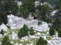
We didn't take the return route via points 6, 2 and 1, but continued on from point 6 towards the Col de Chironne to discover the rocky south face with the caves of the But de Nève, returning via the main path on the left at an altitude of 1,409 metres, which took us back to the Col de St Alexis.
The description of the route is sketchy on unmarked trails and you'll need a GPS to find your way in the forest, as it's easier to follow the ridge to the summit in the final meadow.
A very interesting route as it is quite short from St Alexis BUT: To be done with a GPS and especially not in foggy weather as the final section can be tricky to navigate.
I am attaching photos of this magnificent place.
Thanks to the author.

Machine-translated

vincent martine
vincent martine

Overall rating : 3.7 / 5

Date of your route : Aug 28, 2022
Reliability of the description : ★★★☆☆ Average
Ease of following the route : ★★★☆☆ Average
Route interest : ★★★★★ Very good
Very busy route : No

I wanted to warn anyone planning to do this walk that there are no signposts – in other words, at the first Fork in the road where you’re supposed to take the path on the left?! – it’s absolutely impossible to spot
You really need to pay close attention at the start of this walk!!!
After that, you walk through a forest and it’s a bit monotonous, but when you reach the summit you’re rewarded with a magnificent 360° view, just as Visorando describes
There’s no danger from the Patou dogs as they’re kept in a pen
So I’d recommend this walk for the final stretch, and I’d like to thank Visorando, but you simply can’t do it without a GPS

Machine-translated

Nico et Peggy
Nico et Peggy

Overall rating : 4 / 5

Date of your route : Jul 21, 2022
Reliability of the description : ★★★★☆ Good
Ease of following the route : ★★★☆☆ Average
Route interest : ★★★★★ Very good
Very busy route : No

The climb through the forest was at times difficult to follow. The paths aren’t always clearly marked, but with the help of the app and GPS, we managed to follow them more or less. Once out of the forest, the climb to the Nève viewpoint was straightforward.
The view from the But de Nève is magnificent!!! A 360° panorama. Best enjoyed on a clear, cloudless day.
The return route is easier to follow via the circular route.
Definitely worth doing as a family.

Machine-translated

Other walks in the area

For more walks, use our search engine .

The GPS track and description are the property of this route's author. Please do not copy them without permission.