Raissac – Gréoulou – Tanière circular loop

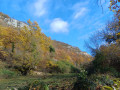
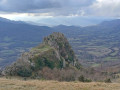
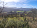
A lovely walk through the Plantaurel Massif, offering splendid views of the Pyrenees to the south and the Garonne plain to the north.

Details

n°69746879
Creation:
Last update:
Last review:
  • Walking
    Activity: Walking
  • ↔
    Distance: 6.52 mi
  • ◔
    Average duration: 4h 15 
  • ▲
    Difficulty: Moderate

  • ⚐
    Back to start: Yes
  • ↗
    Ascent: + 1,434 ft
  • ↘
    Descent: - 1,427 ft

  • ▲
    Highest point: 2,694 ft
  • ▼
    Lowest point: 1,519 ft

Photos

Description of the walk

Park near the church in the hamlet of Raissac. 

(S/E) Walk through the hamlet heading north and go straight up the hill. There are markings on the trees and on the ground as this is a trail route.

(1) At the junction, turn right onto the path which climbs steeply.

(2) Once you reach the ridge, turn left, heading north-west, and make your way to the top of the hamlet of Le Gréoulou, passing via the Cap de la Monge.

(3) Turn left and join the GR® du Pays d’Olmes: marked with yellow and red signs.

(4) Head left, heading west, and reach the hamlet of Cazal in the commune of Ilhat.

(5) Turn left, pass close to the church and the cemetery, and head down to Tanière. 

(6) When you reach the road (D10), turn right. Follow it for about 100 m to cross the hamlet, then take the path leading down to the left.

(7) When you reach the road, turn left as you head downhill. Cross the Douctouyre via the Pont de la Pichole and continue for about a hundred metres. 

(8) Take the path on the left and follow the stream flowing on your left. Cross the stream and head uphill to reach a junction a short distance from the quarry. 

(9) Turn right, then left, and head uphill towards Péreille-d’en-bas. Pass the church and the cemetery and carry straight on. 

(10) At the junction, stay on the road that climbs to the left towards the north-west. Walk past the orientation board , from where you can see the Péreille Gorges and the various peaks of the Tabe Massif: Mont Fourcat, Pic du Han, Saint-Barthélémy and the Monts d’Olmes ski resort. 

(11) At the bottom of the hill, turn left then right to join the D10. Cross the road carefully to return to the car park (S/E). 

Waypoints

  1. S/E : mi 0 - alt. 1,909 ft - The hamlet of Raissac
  2. 1 : mi 0.17 - alt. 2,110 ft - Junction
  3. 2 : mi 0.62 - alt. 2,677 ft - Plantaurel Ridge
  4. 3 : mi 1.13 - alt. 2,536 ft - The hamlet of Gréoulou
  5. 4 : mi 1.79 - alt. 2,385 ft - GR junction in the Pays d’Olmes
  6. 5 : mi 2.92 - alt. 1,722 ft - Cazal hamlet
  7. 6 : mi 3.62 - alt. 1,686 ft - Entrance to the hamlet of Tanière
  8. 7 : mi 3.79 - alt. 1,581 ft - Exit from the hamlet of Tanière
  9. 8 : mi 4.06 - alt. 1,558 ft - Path on the left
  10. 9 : mi 4.99 - alt. 1,778 ft - Entrance to the Péreille Gorges
  11. 10 : mi 5.42 - alt. 2,024 ft - Péreille-d’en-bas - Croix de Péreille
  12. 11 : mi 6.39 - alt. 1,916 ft - Junction
  13. S/E : mi 6.52 - alt. 1,909 ft - The hamlet of Raissac

Always be cautious and plan ahead when you're outdoors. Visorando and the author of this route cannot be held responsible for any accidents occurring on this route.

The GR® and PR® markings are the intellectual property of the Fédération Française de Randonnée Pédestre.

Reviews and comments

3.7 / 5
Based on 3 reviews

Reliability of the description
3.7 / 5
Ease of following the route
3.3 / 5
Route interest
4 / 5
Barric31
Barric31

Overall rating : 3.3 / 5

Date of your route : May 24, 2026
Reliability of the description : ★★★☆☆ Average
Ease of following the route : ★★★☆☆ Average
Route interest : ★★★★☆ Good
Very busy route : No

It’s impossible to park in Raissac; there’s no public car park. In the end, we managed to park at the junction of the D310 and the Route de Raissac; otherwise, you can drive up the D310 – there are spaces a little further up, and it’s on the way back.
Apart from this minor inconvenience, the walk is lovely, but a sat-nav is essential! Beautiful view from the hamlet of Péreille from below.

Machine-translated

Nikos84
Nikos84

Hello, the route is not necessarily marked, so you need to follow the GPS track. Sorry you had to turn back halfway.

Machine-translated

mamina
mamina

Mistake at point 2, located far to the left. Put back on the right track at point 3 by locals. Difficult to find point 4, marked by a branch lifting a wire. Impossible to find point 5, so we turned back. No markings. Too bad.

Machine-translated

fred09300
fred09300

Overall rating : 3.7 / 5

Date of your route : May 30, 2025
Reliability of the description : ★★★★☆ Good
Ease of following the route : ★★★☆☆ Average
Route interest : ★★★★☆ Good
Very busy route : No

A beautiful hike, especially at the end of the gorges. A stunning view of the valley as you leave the village of
Pereille d'en Bas.
The route is shaded almost all the way.
A few difficulties in some places finding the path despite the GPS track. Had to turn off twice but without any major consequences.

Machine-translated

AACR
AACR

Overall rating : 4 / 5

Date of your route : Mar 06, 2025
Reliability of the description : ★★★★☆ Good
Ease of following the route : ★★★★☆ Good
Route interest : ★★★★☆ Good
Very busy route : No

A good climb to start with.
At point 2, we headed down towards Greoulou – a lovely viewpoint beneath the pigeon loft.
We made our way back up via the Richard ruins.
We rejoined the original route, adding 1.5 km to the walk.
Varied landscapes and beautiful views of the snow-capped Monts d’Olmes.
Down in the valley, you can hear the noise from the quarry.
But a very pleasant walk

Machine-translated

Other walks in the area

For more walks, use our search engine .

The GPS track and description are the property of this route's author. Please do not copy them without permission.