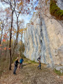
Sautel–Lieurac circular loop

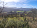
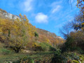
The first half of the walk takes place at the bottom of the valley and passes through fields, meadows and the Ruisseau du Sautel. It then climbs steadily up the hillsides, offering sweeping views of the valley, particularly when the trees are bare. This means that, in summer, you’ll be walking in the shade for the second half of the route.

Details

44727873
Creation:
Last update:
Last review:
  • Walking
    Activity: Walking
  • ↔
    Distance: 2.92 mi
  • ◔
    Average duration: 1h 40 
  • ▲
    Difficulty: Easy

  • ⚐
    Back to start: Yes
  • ↗
    Ascent: + 377 ft
  • ↘
    Descent: - 377 ft

  • ▲
    Highest point: 1,591 ft
  • ▼
    Lowest point: 1,181 ft
  • ⚐ Country: France
  • ⚐
    Area: Pyrenees
  • ⚐ City: Sautel (09300)
  • ⚑
    Start/End: N 42.976223° / E 1.809164°
  • ❏
    IGN map(s): Ref. 2147ET, 2247OT
  • Hour-by-hour weather

Photos

Description of the walk

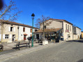
You can park at Place de l’Hort, opposite the café “Au D1”.

(S/E) Turn right onto the D1 and follow it for 100 m towards Lieurac. Turn right at the War Memorial; you’ll pass some picnic tables and a small bridge.

(1) After the rubbish bins, turn left. The path leads through fields and meadows and runs alongside the Ruisseau du Sautel.

(2) Carry straight on. At the second bridge, stay on the right-hand side of the stream without crossing it and join a tarmac road (D12).

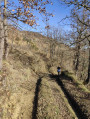
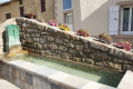
(3) Turn right straight away to take a look at Lieurac’s municipal wash house. Cross the grassy area without returning to the main road to join the steep path that winds its way uphill. During the winter months, the view is always unobstructed. At other times of year, there are sometimes lovely views through the trees and you’ll be walking mostly in the shade. After the water tower, the track turns into a footpath and continues to climb.

(4) The path finally levels out and reaches a junction (elevation 484).

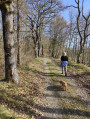
(5) Keep to the right and follow the path, which descends steadily and sharply for some time.

(1) Carry on straight ahead, pass the rubbish bins again, then turn slightly left before the D1 to quickly reach the car park. If time allows, you can enjoy a drink on the café terrace (S/E).

Waypoints

  1. S/E : mi 0 - alt. 1,296 ft - Place de l’Hort
  2. 1 : mi 0.17 - alt. 1,280 ft - Junction of the circular loop
  3. 2 : mi 0.93 - alt. 1,201 ft - Crossroads
  4. 3 : mi 1.27 - alt. 1,184 ft - D12
  5. 4 : mi 2.06 - alt. 1,555 ft - High point
  6. 5 : mi 2.4 - alt. 1,575 ft - Junction, start of descent
  7. S/E : mi 2.92 - alt. 1,296 ft - Place de l’Hort

Worth a visit

Reviews and comments

4.4 / 5
Based on 3 reviews

Reliability of the description
4.7 / 5
Ease of following the route
4.7 / 5
Route interest
4 / 5
Patou des Pyrénées
Patou des Pyrénées

Overall rating : 4 / 5

Date of your route : Jun 23, 2024
Reliability of the description : ★★★★☆ Good
Ease of following the route : ★★★★★ Very good
Route interest : ★★★☆☆ Average
Very busy route : No

A pleasant walk if you’re short on time. It takes just over an hour at a fairly brisk pace.

Machine-translated

Dorca
Dorca

Overall rating : 5 / 5

Date of your route : Feb 27, 2024
Reliability of the description : ★★★★★ Very good
Ease of following the route : ★★★★★ Very good
Route interest : ★★★★★ Very good
Very busy route : No

A wonderful walk with views over the valley – a real treat. Many thanks.

Machine-translated

AILGOF
AILGOF

Overall rating : 4.3 / 5

Date of your route : Feb 22, 2024
Reliability of the description : ★★★★★ Very good
Ease of following the route : ★★★★☆ Good
Route interest : ★★★★☆ Good
Very busy route : No

A pleasant family walk, with lovely views from the hilltops; a bit muddy towards the end of the route.

Machine-translated

Other walks in the area

For more walks, use our search engine .

The GPS track and description are the property of this route's author. Please do not copy them without permission.