Raissac circular walk starting from Lavelanet

A short circular walk passing through Raissac and Lavelanet via the Crête du Plantaurel, with stunning views of the surrounding area. Best undertaken on a clear day to make the most of the panorama. Can be done at a run as it partly follows a trail route.

Details

64729874
Creation:
Last update:
Last review:
  • Walking
    Activity: Walking
  • ↔
    Distance: 5.87 mi
  • ◔
    Average duration: 3h 30 
  • ▲
    Difficulty: Moderate

  • ⚐
    Back to start: Yes
  • ↗
    Ascent: + 951 ft
  • ↘
    Descent: - 981 ft

  • ▲
    Highest point: 2,690 ft
  • ▼
    Lowest point: 1,732 ft

Description of the walk

Park in the car park near the tennis courts in the Chaubets neighbourhood.

(S/E) Head towards Lavelanet along Rue des Sartrous until you reach a junction just before the Super U roundabout.

(1) Keep left on this street until you reach the Cambière cemetery.

(2) Walk along the left-hand side of the cemetery and continue straight on. You’ll come alongside the D10, then turn right to join it at the entrance to the hamlet of Raissac.

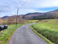
(3) Cross the departmental road, then pass through the hamlet of Raissac and begin a steep climb through the forest to reach the summit of the Plantaurel ridges.

(3) Turn 90° to the right and descend the ridge to the Sainte-Ruffine Chapel: panoramic view.

(4) Head down to the right along a steep slope. You’ll come out onto Rue Pasteur; carry straight on until you reach the junction with Rue Victor Hugo.

(5) Turn right onto it and walk alongside the Bensa cemetery. When the street bends to the left (small car park), veer to the right to continue along Rue Félix Garrigou. Pass Place du 19 Mars 1962 and then reach Avenue Léon Blum (D117).

(6) Follow this avenue to the right until you reach the Super U roundabout. Turn right to return to the first junction you came across at the start.

(1) Turn left and follow the route you took on the way there in the opposite direction to return to the car park (S/E).


Waypoints

  1. S/E : mi 0 - alt. 1,834 ft - Chaubets Tennis Centre car park
  2. 1 : mi 0.28 - alt. 1,824 ft - Crossroads marking the end of the circular loop
  3. 2 : mi 0.71 - alt. 1,772 ft - Cambière Cemetery
  4. 3 : mi 2.74 - alt. 2,674 ft - Plantaurel Ridge
  5. 4 : mi 4.5 - alt. 2,034 ft - Sainte-Ruffine Chapel overlooking the
  6. 5 : mi 4.84 - alt. 1,732 ft - Rue Victor Hugo
  7. 6 : mi 5.31 - alt. 1,788 ft - Avenue Léon Blum
  8. S/E : mi 5.87 - alt. 1,834 ft - Chaubets Tennis Courts car park

Worth a visit

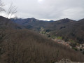
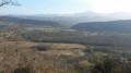
Between (3) and (4), on the ridge, enjoy a stunning view over the northern valleys of the area.

(4) Sainte-Ruffine Chapel: stop off to enjoy the view over Lavelanet and the surrounding area, with a map showing Pic Saint-Barthélémy, Soularac, Mont Fourcat, La Frau, etc.

Reviews and comments

3.8 / 5
Based on 3 reviews

Reliability of the description
4 / 5
Ease of following the route
3 / 5
Route interest
4.3 / 5
MariellePaysdOlmes
MariellePaysdOlmes

Overall rating : 5 / 5

Date of your route : Aug 09, 2026
Reliability of the description : ★★★★★ Very good
Ease of following the route : ★★★★★ Very good
Route interest : ★★★★★ Very good
Very busy route : No

A very lovely walk (the section we did was Raissac to the ridges); the slope is steep, but the view from the ridges is well worth the effort.

As the start point was a bit tricky to find, here’s an alternative: Park next to the town hall or just above it, near the picnic table. Walk round the first barn near the town hall towards Foix, then follow the path to the right of the fenced-off field. The climb takes you to a small gate; carry on straight ahead at the crossroads.

Please note that the ridges are narrow in places; this route is not recommended for those who suffer from vertigo or have balance issues.

The best views are undoubtedly in autumn or winter, as the vegetation is dense. A lovely spot to watch the sunset

Please be mindful of the risk of fire: smoking in the forest is prohibited, and this walk takes place largely within a beautiful forest with a rich biodiversity that must be protected

Machine-translated

User 26983973

Overall rating : 4 / 5

Date of your route : Aug 04, 2025
Reliability of the description : ★★★★☆ Good
Ease of following the route : ★★★☆☆ Average
Route interest : ★★★★★ Very good
Very busy route : No

Good route.
Once you know that the markings are red/pink, it's easy to find your way around.
The path is wild at the end of the route.
Took 3 hours, taking my time.

Great experience

Machine-translated

Nikos84
Nikos84

Hello Rapid92. I’m sorry you weren’t able to complete the route. I don’t understand where you got stuck, as there’s no castle on this route – I’ve done it several times in both directions, in different seasons, either walking or running (except for the climb up to Raissac!).

Machine-translated

rapid92
rapid92

Overall rating : 2.3 / 5

Date of your route : Jul 14, 2025
Reliability of the description : ★★★☆☆ Average
Ease of following the route : ★☆☆☆☆ Very disappointing
Route interest : ★★★☆☆ Average
Very busy route : No

Very beautiful route to the castle, but after that it's difficult with no signposts and nature has taken over. It's straight ahead, impossible to pass

Machine-translated

Other walks in the area

For more walks, use our search engine .

The GPS track and description are the property of this route's author. Please do not copy them without permission.