Jeurre – Montcusel circular loop

The first 5 kilometres of this route follow the River Bienne and are relatively flat.
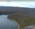
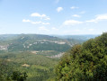
A good warm-up before tackling the steep climb to the hang-gliding launch site, which offers lovely views over Lake Coiselet. The descent via Grand Serve is gentler than the climb and allows you to make your way back to the car at a leisurely pace.

Details

n°3354240
Creation:
Last update:
Last review:
  • Walking
    Activity: Walking
  • ↔
    Distance: 10.61 mi
  • ◔
    Average duration: 6h 15 
  • ▲
    Difficulty: Difficult

  • ⚐
    Back to start: Yes
  • ↗
    Ascent: + 1,585 ft
  • ↘
    Descent: - 1,572 ft

  • ▲
    Highest point: 2,382 ft
  • ▼
    Lowest point: 1,033 ft

Photos

Description of the walk

To get to the starting point, head towards Jeurre. A car-sharing car park is located at the bottom of the D27, just before the bridge over the Bienne.
The start is 150 metres further along the D27, heading uphill.

(S/E) At the ‘La Ranche’ signpost, head towards Lavencia Épercy along the road for 150 metres, then turn left onto the path marked in yellow and red.
Stay on this path running alongside the river until you reach the hamlet of Épercy.

(1) At the junction with the D357, head north for 150 metres, then take the path climbing west-north-west towards Montcusel, following the yellow markings. Take two hairpin bends, one to the left followed by another to the right; take care here as there are several forest tracks that are not shown on the map. You will reach another junction of paths.

(2) Turn left towards the west, then south-west, still following the yellow markings. Stay on this path for about 2 km until you reach the signpost for Le Cul de l’Appa.

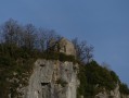
(3) Head due south towards Montcusel-La Niella. Continue to the paragliding and hang-gliding take-off site. Take a moment here to enjoy the superb view.

(4) Continue slightly uphill to reach the village of Montcusel.

(5) At the entrance to the village, turn right and head east towards Grand Serve. Take care to stay on the right path as there are no signposts. Continue to the entrance to Grand Serve.

(6) Turn left at the pétanque court. Continue along Rue du Catallier to the last house. After the last house, at the bend, turn right onto the path through the woodland to the north-east. You’ll reach a crossroads of paths.

(7) Turn right and continue down the slope until you pass directly beneath the power line.

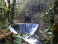
(8) Turn left onto the stony path and head down into the Bois de la Goulette. You’ll reach the Cascade de Douvre.

(9) Continue along the road to easily find the Jeurre car-share car park (S/E).

Waypoints

  1. S/E : mi 0 - alt. 1,070 ft - Jeurre car-share car park. Path towards the - Bienne (rivière)
  2. 1 : mi 3.03 - alt. 1,083 ft - Épercy
  3. 2 : mi 4.29 - alt. 1,703 ft - Trail junction
  4. 3 : mi 5.46 - alt. 2,142 ft - Signpost for Le Cul de l’Appa
  5. 4 : mi 6.68 - alt. 2,165 ft - Paragliding and hang-gliding launch site
  6. 5 : mi 7.55 - alt. 2,096 ft - Montcusel
  7. 6 : mi 7.96 - alt. 2,382 ft - Grand Serve
  8. 7 : mi 8.46 - alt. 2,188 ft - Trail junction
  9. 8 : mi 9.11 - alt. 1,709 ft - Power line
  10. 9 : mi 9.89 - alt. 1,115 ft - Douvre Waterfall
  11. S/E : mi 10.61 - alt. 1,070 ft - Reach the start by road

Notes

- To view the car park and starting point, click here

- There are no water points along the route
- Make sure you wear suitable footwear; the ground is stony and slippery in wet weather.

Worth a visit

Paragliding launch site at Montcusel.
Douvre Waterfall

Reviews and comments

5 / 5
Based on 1 review

Reliability of the description
5 / 5
Ease of following the route
5 / 5
Route interest
5 / 5
alainc5939
alainc5939
• Edited:

Good evening, and thank you for your feedback.
I hope you didn’t suffer too much from the heat.
Have a lovely evening
Alain

Machine-translated

philogum39
philogum39

Overall rating : 5 / 5

Date of your route : Jul 21, 2020
Reliability of the description : ★★★★★ Very good
Ease of following the route : ★★★★★ Very good
Route interest : ★★★★★ Very good
Very busy route : No

A very enjoyable walk.

Machine-translated

Other walks in the area

For more walks, use our search engine .

The GPS track and description are the property of this route's author. Please do not copy them without permission.