Country:
 City:
City:



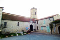
Parking is available in the village square, in front of the town hall.
(S/E) Leave the square and turn right onto the road leading downhill for about a hundred metres; then, opposite a large cypress tree, turn left onto Chemin de la Tuilerie, C4. Continue downhill, cross the bridge over the Ruisseau de Mons, then head uphill to the hamlet of La Tuilerie on the left.
(1) Continue uphill along the road to the right for just over a kilometre, passing the hamlets of Gaudoux and Peyrolade, then Rioua.
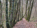
(2) Just before the top of the hill, turn left onto the path markedGR® 652, signposted in white and red or blue. Follow this path for two kilometres until you reach the D282.
(3) Follow it to the left for 300 metres, until you reach the Moirax road (D268).
(4) Follow the road to the right.
(5) Just after the hamlet of Grande Borde, carry on straight ahead along the road.
(6) Turn left onto Route de Daubèze. Pass the old Daubèze Mill and, on a clear day, look out for the Pyrenees mountain range on your left. You’ll come to a fork in the road.
(7) Turn left onto the path towards the hamlet of Cureton. Pass through it, then veer left onto a grassy path until you reach an old cemetery.
(8) Take the grassy path marked in white and red on the left, running alongside a hedge, which climbs up to the D268, which you took on the way there.
(5) Turn right, heading in the opposite direction to the outward journey, towards La Romieu.
(4) Continue carefully along the D268 for just over a kilometre until you reach a cross on the left.
(9) Then turn left onto the stony or grassy track for about one kilometre. Pass the hamlet of Saint-Joseph, leaving the road to Monplaisir on your left, and carry on to the original junction.
(1) Turn right, heading in the opposite direction to the outward journey, passing the hamlet of La Tuilerie once more to reach the village square in Pergain-Taillac (S/E).

 Visorando Member
 Easy
Easy