Around Marmont-Pachas

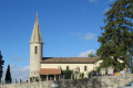
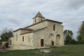
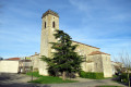
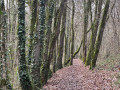
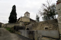
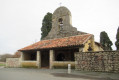
Starting from the church in Pachas, in the commune of Marmont-Pachas, this route—half of which follows theGR®652, the Way of St James from Rocamadour—offers sweeping views of the surrounding hillsides.

Details

n°28353087
Creation:
Last update:
Last review:
  • Walking
    Activity: Walking
  • ↔
    Distance: 5.99 mi
  • ◔
    Average duration: 3h 15 
  • ▲
    Difficulty: Easy

  • ⚐
    Back to start: Yes
  • ↗
    Ascent: + 597 ft
  • ↘
    Descent: - 594 ft

  • ▲
    Highest point: 630 ft
  • ▼
    Lowest point: 338 ft

Photos

Description of the walk

Park in the car park opposite the church in Pachas.

(S/E) Leave the car park via the road you arrived on, heading to the right, and continue to the Route de La Romieu.
Cross the road and follow it to the left for about twenty metres, then turn right onto the VC4, the Chemin des Pyrénées, marked with blue signposts, which turns left towards the D15.

(1) At this junction, at the ‘Give Way’ sign, turn right and follow the road to the hamlet of La Rigaudière.

(2) After the hamlet, turn left onto the Chemin d’Amans (VC1) and continue along this road, which crosses the Ruisseau d’Amans and joins the Chemin des Aouillés.

(3) Turn right onto this path marked Blue and White/RedGR® 652. In front of the house in the hamlet of Les Aouillés, take the grassy path leading uphill to the right, following the blue markings, and continue to the D15.

(4) Cross the road and continue straight ahead onto the Chemin de Rivière. At the house in Rivière, where the road bends to the left, head down the dirt track opposite, marked in blue. After a descent to the Ruisseau de Brousse and a climb back up the dirt track, 100 m past a solitary oak tree, you’ll reach the road.

(5) Pass the signs for Juncas and Barberoux on your left and continue along the ascending road for 200 m.
At the left-hand bend in the road (Blue Cross), take the dirt track running along the edge of the hedge to the right, marked with blue and white/red signposts.

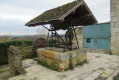
(6) Pass a water source and continue along the dirt track leading uphill opposite.

(7) Leave the marked routes (blue and white/red) to your left and turn right onto the road leading up to Pachas (S/E).

Waypoints

  1. S/E : mi 0 - alt. 623 ft - Car park - Église Notre-Dame (Pachas)
  2. 1 : mi 0.47 - alt. 545 ft - D15 road (Route d’Astaffort)
  3. 2 : mi 0.81 - alt. 509 ft - Amans Path
  4. 3 : mi 1.67 - alt. 341 ft - Chemin des Aouillés
  5. 4 : mi 2.23 - alt. 502 ft - Crossing the D15
  6. 5 : mi 3.19 - alt. 430 ft - Small road
  7. 6 : mi 3.89 - alt. 374 ft - Crossroads – Water source
  8. 7 : mi 4.76 - alt. 518 ft - D282 road
  9. S/E : mi 5.99 - alt. 623 ft - Car park - Église Notre-Dame (Pachas)

Worth a visit

This route, which runs partly along roads and offers little shade, is suitable for wet weather.

Always be cautious and plan ahead when you're outdoors. Visorando and the author of this route cannot be held responsible for any accidents occurring on this route.

The GR® and PR® markings are the intellectual property of the Fédération Française de Randonnée Pédestre.

Reviews and comments

4.2 / 5
Based on 2 reviews

Reliability of the description
4.5 / 5
Ease of following the route
4.5 / 5
Route interest
3.5 / 5
titouver
titouver

Overall rating : 3.7 / 5

Date of your route : Apr 30, 2024
Reliability of the description : ★★★★☆ Good
Ease of following the route : ★★★★☆ Good
Route interest : ★★★☆☆ Average
Very busy route : No

a bit too much tarmac and lots of large fields

Machine-translated

jo47
jo47

Overall rating : 4.7 / 5

Date of your route : Jun 17, 2023
Reliability of the description : ★★★★★ Very good
Ease of following the route : ★★★★★ Very good
Route interest : ★★★★☆ Good
Very busy route : No

I thought it was an IGPN, but it wasn’t. It was the first time I’d used the app and I liked it

Machine-translated

Other walks in the area

For more walks, use our search engine .

The GPS track and description are the property of this route's author. Please do not copy them without permission.