Country:
 City:
City:


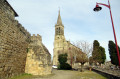

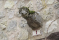
(S/E) From the church car park, enter the village via Rue Grande, skirting the old castle tower – of which a gargoyle remains on the left – and noting the half-timbered houses on the right.
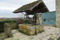
Cross Place du Général Lagrange on the left, noting the old well and the old hand-operated fire pump on the right, then follow Rue des Couteliers to reach the town hall and its promontory, which offers sweeping views over the valley.
Walk down the street opposite to the D284 and turn left behind the wayside cross onto Chemin de Ronde.
(1) Head down to the right along the Chemin de Leyreté Bourg.
Ignore a path on the right – this will be the route back. At the end of the road, continue along the stony then grassy path which passes to the left of the hamlet of Leyreté.
At the end of the descent, cross the bridge over the Leyreté Stream and continue to the right, following the bank of the stream.
(2) At the three-way junction, leave the stream on your right and take the grassy path leading uphill to the left. Pass by the Pagine house and continue along the stony path
(3) At the three-way junction, where the path meets theGR® de Pays de Gascogne trail (marked in yellow and red), follow this white track to the right until you reach the D248, an ancient Roman road.
(4) When you reach the D248, an ancient Roman road, cross carefully and walk along the verge for about a hundred metres. Cross the bridge and turn immediately left towards Labat on theGR® de Gascogne, marked in yellow and red. After passing the house in the hamlet of Labat, continue along the edge of a hedge and the Ruisseau de Leyreté until you reach a road.
.
(5) Turn right towards Le Grand Couloumé. Pass through this hamlet, then turn off towards Tey to reach the hamlet of Prieu. Pass through this hamlet; part of the road here is private property but open to walkers. Please respect the local area. Continue along the road climbing to the right.
(6) Turn right towards Encons, continue along this track and pass through the hamlet of Aux Quatre Vents.
(7) At a bend, where the power line leaves the road, turn right onto the grassy path running alongside a hedge for 100 m, then turn left and then right again.
(8) Before the Tuilerie house, on private land, turn left onto the dirt track before the piles of wood to reach the D248 road; cross it carefully and take the gravelled track opposite towards Peyrolis. Before the Peyrolis house, turn left onto the grassy track.
Walk past the sewage treatment plant and continue along the stony track until you reach a road; turn left onto it to head back up to the village and return to the starting point (S/E).

 Visorando Member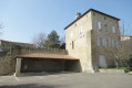
 Moderate

 Difficult