Around Jouy

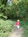
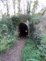
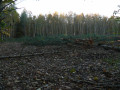
A varied walk: woods, fields, village (road), river, watermills, church, etc. This gentle circular walk features just one short climb.
You can reach the start by car at the entrance to the village.
You can also join the walk from Jouy station (700 m): see Practical Information.

Details

32470154
Creation:
Last update:
Last review:
  • Walking
    Activity: Walking
  • ↔
    Distance: 4.24 mi
  • ◔
    Average duration: 2h 05 
  • ▲
    Difficulty: Easy

  • ⚐
    Back to start: Yes
  • ↗
    Ascent: + 138 ft
  • ↘
    Descent: - 125 ft

  • ▲
    Highest point: 492 ft
  • ▼
    Lowest point: 361 ft
  • ⚐ Country: France
  • ⚐ City: Jouy (28300)
  • ⚑
    Start/End: N 48.502612° / E 1.537876°
  • ❏
    IGN map(s): Ref. 2116O
  • Hour-by-hour weather

Description of the walk

The starting point is on Rue Jean-Pierre Grange de Jouy, at the entrance to the village. There are a few parking spaces near No. 36 (a beautiful house).

(S/E) Take Chemin des Moulins Neufs and, once at the end, turn left onto the dirt track. The route follows a fairly picturesque footpath. Cross the River Eure and join Avenue de Chardon.

(1) Turn left towards the village centre and continue straight on along Rue du Fossé Bourg. Then go round the church on the left, passing close to the war memorial, then turn right onto Avenue de la Gare and follow it for about fifty metres.

(2) Cross at the pedestrian crossing to join Rue du Bout aux Anglois. Continue to the junction opposite the Étang de la Digue.

(3) Take the road on the left which forms part of the GR® pilgrimage route to Santiago de Compostela. After the sewage treatment works, turn left to cross the branches of the River Eure and join Rue du Bout d’Anguy. Turn left and follow this road until the second street on the right, Rue de la Croix.

(4) Turn onto this street, keep left at the three-way junction, then turn left onto Rue de la Dalonne. Walk through a residential area and emerge onto Rue de Berchères.

(5) Turn left, then turn right at the corner by the cemetery to walk alongside it and continue across the fields. Go through a small wood, continue along the tarmac road in the same direction and arrive at Rue Saint-Rémy.

(6) Turn right, then immediately left, staying on the GR® which follows Rue de Picdais and continues along a path leading into a small wood. Then head straight on across the fields.

(7) Please note: this section is not signposted. Turn left to head down into a small wood and reach the houses. Continue straight on along Rue des Moulins Neufs, then turn left at the junction with Rue Jean-Pierre Grange to reach the car park (S/E).

Waypoints

  1. S/E : mi 0 - alt. 377 ft - Rue Jean-Pierre Grange
  2. 1 : mi 0.93 - alt. 371 ft - Avenue de Chardon - Eure (rivière)
  3. 2 : mi 1.22 - alt. 367 ft - Rue du Bout aux Anglois
  4. 3 : mi 1.77 - alt. 364 ft - Étang de la Digue, junction with the GR® Compostelle
  5. 4 : mi 2.31 - alt. 407 ft - Rue de la Croix
  6. 5 : mi 2.87 - alt. 453 ft - Rue de Berchères
  7. 6 : mi 3.27 - alt. 387 ft - Rue Saint-Rémy
  8. 7 : mi 3.92 - alt. 489 ft - Junction, turn left
  9. S/E : mi 4.24 - alt. 377 ft - Rue Jean-Pierre Grange

Notes

A gentle walk: a pair of trainers is all you need, along with water: there are no places to buy refreshments along the route.

You can reach the start by car at the entrance to the village.

You can also join the walk from Jouy station (700 m) if you’re travelling by train. Turn left as you leave the station and follow Avenue de la Gare, which leads to the church. Join the route again at point (2).

Always be cautious and plan ahead when you're outdoors. Visorando and the author of this route cannot be held responsible for any accidents occurring on this route.

The GR® and PR® markings are the intellectual property of the Fédération Française de Randonnée Pédestre.

Reviews and comments

4 / 5
Based on 4 reviews

Reliability of the description
4.3 / 5
Ease of following the route
4.5 / 5
Route interest
3.3 / 5
EH
EH

Overall rating : 3.3 / 5

Date of your route : Jan 04, 2025
Reliability of the description : ★★★☆☆ Average
Ease of following the route : ★★★★☆ Good
Route interest : ★★★☆☆ Average
Very busy route : No

It’s a shame to have to go through the housing estate. The town centre is more picturesque (even without pavements).
Towards the end of the route, the route isn’t very well signposted but is easy to find.

Machine-translated

Jean LEF
Jean LEF

Overall rating : 4 / 5

Date of your route : Jan 22, 2024
Reliability of the description : ★★★★★ Very good
Ease of following the route : ★★★★★ Very good
Route interest : ★★☆☆☆ Disappointing
Very busy route : No

The route is on tarmac for half the time.
Passes through the housing estates around Jouy.
Meh.

Machine-translated

eclo5326
eclo5326
• Edited:

Overall rating : 4.7 / 5

Date of your route : Jun 11, 2023
Reliability of the description : ★★★★★ Very good
Ease of following the route : ★★★★★ Very good
Route interest : ★★★★☆ Good
Very busy route : No

No particular problems.
Covered in 1 hour 22 minutes at an average speed of 5 km/h according to the GPS.
6.8 km, according to it.

Machine-translated

Mimich
Mimich
• Edited:

Overall rating : 4 / 5

Date of your route : May 19, 2023
Reliability of the description : ★★★★☆ Good
Ease of following the route : ★★★★☆ Good
Route interest : ★★★★☆ Good
Very busy route : No

Please note that the final section of the route may seem long and far away, but do stay on the path, as it’s actually a quick walk (about a quarter of an hour).

Machine-translated

Other walks in the area

For more walks, use our search engine .

The GPS track and description are the property of this route's author. Please do not copy them without permission.