Country:
 City:
City:


Park in the car park behind the church.
(S/E) Walk past the church on your right, go down the street, then turn right into Rue du Lavoir until you reach the D33 or Rue du Moulin. Follow this road to the left.
(1) Turn right onto Rue de Bettemay (MTB signpost 18).
(2) Leave the road and take the path leading straight uphill, ignoring the one that veers off to the right.
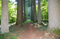
(3) Turn right, following a hedge before entering the woods. The track turns left and heads east.
(4) Turn left (MTB signpost 18) and continue to an MTB signpost with a stone marker.
(5) Walk for about thirty metres, then turn right at right angles through the woods, as the path has become overgrown and is barely visible. Walk for about 150 metres to reach a forest track, which you follow by turning left. You’ll reach the RD33.
(6) Follow it to the right for about 100 metres.
(7) Leave the road and head left towards the cemetery. Continue on this way towards the church and the town hall, before heading down towards Chagny by turning left at the town hall.
(8) At the junction, carry on to the left and, at the end of the tarmac road, turn right onto a downhill track.
(9) At the end of the descent, turn left and carry on straight ahead.
(10) Head left towards Chagny. When you reach the first houses, turn right towards the church and the car park (S/E).

 Visorando Member
 Moderate
  Local authority