Country:

 City:
City:


The route starts from the Vaugneray walkers’ car park. You can access it either via Boulevard des Lavandières or via Chemin de la Garenne. The walkers’ car park is a large, free car park. It has two picnic tables and a drinking water tap.
The starting point is accessible by public transport via bus No. 147, getting off at the “Place de Verdun” stop, which is 350 m from the car park.
Before setting off on your walk, you can consult the large information boards for the circular route of the Val Noir located in the car park.
(S/E) As you leave the car park, take Chemin de la Garenne on your left, heading uphill, and continue along Rue du Babillon to the left. At the Stop sign, cross the road and go straight on along Chemin de la Maletière. Pass between Saint-Antoine Church and the Clinique de l’Ouest Lyonnais (signpost). Continue uphill along Rue de la Maletière.
(1) At the crossroads with a cross, head straight on along Chemin du Laval for 430 m, then take the dirt track to the right (a hairpin bend), Chemin de la Goyette, for 230 m. At the end of this track, turn right onto the tarmac road, Rue du Recret, then left onto Chemin des Gouttes. You will arrive at the Clos des Visitandines (signpost).
(2) 20 m further on, turn left onto the Voie Romaine, where you’ll find another signpost. Continue along this tarmac road for 370 m until you reach Rue du Recret again, then turn right. Further up, turn left onto Chemin de Montferrat and, 330 m further on, you’ll come to a junction.
(3) Carry on by turning right onto the path towards “Col de la Luère – Roche Coucou”. At the end of this stony path, 200 m on, turn left onto the tarmac road, Chemin de Saint-Bonnet.
(4) After 480 m, the road gives way to a dirt track. Follow it straight on. Pass the Roche Coucou orientation table, which offers a 180° north-south panorama stretching as far as the Alps.
Carry on straight ahead along the dirt track, skirting the Roche Coucou campsite. Along the way, you’ll come across an information board about the nursery, featuring fir, spruce and Douglas fir. At the next junction, cross the crossroads, then carry on straight ahead. You’ll arrive at a Red Cross.
(5) Carry on straight ahead, passing to the left of the cross. Stay on this path to reach the Château de Saint-Bonnet-le-Froid (altitude 756 m).
(6) Just before the road, near the ruins where you can take a rest, turn left onto the very pleasant dirt track towards ‘la Berlandine – le Col de Malval’.
(7) At the next junction, 420 m further on, carry straight on along the circular Boucle du Val Noir. You are now on the unpaved forest track heading towards the Col de Malval. On your right, walk alongside rocks and Scots pines. You’ll also come across a bench set against the holly. A little further on, look out for some pretty little huts made from coloured ribbons. It’s a lovely spot for a picnic.
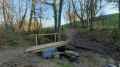
(8) After 1 km along this stony path, you’ll reach the Col de Malval at an altitude of 732 m, where there’s a major junction. To continue along the circular Boucle du Val Noir, cross the junction (watch out for cars) and take the path opposite, to the right of the restaurant Le Domaine de Malval, behind the Courzieu sign. It is tarmac at first, then turns to a dirt track 20 metres further on. Carry on straight ahead.
Take note of these pretty stone walls, which date back several centuries. The climb is steep but steady.
(9) At the end of this track, 840 m from the Col de Malval, cross the D113 road. Take the tarmac road opposite, heading towards the hamlet of Les Jumeaux. A little further down, you’ll find a marker on the beech tree.
(10) 340 m from the information board, further down, you’ll reach a junction. To continue the Val Noir circular route, carry on along the road leading to the hamlet of Les Jumeaux, which you’ll pass through.
A little further down, carry on straight ahead along the Chemin des Jumeaux and then along the Chemin du Soupat. Further on, you’ll see a cross above the entrance to a property. On the path, you’ll also notice an old stone-built basin on your right, dating back over 200 years.
(11) 550 m past the farmhouse with a small cross on the roof, take the hairpin bend to the right. Enjoy the lovely panoramic view. At the junction, turn left onto a path and, after 480 m, follow the road downhill to your left.
(12) Just after this, you’ll come to an orientation table. Take in the beautiful panoramic view over Lyon and as far as the Alps. Further to the right, you’ll see the confluence, the River Rhône, and perhaps even further afield depending on the time of day and the weather.
Opposite the orientation table, take the path leading down. “320 m further on, you’ll find the information board on the megaliths.” Carry on straight ahead for 140 m until you reach the next junction, at Piraluron (altitude 674 m).
(13) To continue the Bal Noir circular route, carry on straight ahead. On this path you’ll find a lovely viewpoint over the village of Yzeron, Le Carmel and the Py-Froid ridge. 500 m further down, take the tarmac road on the left. Then, further down, walk past the Biojolais farm and take the road to the right, then immediately left onto the same tarmac road. A little further on, enjoy the beautiful panoramic view of Fourvière, Lyon with its three tall towers, and the Alps.
(14) When the road bends to the right, pay close attention and take the very inconspicuous stony path in front of you, which descends for about thirty metres. At the bottom, cross the D489 (caution: dangerous crossing) and continue along the path opposite.
The path descends to the left, running almost parallel to the road. At the bottom, continue along this path, which takes a hairpin bend to the right and then enters the woods. Follow the main path as it turns to the left. Carry on until you reach the tarmacked section. You’ve now reached Les Adrets. Follow the road to the bridge.
(15) Cross the bridge over the River Yzeron. You can see fish ladders installed on either side of the bridge. From the bridge, continue for 180 m to the Chemin de la Coursière d’Yzeron. Keep the road on your left.
(16) Turn right at the Fork in the road with the Chemin de la Grande Serve. (On this path, you can read and listen to the information panel on ‘La Grande Serve’ and the one on ‘The well on the Chemin de la Grande Serve’ from the Saint-Laurent-de-Vaux school as part of the ‘À petits pas’ trail.) At the end of the tarmac road, you’ll find yourself at La Mitonnière. Note the cross on your right.
(17) Continue along the Grande Boucle du Val Noir by taking the road to the right. At La Plantée, 170 metres further on, after the glass recycling point, take the path to the right and head uphill towards the Bois du Faix. The tarmac road turns into a stony track that climbs up to the dolmen. The climb is steep but steady.
Carry on straight ahead, ignoring the two paths branching off to the left, then the one on the right, until you reach the signpost marked ‘Le dolmen’.
(18) Continue along the path, turning left. A little further on, the dolmen and its stone bench will be on your left. Carry on to the junction a little further on and turn right.
(19) After 780 m, carry on along the tarmac road on the left, cross it, then take the path leading uphill just to the right, then veer right again. Walk past the goat shed. After 200 m, rejoin the tarmac road on your left, then carry on straight ahead for 360 m until you reach the Route du Cholly. Take in the lovely views of the village of Vaugneray and the Clinique de l’Ouest Lyonnais.
(20) At the signpost ‘Le Plat de Saint-Romain’, at the fork, take the left-hand road towards ‘Le Plat de Saint-Romain’, and carry on straight ahead for 520 metres along the road until you reach the Croix du Plat de Saint-Romain.
(21) At this junction, for the Boucle du Val Noir, carry on straight ahead along the tarmac road to the left of the cross. Along the way, enjoy the panoramic view of Vaugneray and, a little further on, Lyon. Continue along this road for approximately 1 km.
(22) At the junction with a path on the left, carry on along the road for a further 30 m, then leave the tarmac road and turn right onto the stony Piragoy path (altitude 532 m), which leads downhill. At the end of this path, directly ahead and slightly to the right, you’ll see the Messimy orientation table. Turn left onto the tarmac road towards Vaugneray ‘Le Montus’.
80 metres further on, at the fire hydrant, turn onto the dirt track on the right. Along the way, enjoy the view over Messimy, the Boiron factory, La Duchère, the Alps and, on the other side, Vaugneray.
You’ll also find an information board on the chestnut tree.
(23) Further down, 30 metres past the ‘Le Montus’ signpost, at the fork, carry straight on.
(24) At the crossroads, to continue following the Boucle du Val Noir, walk past the Croix de Chatanay and head down the tarmac road for 750 m until you reach the crossroads with a stone cross (Croix du Chemin des Granges).
(25) Turn left towards Vaugneray and continue along this road for 800 m. Along the way, you’ll come across an information board about Japanese knotweed.
(26) At the junction with the D50 road, turn left (watch out for cars). After 170 m, take the wooden steps on the left, just after the Pont Pinay, which lead down to the Yzeron. You are now at the confluence of the Yzeron and the Dronau. Take the path leading uphill to the right, alongside the Dronau (Chemin de l’Aube Rose) for 700 m until you reach the departmental road.
(27) Cross the road (watch out for cars), turn right and walk along the pavement past the Renault garage until you reach the next pedestrian crossing 190 metres further on. Take the
second pedestrian crossing to cross the D489 again and head down Chemin de la Guise towards the nursery. Walk past the nursery, then carry on straight on to the end of this path where you’ll come to the D50 road leading to Brindas.
(28) Cross the D50 (watch out for cars). Follow Chemin des Barcelles, which runs between two houses, to the River Yzeron. You’ll see the SAGYRC sign as you approach the river.
(29) Leave the footbridge on your right and walk along the river on your right-hand side. You’ll see the sluice gate 270 m further on and, 1 km ahead, you’ll reach the signpost marking the fishing spot.
(30) 110 metres after the noticeboard, take the path up to the left, which is a bit steep but short. Cross a field – where you can see the noticeboard about ragweed – and a vineyard plot to reach Chemin du Vallier, which you take on the right. Shortly afterwards, you will also find the noticeboard for the hamlet of Les Aiguillons.
(31) At the Fork in the road, head diagonally left along the road to reach Chemin de la Charlisse on the left, which you follow until you reach the D489, crossing it with care.
On the other side of the road, almost directly opposite, take the path leading to the Voie Verte. You are now on the original route of the Tutu. Look out for the information board at La Halte along the way. Continue straight on, passing the boules court and sports fields on your right, until you reach the ‘InterValle’ theatre. Carry on straight ahead until you reach the road.
(32) Turn left onto the Chemin du Stade (on the pavement) until you reach the junction with Rue du Michon, then carry on straight ahead until you reach the Route de Pollionnay (D70).
(33) Cross via the pedestrian crossing on the left, leave Rue du Recret on your left and head up across the field opposite to reach the war memorial. Look out for the information panel about this war memorial along the way. Walk round the monument and turn left onto the tarmac road, Rue du Monument.
(34) At the junction of Rue du Monument and Rue du Recret, look out for the information board on the round stone. To continue the Grand Circular Route du Val Noir, walk 50 metres up Rue du Recret on your right, then turn left onto Chemin des Demoiselles.
(1) At the end of this path, turn sharp left onto Rue de la Maletière, which leads down to the centre of Vaugneray. At the junction between Rue de Malval and Rue du Babillon, carry straight on between the butcher’s and the bakery, then take Rue de la Garenne to the right at the Fork in the road. 75 metres further down, turn right one last time to return to the walkers’ car park (S/E).
We hope you’ve enjoyed exploring our village and perhaps made a few discoveries along the way. Have a safe journey home and do come back whenever you like – you’ll always be welcome.


 Visorando Member
 Average
 Difficult

 Easy
Easy