Petit Salignac circular loop

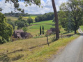
Beautiful panoramic views around the River Beune. A pleasant walk through countryside and woodland, offering a chance to discover the fully restored rural heritage.

Details

6887930
Creation:
Last update:
Last review:
  • Walking
    Activity: Walking
  • ↔
    Distance: 6.17 mi
  • ◔
    Average duration: 3h 30 
  • ▲
    Difficulty: Moderate

  • ⚐
    Back to start: Yes
  • ↗
    Ascent: + 768 ft
  • ↘
    Descent: - 771 ft

  • ▲
    Highest point: 722 ft
  • ▼
    Lowest point: 377 ft

Description of the walk

Start and finish at the Tamniès football pitch along the River Beune, with easy parking.

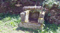
(S/E) Take the road on your right and, before the junction with the D48, take the small path on your left which runs alongside the goat enclosure to the wash house.

Take the path that climbs up to the left onto the D48 and cross over. Then take the path (to the left) directly ahead of you, which leads up towards Tamniès Church. You may wish to visit it and admire its slate roof.

(2) Opposite the hotel, take the path on the left towards La Mérique. At the end of this path, turn left and head downhill. At the next junction, turn right and head uphill to reach the hamlet of Escamps. Continue on to reach the highest point at a crossroads.

(4) Turn left onto this path and head towards Petit Salignac. Walk through the village and, a little further on, you’ll reach a road junction.

(5) At the junction, turn left, leave the road, then turn right and walk through the hamlet of La Brunerie. Continue on to reach the hamlet of Le Breuil.

(6) Before the last house on the cul-de-sac, take the path on the left and follow the road down until you reach the D48.

(7) Take the D48 to the right, then take the next road on the left. After the farm on your left, take the first road on the left and head up to Le Bousquet and La Malonie.

(8) After the tobacco drying shed, turn left onto the Route de Tamniès towards Lamonzie.

(9) At the three larch trees, turn left and take the Chemin des Martres.

(10) Before the first house, take the path on the right. Walk along the meadow and enter the woods. Cross the woods and follow the path down to the next house. At the hamlet of Rivière, take the road on your right and continue straight on along the path to the football pitch.

(S/E) Tamniès football pitch

Waypoints

  1. S/E : mi 0 - alt. 427 ft - Tamniès football pitch. Cross the - Beune (rivière) - Affluent de la Vézère
  2. 1 : mi 0.29 - alt. 433 ft - D48 – cross over and head back up the path
  3. 2 : mi 0.58 - alt. 623 ft - Car park – possible start and finish point - Église Saint-Cybard (Tamniès)
  4. 3 : mi 0.71 - alt. 525 ft
  5. 4 : mi 1.75 - alt. 676 ft - Crossroads towards Petit Salignac
  6. 5 : mi 2.34 - alt. 620 ft - Road junction
  7. 6 : mi 2.85 - alt. 666 ft - Le Breuil
  8. 7 : mi 3.28 - alt. 390 ft - D48 road
  9. 8 : mi 4.74 - alt. 722 ft - at the junction on the left – tobacco drying shed
  10. 9 : mi 4.96 - alt. 702 ft - Three Larch Trees
  11. 10 : mi 5.12 - alt. 679 ft - path on the right before the house
  12. S/E : mi 6.17 - alt. 430 ft - Tamniès football pitch

Reviews and comments

4 / 5
Based on 4 reviews

Reliability of the description
4.3 / 5
Ease of following the route
4 / 5
Route interest
3.8 / 5
User 27603678

Overall rating : 4.7 / 5

Date of your route : Nov 25, 2025
Reliability of the description : ★★★★★ Very good
Ease of following the route : ★★★★☆ Good
Route interest : ★★★★★ Very good
Very busy route : Yes

Very pleasant route

Machine-translated

jano le doc
jano le doc

Overall rating : 3.3 / 5

Date of your route : Nov 05, 2025
Reliability of the description : ★★★★☆ Good
Ease of following the route : ★★★☆☆ Average
Route interest : ★★★☆☆ Average
Very busy route : No

We went hiking on Wednesday afternoon. The route wasn't very easy to follow, partly our fault, as we wanted to take a few small paths through the woods., lots of tarmac, but beautiful scenery, numerous GARIOTTES, an easy route, very good for a leisurely stroll.

Machine-translated

sergeDANY
sergeDANY

Overall rating : 4 / 5

Date of your route : Jun 04, 2022
Reliability of the description : ★★★★☆ Good
Ease of following the route : ★★★★★ Very good
Route interest : ★★★☆☆ Average
Very busy route : No

It’s a shame there’s too much driving involved , with its magnificent scenery; Sergedany with a group of walkers

Machine-translated

Celineetfrederic
Celineetfrederic

Overall rating : 4 / 5

Date of your route : Aug 16, 2021
Reliability of the description : ★★★★☆ Good
Ease of following the route : ★★★★☆ Good
Route interest : ★★★★☆ Good
Very busy route : No

There are some lovely landscapes, particularly the unobstructed views of the valleys from the hillsides, but most of the route is along roads.

Machine-translated

Other walks in the area

For more walks, use our search engine .

The GPS track and description are the property of this route's author. Please do not copy them without permission.