The Turançonnaise Circular Route

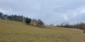
You’ll enjoy magnificent views of the Manoir de Costeperrier and the Valojoulx fish reserve, with the forest as a backdrop.

Details

40024539
Creation:
Last update:
Last review:
  • Walking
    Activity: Walking
  • ↔
    Distance: 5.86 mi
  • ◔
    Average duration: 3h 10 
  • ▲
    Difficulty: Easy

  • ⚐
    Back to start: Yes
  • ↗
    Ascent: + 568 ft
  • ↘
    Descent: - 568 ft

  • ▲
    Highest point: 850 ft
  • ▼
    Lowest point: 367 ft

Description of the walk

From the hiking information point at the Montignac Tourist Office, head towards Sarlat via the D704, continue for 7 km and turn right. The village of La Chapelle-Aubareil is 2 km away. The route starts at the Place du Multiple Rural.

(S/E) With the church on your left, take Rue de la Tour opposite, heading towards Montignac. Leave the village and turn left towards the hamlet of l’Air.

(1) Turn left behind the houses towards Valojoulx. Continue down into the valley where the Turançon flows (fish reserve). Keep going straight on until you reach the road, then turn right onto the Route des Moulins.

(2) Turn right and pass the Moulin de Madame (a large house at the corner of the cobbled path). Follow the Chemin des Étangs, passing the ponds, to reach the Route au lavoir des Moussaries or Route de Lascaux.

(3) Turn right towards La Chapelle Aubareil (local road no. 1), then take the cobbled path on the left leading to Le Castanet. Pass through the hamlet, ignoring two paths on the left, until you reach a crossroads.

(4) Take the path on the left to the hamlet of La Sagne and the Route du Posadou.

(5) Turn right towards the hamlet and cross it, turning left at the bend. Turn immediately right onto a track leading to some houses, then continue along the left-hand path until you reach a fork in the bend.

(6) Turn right to head back up towards the gas pipeline. Join the road when you reach the hamlet known as La Ferranterie. Turn left and continue until you reach the track called Impasse du Fond du Coffre.

(7) Turn right onto it, continue for 50 metres, then turn left until you reach the road.

(8) Take this on the right until you reach the hamlet of Le Terme Rouge; just before the hamlet, turn left onto Rue de la Renarderie.

(9) Follow it to the right to head back towards the village. Finally, continue to the right, past the cemetery, along Rue de la Tour until you return to the starting point (S/E).


Waypoints

  1. S/E : mi 0 - alt. 843 ft - Signpost at Place du Multiple Rural
  2. 1 : mi 0.59 - alt. 771 ft - L’Air – Fork in the road
  3. 2 : mi 1.92 - alt. 367 ft - T-junction. Chemin des Étangs - Turançon (cours d'eau) - Affluent de la Vézère
  4. 3 : mi 3.03 - alt. 446 ft - T-junction. Route de Lascaux - Turançon (cours d'eau) - Affluent de la Vézère
  5. 4 : mi 3.82 - alt. 712 ft - T-junction
  6. 5 : mi 4.11 - alt. 650 ft - T-junction. Route du Posadou
  7. 6 : mi 4.56 - alt. 659 ft - Junction
  8. 7 : mi 5.06 - alt. 823 ft - T-junction. Impasse de Fond du Coffre
  9. 8 : mi 5.25 - alt. 804 ft - Junction. Route de la Fageolle
  10. 9 : mi 5.58 - alt. 820 ft - T-junction. Rue de la Renarderie
  11. S/E : mi 5.86 - alt. 843 ft - Signpost at Place du Multiple Rural

Worth a visit

(S/E) Visit the village of La Chapelle-Aubareil.
(1) Walk past the 18th-century Manoir de l’Air and admire the recently restored Manoir de Costeperrier.

Reviews and comments

4.8 / 5
Based on 2 reviews

Reliability of the description
5 / 5
Ease of following the route
5 / 5
Route interest
4.5 / 5
ARTCODA
ARTCODA

Overall rating : 5 / 5

Date of your route : Jan 28, 2025
Reliability of the description : ★★★★★ Very good
Ease of following the route : ★★★★★ Very good
Route interest : ★★★★★ Very good
Very busy route : Yes

This route is very well-maintained and offers plenty of variety, with some lovely hamlets to discover!
It’s suitable for a wide range of people.

Machine-translated

houbahop
houbahop
• Edited:

Overall rating : 4.7 / 5

Date of your route : Sep 05, 2024
Reliability of the description : ★★★★★ Very good
Ease of following the route : ★★★★★ Very good
Route interest : ★★★★☆ Good
Very busy route : No

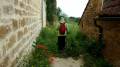
A 3-hour walk (including a lunch break) with no real difficulty. It’s very well signposted. There are few sections on roads, which is great. All changes of direction are clearly marked. You just need to watch out for the first left-hand turn in the hamlet of L’Air. The yellow signpost is on the left in a small recess. We were looking at the houses and ended up missing it! So we walked an extra 50 metres, but it wasn’t a big deal in the end. You’re often in the forest and/or on sunken paths, so there aren’t any unobstructed views of the surroundings, but you’re surrounded by greenery and it’s peaceful, so it’s lovely.

Machine-translated

Other walks in the area

For more walks, use our search engine .

The GPS track and description are the property of this route's author. Please do not copy them without permission.