Country:

 City:
City:


From Montignac, follow the D65 for 9 km, downstream from the bridge along the left bank of the Vézère, towards Sergeac. At the junction with the Tamniès road, turn left and continue for 1 km to the hamlet of La Voulperie.
(S/E) In the hamlet of La Voulperie, take the yellow-marked path on the right. Follow it to the Seignolle valley, a small stream that flows into the Vézère. Walk up the valley to the small pond.
(1) At the crossroads, turn right, go round the pond, follow the path and, at the next junction, take the path that climbs up the hillside to the ridge and its crossroads.
(2) Turn right, heading uphill through the woods, until you reach the cultivated plateau and the road.
(3) At the junction with the tarmac-surfaced local road, turn left towards the hamlet of Caillou Haut. Walk through the hamlet and continue to a fork in the path, 200 metres further on.
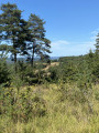
(4) A panoramic view of the region opens up. Follow the bend to the left; the stony path winds across the plateau through oak woods and tall heather. Pass the hamlet of Les Brandes on your right and continue along the path to the junction with the Chemin de la Voulperie.
(5) Continue to the right, ignoring the path on the left. Return to the starting point at La Voulperie with a sweeping view of the Vézère valley, including Belcayre Castle and the village of Sergeac (S/E).


 Tourist office
 Moderate