Country:

 City:
City:


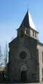
Start from the square in front of Sainte-Colombe church.
(S/E) Take the road leading down towards La Rouqueyrie.
(1) Turn left towards Mas Del Blat. Pass the hamlet on your left, then take the path leading down to your right and follow it for 500m.
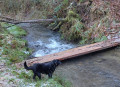
(2) Take the path leading down to the right, cross the stream and follow the path back up. At the junction with a wider path, turn right and head back up to the road.
(3) At the road, turn right then take the first road on the left. Continue to a fork in the road (altitude 479m) and carry on to the right for 250m.
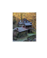
(4) At the right-hand bend, take the path on the left and follow it to the Goule mill (the path is not shown on the IGN map). Turn right onto the road, cross the stream, then turn left towards Cantagrel.
(5) Continue along the stony path that climbs. You will reach the hamlet of Arides. Before the last buildings, take the road that climbs to the left. At a bend, on the right as you climb, take the path that leads straight ahead. At the junction, continue straight ahead, then at the next one, turn left towards the hamlet of Lascombelles. Walk through it.
(6) At the next junction, turn left and follow the path downhill (part of which is not shown on the IGN map). Pass a path on the left, then continue along the road to return to the starting point (S/E).



 Visorando Member
 Association / Club / Walk leader
 Easy
Easy