Country:

 City:
City:


To reach the start of the walk, you can park in the car park at the entrance to Les Hières: please note, there is no car park on the way out of the village.
It is also possible to drive up to the Clot du Plot car park: the road is suitable for all types of car, but I personally prefer to admire the two small hamlets on foot.
(S/E) Walk up to the hamlet of Pramailler.
(1) Take the path that climbs to the left towards La Saulce. Walk between the houses and then go through a few fences (gateways) following the red markings, which appear regularly throughout the climb up to the ruins of the Chalet du Puy Garnier.
(2) Continue to the right towards the small pass that you can see. This section presents no difficulty: the path climbs steadily through meadows where you may spot a herd or two of cows accompanied by the tinkling of their bells.
(3) At this valley, pay close attention to the signposts so as not to lose the path. Reach the foot of the Col du Cruq des Aiguilles and continue climbing to reach the pass.
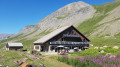
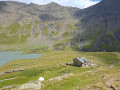
(4) At the pass, the path winds its way along a gently sloping stretch until you can see Lac du Goélon and its mountain hut. Head down to reach it.
(5) Follow the path on the right, which branches out before rejoining as a single track, descending quite steeply down the middle of the valley. Reach the banks of the Maurian and continue the descent alongside the torrent. Pass the Clot du Plot car park and return to the Pramailler junction.
(1) Carry on straight ahead to return to the Les Hières car park (S/E).
 Visorando Member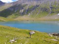

 Very difficult
  Difficult