


 Country:
 City:
City:


Steep steps at the beginning and end
Loop along the coastal path in Blanes


Hike in the creeks and on Sant Francesco beach (Costa Bianca), allowing you to explore the creeks without going inland.
Parking is difficult on Carrer Mirador de la Cala, but accessible via the middle of the hike (Passeig Bitacora).
Details
Creation:
Last update:
Last review:
–
–
-
 Activity: Walking
 -
 Distance: 1.54 mi
 -
 Average duration: 1h 05
 -
 Difficulty: Moderate
 -
-
 Back to start: Yes
 -
 Ascent: + 446 ft
 -
 Descent: - 446 ft
 -
-
 Highest point: 289 ft
 -
 Lowest point: 23 ft
Waypoints
- S/E : mi 0 - alt. 289 ft - Carrer del Mirador de la Cala
- 1 : mi 0.09 - alt. 82 ft - Coastal path
- 2 : mi 0.29 - alt. 52 ft - Platja de Sant Francesc
- 3 : mi 0.62 - alt. 115 ft - Crossroads at the end of the loop
- 4 : mi 0.76 - alt. 49 ft - Mirador de Carlos Pau
- S/E : mi 1.54 - alt. 289 ft - Carrer del Mirador de la Cala
Notes
Worth a visit
Temple Linné
Fisherman's Tower
Margalef Viewpoint
Other walks in the area
From Blanès to Lloret de Mar via the Cami de Ronda and the GR®92
 Visorando Member
 6.17 mi
+958 ft
-935 ft
3h 40
Moderate
6.17 mi
+958 ft
-935 ft
3h 40
Moderate
 Departure from Blanes (Girona)
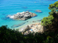
This semi-urban walk, situated at the southern end of the Costa Brava, leads to several magnificent beaches and coves in the area between Blanès and Lloret de Mar. A significant portion of the route is on tarmac through residential areas, particularly as part of the original Cami de Ronda has been closed for safety reasons. However, this drawback is more than made up for by the numerous viewpoints and beaches of all sizes, offering wonderful spots for swimming and taking a break. To get the most out of this route, it is best to avoid the summer months and mid-season weekends if possible, as the area is very popular with Spanish residents. Finally, despite its modest length, the climb up several long, steep flights of steps that follow one after another along the route requires a fair amount of physical effort, which you should bear in mind.
From Lloret de Mar to Tossa de Mar along the Camino de Ronda
 8.73 mi
+1,480 ft
-1,476 ft
5h 20
8.73 mi
+1,480 ft
-1,476 ft
5h 20
 Very difficult
Departure from Lloret de Mar (Girona)
Very difficult
Departure from Lloret de Mar (Girona)
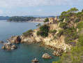
This route links Lloret de Mar to Tossa de Mar along the old coastal path "Camino de Ronda". It offers many panoramic views, as well as the crossing of numerous coves of varying steepness.
Warning : the off-GR® section has some fairly difficult stretches. It is, however, possible to keep to the GR® which circumnavigates Santa Maria de Lloret between points (3) and (12) but the latter passes inland, greatly reducing theinterest of this hike.
From Lloret de Mar to Santa Maria de Llorell via the Cami de Ronda
 6.63 mi
+1,473 ft
-1,066 ft
4h 20
6.63 mi
+1,473 ft
-1,066 ft
4h 20
 Difficult
Departure from Lloret de Mar (Girona)
Difficult
Departure from Lloret de Mar (Girona)
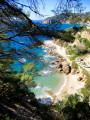
This walk, starting from the seaside resort of Lloret de Mar, leads to the residential area of Santa Maria de Llorell along the Cami de Ronda or coastal path. It alternates between urban areas and stretches along the beautiful, rugged rocky coastline. The urban section may seem tedious, but that would be to overlook the beauty of the many gardens and properties dotted along the route. The natural section, meanwhile, offers the chance to discover a multitude of secluded coves and magnificent beaches where it is lovely to swim in the summer months. However, if you wish to enjoy it to the full, you must not overlook the difficulty of this hike, which is mainly due to the rugged terrain requiring constant and sustained physical effort.
Circular Santa Maria de Llorell and return via the Cami de Ronda
 6.13 mi
+1,319 ft
-1,316 ft
4h 00
Difficult
Departure from Tossa de Mar (Girona)
6.13 mi
+1,319 ft
-1,316 ft
4h 00
Difficult
Departure from Tossa de Mar (Girona)
Starting from Tossa de Mar, this challenging hike first leads to Santa Maria de Llorell and its magnificent villas, before descending to the Cami de Ronda. This magnificent coastal path is a rollercoaster ride, sometimes very challenging, passing through several beautiful coves and beaches, where it will be difficult to resist a welcome swim in the summer. The end of the route takes you back to the gates of Tossa de Mar, where the bravest and least tired may take the time to visit the old town surrounded by ramparts. Despite its relatively modest distance, the difficulty of this route should not be underestimated, as it includes several very tricky sections and particularly steep slopes, both uphill and downhill, on slippery ground.
Tossa de Mar – Salionç, returning via the Cami de Ronda
 8.71 mi
+1,801 ft
-1,804 ft
5h 35
Difficult
Departure from Tossa de Mar (Girona)
8.71 mi
+1,801 ft
-1,804 ft
5h 35
Difficult
Departure from Tossa de Mar (Girona)
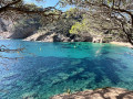
Starting from the beautiful seaside resort of Tossa de Mar, the route begins in the hills, passing through the Coll del Sastre. The long traverse, along the hillside amidst pine and cork oak trees, offers sweeping views of the coast, before joining the coastal path (Cami de Ronda) at Salionç. All that remains is to follow it along the many small coves or ‘calas’, which offer excellent opportunities for swimming in the summer months. To enjoy it to the full, however, you will need to be prepared for the considerable physical effort required to tackle the numerous ascents and descents, which are often very steep, where the many steps to climb add to the fatigue by the end of the route.
Cala del Canyets - Cala d'en Bosc
 9.93 mi
+2,178 ft
-2,201 ft
6h 30
Very difficult
Departure from Sant Feliu de Guíxols (Girona)
9.93 mi
+2,178 ft
-2,201 ft
6h 30
Very difficult
Departure from Sant Feliu de Guíxols (Girona)
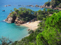
Starting from San Feliu de Guixols, this hike is divided into two distinct parts of very different difficulty. The first part takes you through the hills via a well-marked path through beautiful pine undergrowth. It then leads to the delightful Cala Canyets, a little haven of peace even in high season. The return journey follows the old Cami de Ronda route, which has now been diverted and is therefore unmarked. The paths leading to Cala d'Urgell and then to the tiny Cala d'en Bosc are indistinct and difficult to follow in a rather steep environment where great care is required. The passage of large boulders along the seashore along these two coves also presents a certain challenge. The end of the route partly follows the GI-682 and then rejoins the starting route for greater comfort. A beautiful adventure in prospect, but reserved for very good walkers who are able to find their way in difficult terrain and cope with very steep slopes
Romanya de la Selva
 2.07 mi
+154 ft
-154 ft
1h 05
2.07 mi
+154 ft
-154 ft
1h 05
 Easy
Departure from Santa Cristina d'Aro (Girona)
Easy
Departure from Santa Cristina d'Aro (Girona)
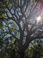
The Ruta dels Gégants Bosc in Romanya de la Selva offers a short walk that allows you to discover both magnificent cork oaks and megalithic monuments.
The Cap Roig botanical garden, starting from Palamós
 9.69 mi
+1,070 ft
-1,083 ft
5h 25
Moderate
Departure from Palamós (Girona)
9.69 mi
+1,070 ft
-1,083 ft
5h 25
Moderate
Departure from Palamós (Girona)
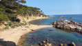
The visit to the Cap Roig botanical garden is just an excuse, as the views along this coastal path are splendid and alone make this hike worthwhile. The many fine sandy beaches nestled in the coves, the typical fishermen's houses and the various forests you pass through are remarkable.
For more walks, use our search engine .
The GPS track and description are the property of this route's author. Please do not copy them without permission.

