Country:
 City:
City:


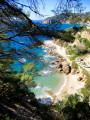
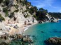
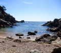
In Lloret de Mar, park in the seafront car park at the end of Avenida Pablo Casals.
GR®92 signposting: White and Red + Yellow
(S/E) Facing the sea, turn left towards the castle, taking the lovely promenade lined with bars and restaurants. Reach the small beach of Sa Caleta and the yellow signpost indicating Tossa de Mar is 11.6 km away.
(1) Continue along the Cami de Ronda following the dual signposting, go round the rock on which the castle is built and follow the beautiful paved path that hugs the contours of the many coves that follow one after another. Arrive at Caleta d'en Trons: signpost.
(2) Go straight on, staying on the Cami de Ronda, pass Cala d'en Simon and climb a steep, winding path to reach the end of a tarmac road.
(3) Turn left, keep right at the junction and join a side street. Turn sharply right and continue to a three-way junction. Take the right-hand road, following the Baixada de la Costa de Llevant. About fifty metres before reaching a dead end, turn left onto a road that climbs quite steeply before levelling out.
No signposting
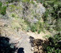
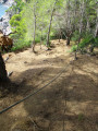
(4) Leave the road and take a discreet path on the right starting at the foot of an electricity pole. Descend a steep and difficult slope on loose, earthen ground with no grip, where you will need to use your hands twice. Once at the bottom of the gully, which is covered in bamboo, climb up the opposite side until the slope levels out, head right towards the remains of a heavily graffiti-covered building and go round it on the left. A wide, flat path then leads to a junction with a track: signpost.
GR®92 markings: White and Red + Yellow
(5) Turn right and rejoin the tarmac at Carrer d'Anglaterra.
(6) Go straight on and go round an old hotel on the right.
No markings
Temporarily leave the markings at a few parking spaces and follow Carrer d'Italia to the junction with Carrer de Polònia. Turn left for a few metres.
(7) Go down the very narrow and steep staircase on the right at the gate of house no. 4, then come out onto Ronda d'Europa.
GR®92 signposting: white and red + yellow.
Turn right and arrive at the entrance to a small road tunnel where a signpost indicates Tossa de Mar on the left. Turn left onto the dead-end road.
(8) Before reaching the dead end, take the steps on the right which lead directly to Cala Canyelles beach. Turn left, then left again between the two restaurants and reach a roundabout after crossing a small car park.
(9) Head right to follow the uphill street called Carrer de Nàpols, ignore Carrer de Malta on the left and continue to the next junction.
(10) Turn right onto Carrer d'Alexandria, keep right at the three-way junction and reach the junction with Carrer d'Alger. Turn right twice in succession to take Carrer de Capri until the hairpin bend on the left.
No signposting
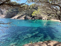
(11) Leave the street and follow the path on the right at the yellow sign pointing to Cala Morisca. Initially wide, this path narrows into a trail and winds its way down a few bends before reaching the cove in question.
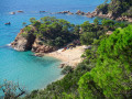
(12) Look out for a faint white mark on a rock high up on the left, indicating the narrow passage you must cross using your hands to reach the rest of the path. Continue uphill to a junction marked by a sign warning that access to the cliffs is dangerous due to the risk of rockfalls and falls. Leave the wide path on your left and head straight along a narrower track leading to a very steep descent, fortunately equipped with small log steps. After this, tackle the first section over sloping rock slabs, secured by a rope and a chain: cross this section with your back to the slope for added safety. Return to the path, descend further steps and begin the second difficult section, also secured by a chain and a rope partially fitted with knots to aid grip. Reach the magnificent site of the first Portopi beach, then the second of the same name after passing through a rock tunnel.
(13) Descend the steps on the right leading to Garbi de Llorell beach and walk along it towards its far end and the beautiful cluster of palm trees that shelters a bar-restaurant open in the summer. Continue straight on until you reach a junction.
(14) Turn right and look for the staircase on the right leading to a path heading towards Cala d'en Carlos. Stay on the Cami de Ronda, which further on joins a small car park near the tiny Cala d'es Llevador.
(15) Head down to the right towards the cove and, just before reaching it, take the very steep path that climbs up the rocky promontory opposite: the slope is very steep and the ground heavily eroded, where tree roots help you make your way. You’ll come out at a junction marked by an old signpost lying on the ground, the markings of which have faded. Turn left and follow the path heading due north to come out onto a wider track; follow this straight on to reach a junction about fifty metres further on.
(16) Turn right and follow the path as it winds lazily along the contour line before joining another lovely cross-country path.
GR®92 red and white markings
(17) Turn left and begin the descent towards the GI-682 road. Just before reaching it, turn left onto the path that runs alongside it, then joins the road at a restaurant, a small car park and the Cala Llevadó bus stop (S/E).
 Visorando Member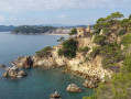
 Very difficult
  Moderate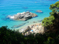
 Easy
Easy