Country:
 City:


Start from the car park situated between the community centre and the church in Romainvilliers.
No signposting
(S/E) Head west, moving away from the church and leaving the community centre on your left. When the street bends to the right, carry on straight ahead and climb a flight of steps. At the top, turn right into Allée des Tilleuls. After about fifty metres, turn sharply left towards the town hall car park and walk gently uphill.
(1) At the foot of the town hall, leave the building on your left and cross the car park diagonally to the right towards a black metal gate. Go through this gate (close it behind you). On the other side, turn left, pass through a forest gate, follow a path and climb up alongside a wall on your left.
Yellow markings
(2) At the top, at a three-way junction, take the path diagonally to the left which descends between plots no. 21 and no. 22. Descend gently (south-west) and note the tree-top adventure course on the right-hand side (ignore a path branching off to the right). At a three-way junction (elevation 137), keep to the right and head back uphill.
Unmarked
(3) At the top, at a junction, carry straight on along a wide path that starts between a tree marked no. 8 on the left-hand side and some picnic tables on the right-hand side. Walk first on level ground, then slightly downhill. Turn left onto the wide path and ignore a turn-off to the right, then another to the left. Head slightly uphill, pass a bench and some picnic tables on the right, and continue straight ahead (east-north-east) along a gently sloping path.
Yellow markings
(4) You’ll come out onto another path; follow it to the right, passing a small car park on the left. Go through a forest gate, turn right onto the path and pass under a gantry.
No markings
(5) Just after the archway, turn sharply left and follow a path running alongside the woodland on your left and a field on your right. At the corner of the field, carry on straight ahead, enter the woodland and head downhill. Cross briefly through a sort of wasteland and continue the descent along a sunken track through the undergrowth. When you reach the first houses, continue downhill along a gravel track.
Yellow signposts
(6) Return to the tarmac road and turn right twice towards Les Alluets-le-Roi. At the next junction, turn left and walk through a housing estate. At the next junction, go straight on along the Chemin de l’Orme and immediately ignore a turning on the left.
(7) When the road bends to the left, carry on straight ahead along a grassy track running alongside the field on the right-hand side. After the last houses, head straight down between the fields.
Red and white markings
(8) At the T-junction, follow a dirt track to the left. Walk on roughly level ground and, at two successive junctions, continue straight on along the GR®26.
(9) Cross a small road at the pedestrian crossing, then first turn left then right to join the Chemin de la Bachille, still following the GR®.
No signposting
(10) At the junction, go straight on along a gravel track and follow a hedge on your left. The track soon gives way to a dirt track dotted with a few trees and yellow double-sided signs. After a long, mostly flat stretch, there is a short descent.
(11) Cross a track, then a stream, and continue straight ahead on a path alongside a row of young pine trees. The path climbs slightly.
Yellow markings
(12) Cross a small road, take the path opposite and walk alongside a fenced garden on your left. Climb gently then enter a woodland.
Red and white + orange markings
(13) You’ll come out onto a small road (with a telecoms mast on the right) and follow it to the left between two wire fences.
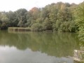
(14) At a roundabout (Château de Romainville on the right), take the second left, a path that descends alongside a hedge on the right-hand side. Cross a stream and continue alongside the hedge (occasional gaps offer views of a pond and a meadow adorned with… plastic cows). Head back up, keeping to the left of a wire fence, and enter the woods again.
No signposting
(15) At a fork (information boards), head left between two plots of land undergoing regeneration. Descend slightly and then climb back up again.
Red and white markings
At a triangular junction (large oak tree in the centre), rejoin the GR® and continue straight on (east). Walk gently downhill through the woodland. Pass through a forest gate and continue along a narrow lane. Ignore a lane on the right and, at the next junction, go straight on.
(16) At the T-junction, turn right onto the Grande Rue and pass through a 30 km/h zone. Cross the Rue de la Grande Haie and continue straight on along the Grande Rue. Go round the roundabout on the right and take the second exit, towards the car park. Pass by the foot of Saint-Léger Church and you’ll immediately reach the car park (S/E).
 Visorando Member

 Difficult
 Easy