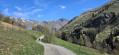
Champ Perouze circular in La Toussuire

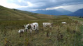
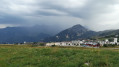
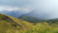
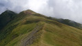
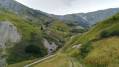
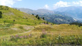
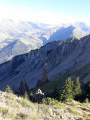
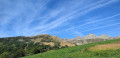
A short, easy walk overlooking the Toussuire amongst the mountain pastures.

Details

1349132
Creation:
Last update:
Last review:
  • Walking
    Activity: Walking
  • ↔
    Distance: 2.82 mi
  • ◔
    Average duration: 1h 35 
  • ▲
    Difficulty: Easy

  • ⚐
    Back to start: Yes
  • ↗
    Ascent: + 374 ft
  • ↘
    Descent: - 394 ft

  • ▲
    Highest point: 5,922 ft
  • ▼
    Lowest point: 5,499 ft

Photos

Description of the walk

Park near the Toussuire Tourist Office.

(S/E) Walk up the high street to the top, until you reach the junction by the swimming pool.

(1) Turn left onto the path next to the Ravieres chairlift and, after about 600 metres, turn right next to the pumping station. Continue along the path towards La Lauzaz. Cross the Marolay, Soleil and Grand Truc chairlifts in turn. You’ll reach the Lachal stream.

(2) Turn right to cross it, then head down to the right towards La Toussuire. Turn right at the next junction and you’ll reach the village’s main road. Turn right until you reach the junction with Impasse Pierre Collet.

(3) Turn left onto this road and then veer right onto a path. Turn left and cross to the other bank of the Toussuire between the tennis courts. You’ll come out onto Rue du Marché, where you’ll return to the starting point (S/E).

Waypoints

  1. S/E : mi 0 - alt. 5,548 ft - Tourist Office
  2. 1 : mi 0.26 - alt. 5,597 ft - Les Ravieres chairlift
  3. 2 : mi 1.63 - alt. 5,807 ft - Turn right towards the stream
  4. 3 : mi 2.49 - alt. 5,545 ft - Impasse Collet
  5. S/E : mi 2.82 - alt. 5,548 ft - Tourist Office

Reviews and comments

4.8 / 5
Based on 2 reviews

Reliability of the description
5 / 5
Ease of following the route
5 / 5
Route interest
4.5 / 5
Betsy
Betsy

Overall rating : 5 / 5

Date of your route : Jul 03, 2023
Reliability of the description : ★★★★★ Very good
Ease of following the route : ★★★★★ Very good
Route interest : ★★★★★ Very good
Very busy route : No

A lovely walk with spectacular views.

Machine-translated

momo5338
momo5338
• Edited:

Overall rating : 4.7 / 5

Date of your route : Jun 20, 2021
Reliability of the description : ★★★★★ Very good
Ease of following the route : ★★★★★ Very good
Route interest : ★★★★☆ Good
Very busy route : Yes

A lovely walk through the mountainous countryside.
The gentians are in bud; next week they’ll surely be in full bloom.
It’s a shame that, for most of the route, the path doesn’t follow the ridge exactly but runs a few metres behind it: the very slight drop blocks the view downwards.
There are still some lovely views, though.
The mountains are all around you.

Machine-translated

Other walks in the area

For more walks, use our search engine .

The GPS track and description are the property of this route's author. Please do not copy them without permission.