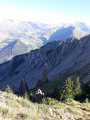
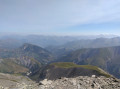
Tour of Villarembert via Les Fromentières and Les Crevasses

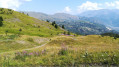
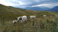
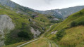
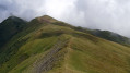
A short, varied route to explore the area around Villarembert: woods, streams, pastures, the village, and a lake with a picnic area.

Details

n°55514704
Creation:
Last update:
Last review:
  • Walking
    Activity: Walking
  • ↔
    Distance: 2.09 mi
  • ◔
    Average duration: 1h 25 
  • ▲
    Difficulty: Easy

  • ⚐
    Back to start: Yes
  • ↗
    Ascent: + 538 ft
  • ↘
    Descent: - 538 ft

  • ▲
    Highest point: 4,698 ft
  • ▼
    Lowest point: 4,160 ft

Description of the walk

Park near the Villarembert campsite, taking the exit towards Le Corbier.

(S/E) Continue down the road for a few dozen metres and keep to the right at the Fork in the road in front of a very new house. Opposite the house’s courtyard, turn immediately right onto the dirt track which climbs straight up the steep slope and joins the D78a. Walk down to the right for about a hundred metres.

(1) Turn left onto the grassy path that climbs diagonally into the woods, just before a waterfall. Walk uphill through the woods alongside the stream until you reach the gravel road.

(2) Turn right to head up this road, which goes round a chalet and then past an old building. Carry on straight ahead through the woods, cross the bridge over the Garney and continue uphill until you reach the start of a tarmac road amongst the houses in Les Fromentières.

(3) Turn right to head down this road. Pass the first cluster of houses and carry on to the next one, at Les Crevasses-en-Bas. Turn right at the junction and carry on to the three-way junction.

(4) Head down to the left: at this point, you are just below the chalet where the film “Anatomy of a Fall” was shot. Continue down to the village and join the D78a at the town hall. Cross via the raised footbridge to take the street opposite. Walk past the church to reach the bottom of the street.

(5) Take the grassy path on the left which runs alongside the last few houses. At the next junction, follow the path on the right. Turn left before reaching the departmental road, then cross the bridge over the Ruisseau de Garney. At the crossroads, carry on straight ahead downhill to return to the car park, near the campsite (S/E).

Waypoints

  1. S/E : mi 0 - alt. 4,160 ft - Villarembert Campsite
  2. 1 : mi 0.18 - alt. 4,288 ft - Entrance to the woods on the left
  3. 2 : mi 0.31 - alt. 4,462 ft - Gravel road
  4. 3 : mi 0.69 - alt. 4,698 ft - Les Fromentières
  5. 4 : mi 1.12 - alt. 4,524 ft - Les Crevasses below
  6. 5 : mi 1.7 - alt. 4,219 ft - Grass path to the left
  7. S/E : mi 2.09 - alt. 4,160 ft - Campsite – Villarembert lake

Worth a visit

(S/E) Villarembert Campsite. The lake is equipped with picnic tables and permanent barbecues.
(2) The leather workshop is open to visitors, a little further down the road.
(4) Chalet, the filming location for the film “Anatomy of a Fall”.

In Le Corbier and La Toussuire, during the season – whether in winter or summer – you can use the ski lifts with a pedestrian pass.
The resort’s bars and shops are closed in the off-season, but open in winter and in July and August.
In the off-season, the Sherpa mini-market at the very bottom of Le Corbier is open four mornings a week.

During the winter and summer seasons, there are plenty of events in Le Corbier and La Toussuire.

Reviews and comments

4.8 / 5
Based on 2 reviews

Reliability of the description
5 / 5
Ease of following the route
5 / 5
Route interest
4.5 / 5
User 31177340

Overall rating : 5 / 5

Date of your route : Oct 19, 2026
Reliability of the description : ★★★★★ Very good
Ease of following the route : ★★★★★ Very good
Route interest : ★★★★★ Very good
Very busy route : No

A lovely walk with views of the mountain range. A good amount of elevation gain.

Machine-translated

OCaptn
OCaptn

Overall rating : 4.7 / 5

Date of your route : Aug 08, 2024
Reliability of the description : ★★★★★ Very good
Ease of following the route : ★★★★★ Very good
Route interest : ★★★★☆ Good
Very busy route : No

A lovely walk and an easy route to follow, but do take care not to miss the path opposite the house at the start.
The climb is a bit steep for a beginner.

Machine-translated

Other walks in the area

For more walks, use our search engine .

The GPS track and description are the property of this route's author. Please do not copy them without permission.