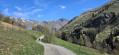
Circular route from La Toussuire to Le Corbier

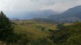
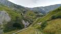
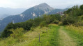
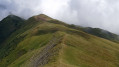
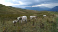
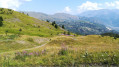
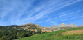
A short, easy and pleasant walk at an altitude of between 1,500 and 1,800 metres, which forms a circular route between La Toussuire and Le Corbier. No particular difficulties.

Details

1346142
Creation:
Last update:
Last review:
  • Walking
    Activity: Walking
  • ↔
    Distance: 4.05 mi
  • ◔
    Average duration: 2h 45 
  • ▲
    Difficulty: Moderate

  • ⚐
    Back to start: Yes
  • ↗
    Ascent: + 1,014 ft
  • ↘
    Descent: - 1,014 ft

  • ▲
    Highest point: 5,820 ft
  • ▼
    Lowest point: 4,928 ft

Photos

Description of the walk

Start at the La Toussuire Tourist Office.

(S/E) Walk down the road from the Tourist Office towards the La Toussuire bridge until you reach the first junction.

(1) Take the small path on the right which leads down towards Les Corbiers. Follow the yellow signposts. You’ll reach the viewpoint overlooking the Garney ravine.

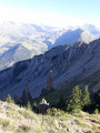
(2) Head down the path on the left. Turn left and walk for about fifty metres to reach the cross by the side of the path. Enjoy the lovely view over the valley. Then head back up to the Garney Bridge.

(3) Cross the bridge and head uphill towards the village of Les Corbiers. Continue past the post office until you reach the swimming pool.

(4) Walk all the way up the pedestrianised street to the D78A roundabout.

(5) Turn left and follow the road which joins the D78A, then follow it until you reach the Garney stream at the sharp right-hand bend.

(6) Turn left onto the stony path leading uphill. Pass by the Envers chairlift and carry on straight ahead until you reach the hairpin bend at Vallon de Comborsière.

(7) Turn right, heading uphill towards a small chalet. Carry on to La Toussuire. Return to the starting point either via the village streets or via the Comborsière path (S/E).

Waypoints

  1. S/E : mi 0 - alt. 5,548 ft - Tourist Office
  2. 1 : mi 0.49 - alt. 5,430 ft - Start of the Chemin des Corbiers
  3. 2 : mi 1.35 - alt. 5,115 ft - Viewpoint at the Garney Ravine
  4. 3 : mi 1.64 - alt. 4,951 ft - Garney Bridge
  5. 4 : mi 2.07 - alt. 5,115 ft - Corbier Swimming Pool
  6. 5 : mi 2.3 - alt. 5,144 ft - Roundabout
  7. 6 : mi 2.68 - alt. 5,207 ft - RD78a: Garney stream bridge
  8. 7 : mi 3.18 - alt. 5,522 ft - Comborsière junction
  9. S/E : mi 4.05 - alt. 5,548 ft - Tourist Office

Notes

(4) You’ll find all the resort’s shops here.

Reviews and comments

4.3 / 5
Based on 2 reviews

Reliability of the description
4 / 5
Ease of following the route
4.5 / 5
Route interest
4.5 / 5
Emmanuel 54
Emmanuel 54

Overall rating : 4.3 / 5

Date of your route : Aug 13, 2023
Reliability of the description : ★★★★☆ Good
Ease of following the route : ★★★★★ Very good
Route interest : ★★★★☆ Good
Very busy route : No

This was our second walk on our first day in La Toussuire. A really good walk to get us up to speed for the days ahead. Part of it was through the mountain pastures, and part through the woodland.

Machine-translated

momo5338
momo5338

Overall rating : 4.3 / 5

Date of your route : Jun 26, 2021
Reliability of the description : ★★★★☆ Good
Ease of following the route : ★★★★☆ Good
Route interest : ★★★★★ Very good
Very busy route : No

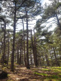
A lovely walk in the mountains, with a variety of scenery: the village of La Toussuire, pastures, woodland, the village of Le Corbier, mountain streams, etc. Plenty of views over the valley and the mountains.
Between points 1 and 2, some signposts seem to be missing, and the route marking on the ground wasn’t very clear. A GPS is useful for finding your way. We had to cross numerous electric fences (which must be repositioned depending on which pastures are in use).
Before reaching the lowest point, we opted for a path that crosses the stream further up, which is less strenuous.
The paths changed slightly at Le Corbier, and on the return journey to La Toussuire, but not enough to cause too much confusion.

Machine-translated

Other walks in the area

For more walks, use our search engine .

The GPS track and description are the property of this route's author. Please do not copy them without permission.