The Mourtisses Circular Trail and Valpane Waterfall

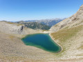
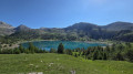
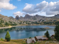
A forest trail leading to the pretty Valplane waterfall on the edge of the Mercantour National Park.

Details

n°48655453
Creation:
Last update:
Last review:
  • Walking
    Activity: Walking
  • ↔
    Distance: 1.43 mi
  • ◔
    Average duration: 0h 55 
  • ▲
    Difficulty: Easy

  • ⚐
    Back to start: Yes
  • ↗
    Ascent: + 295 ft
  • ↘
    Descent: - 282 ft

  • ▲
    Highest point: 6,165 ft
  • ▼
    Lowest point: 5,853 ft

Photos

Description of the walk

From the village of Val d’Allos, head to the Cluite car park via a small mountain road which is open to traffic from June to October (weather permitting).

(S/E) Return to the road and head back towards the village.

(1) Take the path on the right, following the signposts.

(2) Cross the Route du Lac and continue along the path opposite, still through the forest. At the various junctions, keep to the left. This will take you to the Valplane waterfall.

(3) Continue along the path, heading north-west, and head downhill. Pass a picnic table and you’ll soon reach the car park (S/E).

Waypoints

  1. S/E : mi 0 - alt. 5,896 ft - Parking de la Cluite
  2. 1 : mi 0.1 - alt. 5,866 ft - Start of the trail
  3. 2 : mi 0.25 - alt. 5,948 ft - Crossing the road
  4. 3 : mi 1.02 - alt. 6,073 ft - Cascade de Valplane
  5. S/E : mi 1.43 - alt. 5,892 ft - La Cluite car park

Notes

Make sure you bring water.

At certain times of year, a herd may be present in these pastures.

Worth a visit

During the summer season, do take the time to stop off at the village of Allos.

For further information, contact the Val d’Allos Tourist Office: 04 92 83 02 81

Reviews and comments

4.7 / 5
Based on 1 review

Reliability of the description
5 / 5
Ease of following the route
5 / 5
Route interest
4 / 5
Val d'Allos
Val d'Allos

Hello patrick.sicsic,

Thank you for taking the time to give us this detailed feedback on the hike.

Machine-translated

patrick.sicsic
patrick.sicsic

Overall rating : 4.7 / 5

Date of your route : Aug 13, 2026
Reliability of the description : ★★★★★ Very good
Ease of following the route : ★★★★★ Very good
Route interest : ★★★★☆ Good
Very busy route : Yes

A short walk of about an hour. The direction of the circular loop is spot on.
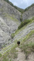
We only saw walkers heading in the opposite direction, as there are signs in the car park. However, going in the direction suggested by the car park is more difficult for ‘younger’ walkers; near the waterfall there’s a scree slope to climb, which is quite steep...
A lovely walk, a nice way to stay cool in the woodland.

Machine-translated

Other walks in the area

For more walks, use our search engine .

The GPS track and description are the property of this route's author. Please do not copy them without permission.