Monts du Pays Vizillois Circular Loop

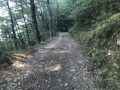
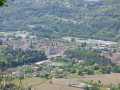
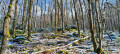
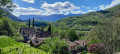
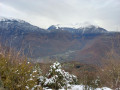
A pleasant walk, mostly through woodland.
However, there is an 800m climb over just over 4km.

Details

1270530
Creation:
Last update:
Last review:
  • Walking
    Activity: Walking
  • ↔
    Distance: 6.47 mi
  • ◔
    Average duration: 5h 20 
  • ▲
    Difficulty: Moderate

  • ⚐
    Back to start: Yes
  • ↗
    Ascent: + 2,713 ft
  • ↘
    Descent: - 2,717 ft

  • ▲
    Highest point: 3,714 ft
  • ▼
    Lowest point: 994 ft

Photos

Description of the walk

Park in the spacious car park at Les Allas, on the eastern outskirts of Vizille, beside theGR®549.
Just make sure you do not obstruct traffic on the forest track, which is open to residents of the hilltop hamlets, amongst others.

(S/E) From an altitude of 308m, turn right onto theGR®549, marked with red and white signs, and follow the direction of Montjean. Stay on this path until you reach the hamlet, after passing two fountains (on the left).
Ignore the adjacent paths.

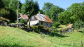
(1) At the hamlet of Montjean, turn left, still on theGR®549, towards Pléney for 30 metres.
Turn left again onto the path, marked with pale yellow signs but with a clearly visible track. The path winds several times through the Bois de Mont Sec before reaching the forest road at the hamlet of Pléney.

(2) Turn right onto the track heading south. Pass through the houses in Pléney to reach the junction with theGR®549. This is the highest point of the route.

(3) Continue once more along theGR®549; at the first fork, turn right onto the road leading to Mont Sec.

(4) Carry on to the right along the path, following the very clear signposting, which leads back to a four-way junction.

(5) At the crossroads on the hilltop (1,079 m), turn right and continue along theGR®549, heading due north towards Montjean

(1) Carry on straight ahead, following the same route as on the way out to reach the starting car park (S/E).

Waypoints

  1. S/E : mi 0 - alt. 1,001 ft - Car park at Les Allas
  2. 1 : mi 1.54 - alt. 2,385 ft - The hamlet of Montjean.
  3. 2 : mi 2.59 - alt. 3,560 ft - The hamlet of Le Pleney.
  4. 3 : mi 3.49 - alt. 3,661 ft - GR junction
  5. 4 : mi 3.78 - alt. 3,688 ft - Mont Sec
  6. 5 : mi 4.07 - alt. 3,533 ft - Four-way junction
  7. S/E : mi 6.47 - alt. 1,007 ft - Car park at Les Allas

Notes

Wear sturdy footwear to ensure safety on the descent from Montsec.
Bring water with you. The fountains along the route do not indicate whether the water is safe to drink.
No particular difficulties; tracks and paths are in good condition, but there are significant elevation changes (up and down) over the course of the route.

Always be cautious and plan ahead when you're outdoors. Visorando and the author of this route cannot be held responsible for any accidents occurring on this route.

The GR® and PR® markings are the intellectual property of the Fédération Française de Randonnée Pédestre.

Reviews and comments

4.8 / 5
Based on 2 reviews

Reliability of the description
5 / 5
Ease of following the route
5 / 5
Route interest
4.5 / 5
Sardine*
Sardine*

Overall rating : 4.7 / 5

Date of your route : Sep 03, 2025
Reliability of the description : ★★★★★ Very good
Ease of following the route : ★★★★★ Very good
Route interest : ★★★★☆ Good
Very busy route : Yes

Shady stroll

Machine-translated

Asba
Asba

Hello,

We went hiking during the week, which explains why there weren’t many people about.
A lovely walk, with some beautiful scenery.
However, our reliable pedometer showed 14 km. 3

Machine-translated

GSSBS
GSSBS

Overall rating : 5 / 5

Date of your route : Jul 05, 2020
Reliability of the description : ★★★★★ Very good
Ease of following the route : ★★★★★ Very good
Route interest : ★★★★★ Very good
Very busy route : No

This walk is one of my favourites!
A superb route (and perfectly described, too), with a good balance of difficulty. The route is well signposted and pleasant to walk (especially in hot weather). There are some truly beautiful and varied landscapes and views all along the way.
You really do need to wear good walking boots for this hike.

A possible extension to this route: at point number three, you can take the path that branches off to the left, towards the Col de la Madeleine (1,183 m): for a round trip of approximately 1.5 km (and perhaps a few extra metres of elevation gain 😉), this pass offers a sublime view of the Taillefer, the Grand Serre, the Grands Lacs de Laffrey, the Sénépy, the Connex, the Vercors…

Machine-translated

Other walks in the area

For more walks, use our search engine .

The GPS track and description are the property of this route's author. Please do not copy them without permission.