Country:

 City:
City:


A89 motorway, Montignac exit, follow signs for Montignac then Les Farges. Park in the Les Farges car park next to the town hall.
(S/E) Set off from the town hall, with it behind you, towards the centre of the village. Continue until you reach the Route du Presbytère.
(1) Turn right onto this road and follow it to the edge of the village at the Route du Palin.
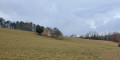
(2) Turn left towards La Bachellerie and follow a small tarmac road to the petrol station: for 500 metres, the landscape opens out to the south towards Aubas and Montignac. Continue to the petrol station.
(3) Turn right onto a track leading through the woods to the Mas de Lérou. At the first junction, continue straight on; at the second junction, turn right. Turn left then right in the village and continue for 10 metres (Route du Fer à Cheval).
(4) Turn left onto a country lane, opposite the rubbish skips. This is a lovely sunken lane flanked by walls, which, as recently as 50 years ago, provided a quick route to the Cern valley at the Route des Chêne (D46).
(5) Cross this road to rejoin, in a straight line, the country lane that climbs gently up onto the plateau. Turn left at the first junction and you’ll soon reach a second crossroads.
(6) Turn left to reach the hamlet of La Boissière and come out onto the road.
(7) Keep to the right on this road, heading towards: Le Lardin. Walk through the hamlet of La Boissière.
(8) On leaving the hamlet, take a country lane on the right which climbs steadily up to the top of the plateau, following a dry, fairly narrow and winding valley. Meadows and fallow land alternate until you reach the tarmac road.
(9) At the end of the track, turn right to head back towards Les Farges. At the end of this road, you’ll easily come across the hamlet of Les Grézous.
(10) Turn right in the hamlet and head back towards your starting point, first turning right then left at the crossroads. (S/E)


 Tourist office
 Moderate
 Visorando Member