The ‘Balcons du Sud’ circular route, starting from Les Farges

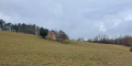
Hills and promontories rise above the Aubas plain and the Vézère valley. A long, easy walk that provides a good illustration of the terrain in the southern part of the commune of Les Farges. It takes you from west to east across the plateau of Cretaceous and then Jurassic limestone, a plateau deeply carved into ridges and promontories by dry valleys leading down to the Vézère.

Details

n°40321635
Creation:
Last update:
Last review:
  • Walking
    Activity: Walking
  • ↔
    Distance: 5.43 mi
  • ◔
    Average duration: 3h 05 
  • ▲
    Difficulty: Average

  • ⚐
    Back to start: Yes
  • ↗
    Ascent: + 705 ft
  • ↘
    Descent: - 705 ft

  • ▲
    Highest point: 784 ft
  • ▼
    Lowest point: 259 ft

Description of the walk

A89 motorway, Montignac exit, follow signs for Montignac then Les Farges. Park in the Les Farges car park, next to the town hall.

(S/E) Set off from the town hall, heading west towards the church. Walk through the village towards ‘Monteyx’ until you reach the first junction with the Route de la Borie.

(1) Turn left onto the Route de la Borie. Farmland with walnut trees and maize fields, with the wooded hills of Montignac in the distance. After the hamlet of Les Tuilières, you’ll reach the junction with the Chemin des Orchidées.

(2) Turn right and continue along this road until you reach the hamlet of “La Mijardie”. Carry on straight ahead along the road until you reach a junction on the outskirts of the village with the Route de la Côte des Farges.

(3) Make a sharp turn and head left, north-east, towards the Côte des Farges until you reach the D46: a one-kilometre walk through fields, past new houses and rocky hillsides, until you reach the Route des Chênes (D46).

(4) Cross it and head towards “Les Communaux”. A small road leads to Le Cheylard and serves a few new houses, near the Route du Guer.

(5) At the junction with this road, turn left. This marks the start of a long descent from the plateau towards the Vézère plains, through oak and hornbeam woods. You’ll reach a junction at the end of the descent.

(6) Continue along the path opposite, until you reach the hamlet of “La Valade”.

(7) Take the path on the left to begin the climb back up to the plateau. This involves a long walk through woods, heathland and fields on the hillsides. It is a vast, deserted, uninhabited and wild area. You’ll reach the road at a place called “Les Grézous”.

(8) Turn right, then, 100 metres further on, turn left onto the Route du Tilleul, which takes you back towards the village of Les Farges. Continue straight ahead at the first junction, then, at the second, turn right towards the town hall and the starting point (S/E).

Waypoints

  1. S/E : mi 0 - alt. 774 ft - Les Farges Town Hall
  2. 1 : mi 0.2 - alt. 755 ft - Route of the Drystone Shelter
  3. 2 : mi 0.46 - alt. 699 ft - Orchid Trail
  4. 3 : mi 1.62 - alt. 377 ft - Route de la Côte des Farges
  5. 4 : mi 2.29 - alt. 581 ft - Cross the Route des Chênes
  6. 5 : mi 2.66 - alt. 535 ft - Route du Guer - Vézère (rivière)
  7. 6 : mi 3.42 - alt. 262 ft - Path opposite
  8. 7 : mi 3.72 - alt. 285 ft - La Valade
  9. 8 : mi 5.01 - alt. 692 ft - Les Grézous
  10. S/E : mi 5.43 - alt. 774 ft - Les Farges Town Hall

Worth a visit

(4) To the south, you can see the ‘Cheylard’ hill. This former parish centre is home to a few houses, a small castle and the ruins of a Romanesque church. As part of this walk, allow for an additional 1 km round trip to reach it.
(5) We are near Sauveboeuf Castle, which can be glimpsed from time to time.

Reviews and comments

4.3 / 5
Based on 2 reviews

Reliability of the description
4.5 / 5
Ease of following the route
4.5 / 5
Route interest
4 / 5
Sophal
Sophal

Overall rating : 4.7 / 5

Date of your route : Oct 11, 2024
Reliability of the description : ★★★★★ Very good
Ease of following the route : ★★★★★ Very good
Route interest : ★★★★☆ Good
Very busy route : No

A pleasant route with no difficulties.
It’s a bit of a shame there are too many small tarmac roads, especially on the first part of the route.
There’s a huge poultry farm along the route.

Machine-translated

lemarcheur65
lemarcheur65 ★

Hello Namassepasmousse

You wrote:

There’s no network connection, which makes the app useless.

Just to remind you, you don’t need a network connection to follow a route; only the GPS function (in aeroplane mode) is required.

Machine-translated

Namassepasmousse
Namassepasmousse
• Edited:

Overall rating : 4 / 5

Date of your route : Jul 24, 2024
Reliability of the description : ★★★★☆ Good
Ease of following the route : ★★★★☆ Good
Route interest : ★★★★☆ Good
Very busy route : No

I should point out that, halfway between points 7 and 8, the trail becomes increasingly difficult to follow and eventually disappears completely. There’s no mobile signal, which makes the app useless. I ended up in the undergrowth – or rather, brambles – and found myself in a clearing where you can see the yellow markers for a gas pipeline. I turned left and, after a fair bit of scrambling – particularly through private property – I found the entrance to Les Farges near Le Gréoux.
The (ruined) church at Le Cheylard is worth a visit. It’s not easy to find, but it’s a lovely, secluded spot for a break.

Machine-translated

Other walks in the area

For more walks, use our search engine .

The GPS track and description are the property of this route's author. Please do not copy them without permission.