Country:

 City:


Park in the small car park near the Croix de la Rivière or, if the area is busy, at the side of the Chemin de la Rivière.
(S/E) From the Rivière cross, take the path on the left which climbs quite steeply through the forest.
(1) At the top of the climb, at the ‘Bois d’Azole’ signpost, head down to the left towards Panissières.
Once at the bottom of the descent, leave the woods.
(2) Caution: dangerous sections– cross two roads, head towards the small wood opposite and continue past the greenhouses and the riding centre.
At thefirst junction, at the ‘Croix de Signy’ signpost, turn right and keep to the right as you walk alongside the horse paddock.
At the three-way junction, take the steep descent to the right.
(3) At the bottom of the descent, at the junction near the stream, turn immediately left into the woods.
At the four-way junction, go straight on, then continue straight on up the hill through the woods.
In the middle of the woods, at the junction with a path that curves sharply to the right and another that heads left, take the one straight ahead, veering slightly to the right.
At the next junction, continue to the right, following the red mountain-bike markings.
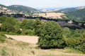
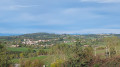
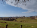
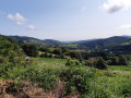
(4) When you reach the top at Plan Melay, with a lovely view of the Forez plain to your right and Chalmazel and then Panissières opposite, turn right.
After 500 m, head towards the Yellow Cross, not the path on the right
After the cross, turn right onto the red mountain bike route.
(5) When you reach a triangular junction, follow the red mountain bike signs pointing to the left to reach the bike park.
Caution: mountain bikes may be travelling at high speed
100 m further on, stay on the path which continues straight ahead; it’s a slight uphill stretch – keep following the mountain bike signposting. At the next four-way junction with a triangle in the middle, carry on straight ahead; do not follow the mountain bike signposting any further.
At the bottom of the descent, in a small clearing, go straight on, cross the small stream and head uphill opposite; then, at the next four-way junction with a large triangle, keep left.
(6) When you reach the tarmac road, take the dirt track straight ahead into the woods, marked with yellow and white signs.
At the next tarmac path, take the Chemin du Moine straight ahead.
(7) 100 m before reaching the house, take the path leading down to the right, marked with yellow and white signs, then turn left.
When you reach the top of the track, at the junction on the other side of Plan Melay, turn right into the woods – there are no signposts.
At the bottom of the path, at the junction, head down to the left towards the main road.
(8) When you reach the departmental road, cross over (dangerous crossing) and keep slightly to the right to follow the Chemin de l’Étang towards the Auberge de l’Étang.
Continue along this tarmac path straight ahead, passing the Auberge de l’Étang, then the pond. At the junction towards the Croix de l’Étang, stay on the tarmac path veering slightly to the left, towards La Brioude. Keep your dogs on a lead as you approach the farms.
At the junction – a dangerous crossroads – cross the road once, then turn left to cross again and follow the road to reach the river (S/E).


 Visorando Member

 Association / Club / Walk leader
 Easy