Country:

 City:
City:


Start from the car park in the hamlet of La Rivière in Villechenève.
(S/E) In front of the cross, turn right and follow theGR®7until you reach a Fork in the road.
(1) At the first three-way junction, turn right then keep to the left.
(2) Cross the Ruisseau des Mollières and follow the very stony path uphill to the junction towards Chez Ligot. Go straight on towards the village of Affoux. When you reach the tarmac road, carry on straight ahead until you reach the main street in Affoux.
(3) Turn left towards the cemetery until you reach the first tarmac track on the right leading towards Mont du Crépier.
(4) At the Croix de la Poyat, continue straight ahead along this path until you reach the start of the third route to the car park.
- You can also start the walk here to do a 13.5 km circular route.
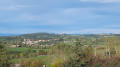
- Otherwise, leave the tarmac track very quickly, go straight on and, at the three-way junction that follows, take the right-hand path. At the clearing with the three-way junction, admire the beautiful view of Saint-Forgeux and Mont Verdun and keep to the left twice. In the middle of the woods, take the descent on the right and the next hairpin bend on the left – keep a close eye on the route on your phone!
(5) At the bottom of a steep descent, take the hairpin bend to the right, then carry on straight ahead, leaving the path on your left.
At the next junction, carry on downhill to the left, then straight on, veering slightly to the left, and leave the most obvious path to reach a horse paddock. Walk alongside it until you reach the road.
(6) Turn left until you reach a junction where three roads meet.
(7) Head towards Saint-Forgeux, taking the second right. At the junction of two small roads, carry on uphill (towards a car in a quarry) until you reach the Croix de Ronzière signpost at a multi-way junction.
(8) Leave the road and turn right towards Saint-Forgeux/Saint-Marcel-les-Fourches. At the first three-way junction in the road, turn right to reach a second one.
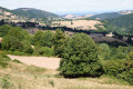
(9) At the edge of the forest, turn left, then right, and carry on straight ahead to Crêt Marmont (alt. 724 m), where there’s a lovely 360° view at the edge of a meadow.
(10) Retrace your steps back to the Croix de Ronzière.
(8) Carry on straight ahead, crossing the road into the woods. At the three-way junction, keep left and admire the lovely view. Walk along a path running parallel to a cleared patch of woodland until you reach the barbed wire at the tip, then the road at the ‘La Croix’ signpost; cross over towards Affoux and the Croix de la Poyat to reach another junction at the entrance to a wood.
(11) Keep to the right until the next three-way junction. Continue to the right, then head towards the Croix Casard.
(4) Turn right and retrace your steps to return to the hamlet of La Rivière (S/E).

 Association / Club / Walk leader
 Easy
Easy 
 Visorando Member