Villechenève, Madone, Souzy Chapel circular route

A slightly more challenging circular route than the previous suggested circular routes.
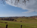
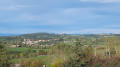
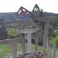
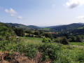
From the Madone site, where you’ll enjoy a magnificent view of the village, the Forez and the Massif Central, you’ll set off to explore the Souzy Chapel.
The route passes through the hamlets of Le Lafay, Le Goutail, La Parollière, Le Souzy, La Renardière, Le Bertrand and Les Olmes.

Details

15516418
Creation:
Last update:
Last review:
  • Walking
    Activity: Walking
  • ↔
    Distance: 6.22 mi
  • ◔
    Average duration: 3h 40 
  • ▲
    Difficulty: Moderate

  • ⚐
    Back to start: Yes
  • ↗
    Ascent: + 925 ft
  • ↘
    Descent: - 942 ft

  • ▲
    Highest point: 2,497 ft
  • ▼
    Lowest point: 1,896 ft

Photos

Description of the walk

Park at the Madone site in Villechevène.

(S/E) Head towards the Yellow Cross along theGR®7and you’ll soon come to a crossroads.

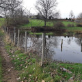
(1) Leave theGR® here, turn left, then walk past the farm and down to the pond. After a left-hand bend, you’ll reach the houses at Lafay.

(2) Continue slightly to the left, following the yellow markings. You’ll soon reach the Ruisseau Gouby.

(3) Cross it, head uphill and turn right. Continue following the yellow markings to the Gouby signpost. You’ll come to another bridge.

(4) Cross this bridge, leave the yellow markings here and continue straight ahead into the woods. Walk past the Goutail building. At the junction, turn right to head uphill into the woods and follow the mountain bike markings. You will then reach another crossroads.

(5) Here, rejoin the yellow markings. Stay on the main path at all times, passing a farm track on your right, until you reach the La Parollière signpost. Head towards Chez Jacques.
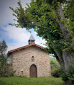
At the Souzy cross, continue along the tarmac road, ignoring the path that climbs up to the right. You’ll reach the hamlet of Soucy and its chapel.

(6) Carry on to reach the ‘Chez Jacques’ signpost.

(7) Take the Chemin le Bertrand straight ahead. Be careful: three paths start side by side. Make sure you take the one in the middle and follow the yellow markings again.
At thefirst junction, turn right, following the yellow markings and the mountain bike signs.
When you reach the Saint-Galmier farm and the tarmac track, carry on straight ahead until you reach the D 4 county road.

(8) Cross the road carefully, as it is a dangerous crossing, and continue down the slope opposite.
At the bend, turn left onto a fairly poorly marked track and follow the yellow markings on thethird tree and the barely visible mountain bike sign; the track runs alongside the meadow.
At the tarmac track, by the ‘Le Bertrand’ signpost, head down to the right towards the houses in Villechenève-les-Terres-Rondes.

(9) Turn right between the houses, following the yellow markings.
On the uphill stretch, at the small junction, carry on straight ahead.
Join the tarmac road in the Les Olmes neighbourhood and carry on straight ahead until you reach the first three-way junction.

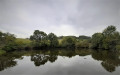
(10) Turn left, then right onto a dirt track leading down to the Étang des Olmes.
At the top of the track, at the tarmac road, turn left towards the ‘3 Chênes’ building, go round it, then turn right as you walk alongside the building and head towards the village.
At the wash house, head down slightly to the left, then immediately turn right onto the one-way street
At the end of the street, carry on straight ahead until you reach the junction with the school’s cul-de-sac.
Take the uphill path on the right, Chemin de la Yellow Cross – la Madone, and you’ll return to the original crossroads.

(1) Turn slightly left to return to the Madone car park (S/E).

Waypoints

  1. S/E : mi 0 - alt. 2,497 ft - Car park at the Madone site
  2. 1 : mi 0.09 - alt. 2,477 ft - Crossroads at the end of the circular loop
  3. 2 : mi 0.6 - alt. 2,267 ft - Lafay
  4. 3 : mi 0.85 - alt. 2,093 ft - Gouby Stream
  5. 4 : mi 1.64 - alt. 1,896 ft - Bridge
  6. 5 : mi 2.25 - alt. 2,198 ft - PR junction
  7. 6 : mi 3 - alt. 2,123 ft - Souzy Chapel
  8. 7 : mi 3.43 - alt. 1,991 ft - Chez Jacques
  9. 8 : mi 4.47 - alt. 2,329 ft - D 4
  10. 9 : mi 4.82 - alt. 2,241 ft - Le Bertrand
  11. 10 : mi 5.27 - alt. 2,392 ft - Les Olmes
  12. S/E : mi 6.22 - alt. 2,484 ft - Car park at the Madone site

Notes

This route is not suitable for pushchairs.
No drinking water along the route.

Worth a visit

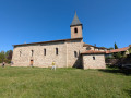
(6) Souzy Chapel: a sign in front of the entrance explains the history of the chapel.

Always be cautious and plan ahead when you're outdoors. Visorando and the author of this route cannot be held responsible for any accidents occurring on this route.

The GR® and PR® markings are the intellectual property of the Fédération Française de Randonnée Pédestre.

Reviews and comments

4.6 / 5
Based on 3 reviews

Reliability of the description
4.7 / 5
Ease of following the route
4.3 / 5
Route interest
4.7 / 5
Berny69
Berny69

Overall rating : 5 / 5

Date of your route : Oct 10, 2023
Reliability of the description : ★★★★★ Very good
Ease of following the route : ★★★★★ Very good
Route interest : ★★★★★ Very good
Very busy route : No

A lovely walk with stunning scenery

Machine-translated

petitmarcheuse
petitmarcheuse

Overall rating : 5 / 5

Date of your route : Jun 27, 2023
Reliability of the description : ★★★★★ Very good
Ease of following the route : ★★★★★ Very good
Route interest : ★★★★★ Very good
Very busy route : Yes

I’m not really sure about a hike

Machine-translated

RobLangdon
RobLangdon

Overall rating : 3.7 / 5

Date of your route : Apr 10, 2022
Reliability of the description : ★★★★☆ Good
Ease of following the route : ★★★☆☆ Average
Route interest : ★★★★☆ Good
Very busy route : No

An important point to note about this walk: there is no mobile phone coverage along much of the route. This means you absolutely must download the map files before setting off (or print out a paper map). The route can be tricky in places (I had to turn back several times); a map is essential to ensure you don’t go astray....

Machine-translated

Other walks in the area

For more walks, use our search engine .

The GPS track and description are the property of this route's author. Please do not copy them without permission.