Villechenève, La Rivière, Bois d'Azol circular loop, via the gardens of La Rivière

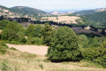
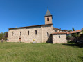
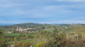
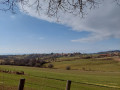
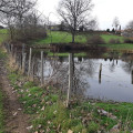
This walk, suitable for everyone, takes you through the hamlet of La Rivière with its imposing buildings, the Bois d’Azol with a slight incline, and offers views of the nearby Loire department from the Vilette area. On the way back, explore the gardens of La Rivière.

Details

11235166
Creation:
Last update:
Last review:
  • Walking
    Activity: Walking
  • ↔
    Distance: 4.32 mi
  • ◔
    Average duration: 2h 40 
  • ▲
    Difficulty: Easy

  • ⚐
    Back to start: Yes
  • ↗
    Ascent: + 804 ft
  • ↘
    Descent: - 830 ft

  • ▲
    Highest point: 2,844 ft
  • ▼
    Lowest point: 2,461 ft

Photos

Description of the walk

Park in the small car park near the Croix de la Rivière or, if the area is busy, at the side of the Chemin de la Rivière.

(S/E) From the Croix de la Rivière, take the path on the left which climbs quite steeply into the forest.

(1) At the top of the climb, at the Bois d’Azol signpost, head straight on towards Croix des Molières, then immediately take the small path on the left, marked in yellow – please note that the markings are not very visible. At the bottom of the short descent, cross the main road (caution: dangerous crossing) and head straight into the woods; at the bottom: yellow markings.

(2) At the bottom of the descent, turn immediately right and continue to follow the yellow markings.
200 m before reaching the road at the top, turn left; the yellow markings are not very visible. Continue down through the woods; at the clearing at the bottom of the descent, turn right.

As soon as you see a tarmac road in the distance, do not take thefirst path on the right but, after about 400 m, take the next one on the right. Note: the yellow markings on the right are hidden by the leaves. The path climbs and is quite stony. After about twenty metres, you’ll see Villette Castle on your left. Continue straight ahead, then take a sharp right-hand bend.

(3) At the top of the wider path, continue to the left, leaving the markings behind. At the tarmac road, turn right until you reach the A-road. Caution: dangerous road!

(4) Take the main road on the left via a narrow footpath behind the safety barrier (around the bend), then turn left at the hamlet of Les Douglas onto Chemin des Molières.

(5) Walk past the house and follow the tarmac path which climbs to the right and behind it.
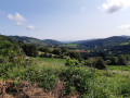
At the Molières cross, turn right towards Villechenève and enjoy the view! In good weather, you can see Mont Blanc a little further on. Cross the main road (dangerous crossing) and continue straight ahead.

(6) At the “Chez Ligot” signpost, turn right towards Villechenève. A slightly steep and stony descent takes you down to the little Molières stream. Cross it and turn left onto theGR®7, marked in red and white
At the first junction, go straight on.

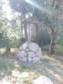
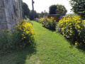
(7) As you climb, you will come to a slightly wider path. Take it to the left and follow the edge of the forest until you reach the Rivière cross. Before returning to your starting point, you can take a short circular loop through the houses and rejoin the path that runs between the (private) gardens of La Rivière (S/E).


Waypoints

  1. S/E : mi 0 - alt. 2,523 ft - Parking at La Rivière
  2. 1 : mi 0.37 - alt. 2,785 ft - Crossroads at the top in the forest
  3. 2 : mi 0.56 - alt. 2,598 ft - Deep in the woods
  4. 3 : mi 1.9 - alt. 2,667 ft - Fork in the path
  5. 4 : mi 2.32 - alt. 2,756 ft - Junction D38
  6. 5 : mi 2.48 - alt. 2,743 ft - The Douglas
  7. 6 : mi 2.93 - alt. 2,762 ft - Chez Ligot signpost
  8. 7 : mi 3.54 - alt. 2,664 ft - Junction with wider path
  9. S/E : mi 4.32 - alt. 2,523 ft - Parking at La Rivière

Notes

This walk is suitable for everyone, but is not recommended with pushchairs.
(An uphill and downhill section strewn with large stones will prevent you from passing)
There are no water sources along the route; the water in the stream is not drinkable. Please bring your own water.

Always be cautious and plan ahead when you're outdoors. Visorando and the author of this route cannot be held responsible for any accidents occurring on this route.

The GR® and PR® markings are the intellectual property of the Fédération Française de Randonnée Pédestre.

Reviews and comments

4.8 / 5
Based on 4 reviews

Reliability of the description
5 / 5
Ease of following the route
5 / 5
Route interest
4.5 / 5
starstella
starstella

Overall rating : 5 / 5

Date of your route : Sep 22, 2024
Reliability of the description : ★★★★★ Very good
Ease of following the route : ★★★★★ Very good
Route interest : ★★★★★ Very good
Very busy route : No

I’ve done this route several times and never thought to leave a review. It’s a lovely route when it’s warm, as the route is shaded. It’s very peaceful in the woods; I really love this spot. Thanks to the author.

Machine-translated

Milorando
Milorando

Hello JulAlex
What did you think of the route?
Unfortunately, your feedback on the app isn’t seen by the app’s developers… here, it’s the creators of the walks (ordinary people like you and me) who receive your message 😀
Have a nice day
Cindy (milorando)

Machine-translated

March2b
March2b

Overall rating : 4.7 / 5

Date of your route : Aug 19, 2024
Reliability of the description : ★★★★★ Very good
Ease of following the route : ★★★★★ Very good
Route interest : ★★★★☆ Good
Very busy route : No

A lovely walk. Quite easy.

Machine-translated

alinou69
alinou69

Overall rating : 4.7 / 5

Date of your route : Jan 22, 2024
Reliability of the description : ★★★★★ Very good
Ease of following the route : ★★★★★ Very good
Route interest : ★★★★☆ Good
Very busy route : Yes

A lovely route with views of the Alps

Machine-translated

JulAlex
JulAlex

Overall rating : 5 / 5

Date of your route : Sep 11, 2023
Reliability of the description : ★★★★★ Very good
Ease of following the route : ★★★★★ Very good
Route interest : ★★★★★ Very good
Very busy route : No

We’ve been using Visorando for a few months now, and we’re very happy with the service.
Whether for short hikes near home or longer circular routes involving camping, the maps are up to date, downloads are quick and the app uses very little battery power, so it’s possible to track your GPS throughout the entire route.
The planning features of the PC version are also very handy.
So, nothing but positives, except for the fact (though perhaps I’m just hopeless…) that the tracks I create aren’t saved and disappear. Furthermore, the elevation gain shown is generally incorrect for each hike; expect an extra 150 to 200 metres of ascent.

Machine-translated

Other walks in the area

For more walks, use our search engine .

The GPS track and description are the property of this route's author. Please do not copy them without permission.