Country:

 City:
City:


Car park on the left as you leave the village.
(S/E) Walk up the village’s main street.
(1) At the junction with Rue du Champet on the right, carry on straight ahead along the main street. At the bend after the village hall, take the path on the left until the first fork. Follow the path straight ahead. Cross the stream (the Vidrésonne). Carry on straight ahead to reach the hamlet of Le Vernet.
(2) Follow the road to the right and walk through the hamlet. Continue straight on to La Bruyère.
(3) Follow the road to the left, then, after 50 m, cross it and take the small road to the right. Continue along the uphill path which joins theGR®3. Follow it to the right for 100 m, then take the forest track to the left. Head uphill through the forest until you reach a forest track.
(4) Follow it to the right. Join the Route du Pin and follow it to the right for 60 m.
(5) Take the path on the left and head towards the hamlet of Le Pin. Walk through the hamlet, then follow the path on the right to reach the hamlet of Barge.
(6) Continue along the path opposite, skirting the houses, and head towards Le Palais. After the hamlet, take the path on the right. Join the road (Chemin de Viallard) and follow it to the right for 600 m.
(7) At the start ofthe third bend, take the path on the left. Walk towards the houses in Frédifont and take the path on the left before reaching the houses; walk alongside them and then join the Route de Bard. Follow it to the left for about 500 m.
(8) Take the path on the right and cross the stream (the Moingt). At the next fork, take the path on the left and join the road. Continue along the road opposite and head towards the centre of Lérigneux.
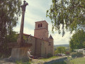
(9) Walk round the church and continue along the road towards the cemetery.
(10) Turn right and walk alongside the cemetery; continue for 300 m and take the road on the left as it descends at the start of the bend. After 150 m, carry on straight ahead along the path to reach the hamlet of Fougerolles. Follow the road to the right until you reach the junction.
(11) Turn left and, at the start of the next bend, take the path on the left and walk up the slope, heading due north, to join theGR®3alternative route.
(12) Follow thisGR® to the right, join the road and follow it to the right for 50 m.
(13) Turn right and head for the hamlet of Contéol. Continue along the road to the right for 800 m and, before the houses, take the path sloping gently down to the left until you reach a road.
(14) Cross the road, then the stream. Start the climb and take the path on the left. Go round the peak and reach the village of Bard.
(15) Walk straight through the village. Pass the church on your left and take theGR® to the right. Follow theGR® to the hamlet of Le Plenet.
(16) Before the last few houses, take the path on the right. Follow theGR® to the hamlet of Le Mas.
(17) After the houses, follow theGR® to the left and head towards the stadium. Walk alongside the sports ground on your right and follow the road to the junction with the D496.
(18) Carry on straight ahead, then, at the next junction, turn left and head towards Verrières, then back to the junction you passed at the start of the route.
(1) Turn left, heading in the opposite direction to the outward journey, to reach the car park (S/E).

 Local authority
 Easy
Easy 
 Visorando Member