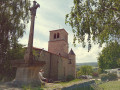
The village of Bard and its two rivers

This walk, starting from the village of Bard, will take you along the banks of the two streams that flow through the commune: the Cotayet and the Bouchat. You’ll enjoy lovely views of the mountains and the Forez plain. 

Details

69706229
Creation:
Last update:
Last review:
  • Walking
    Activity: Walking
  • ↔
    Distance: 6.89 mi
  • ◔
    Average duration: 3h 55 
  • ▲
    Difficulty: Moderate

  • ⚐
    Back to start: Yes
  • ↗
    Ascent: + 823 ft
  • ↘
    Descent: - 814 ft

  • ▲
    Highest point: 2,890 ft
  • ▼
    Lowest point: 2,434 ft

Description of the walk

Park at Place de la Paix in the village of Bard.

(S/E) Cross over to take the small road (Montée du Pic) which climbs opposite the auberge.

(1) Leave the return path on your right, stay on this small road, and walk past the water tower. At the cross, turn onto the path on the right.

(2) At the next junction, carry on straight ahead and head downhill to the Cotayet bridge.

(3) Head back up, cross the RD113-2 carefully and take the path opposite.

(4) At the road, turn left. At the stone cross, keep to the right to follow the road uphill towards Prassouroux. When you reach the hairpin bend, leave the road and head along the path on the left to the hamlet of Fougerolles.

(5) Take the small tarmac road opposite for about fifty metres, towards La Loge, then follow the dirt track to the left, towards Lérigneux. After the last house, stay on this track, veering slightly to the left.

(6) Leave this path to head down to the left and join a small tarmac road leading to the D113-2. Cross it carefully, continue along the path opposite, cross the Cotayet, then head back up to Champblanc Sud and walk alongside the farm.

(7) Take the path on the left to reach Le Maisonny. Continue to the first house, then turn right to enter the hamlet: the wash house is on the right. Pass under the barn bridge to rejoin the D113. Cross it carefully, take the path opposite to reach and cross the Charavan. Continue to Le Sauzet.

(8) Take the small tarmac road opposite leading into the hamlet. Follow it beyond the tarmac and you’ll reach the D44.

(9) Turn left onto it for 50 m, then follow the small road to the left. Pass to the right of the cross and stay on the path until you reach Cordailleux.

(10) Turn left at the entrance to the hamlet. Walk past the farm building and continue along the path.

(11) Turn left towards Bard. Follow this path downhill and cross the stream twice before heading back up a steep path.

(12) At the top of the climb, take the path on the right and join the D113. Follow it to the right until you reach the fork in the road.

(13) Turn left onto the small tarmac road signposted “le Montel”. In the hamlet, turn right towards Les Grangères and follow the small tarmac road on the left until you reach the stone cross. 

(14) Turn left onto the dirt track and continue to the crossroads you passed on the way out.

(2) Follow the small path opposite and stay on the main track. 

(15) Ignore the path opposite leading to Le Garet and turn right onto the wide, flat track. Continue until you rejoin the Montée du Pic.

(1) Take this path on the left to head back down, cross the D113 again and return to the car park (S/E).


Waypoints

  1. S/E : mi 0 - alt. 2,503 ft - Car park - Église Saint-Jean (Bard)
  2. 1 : mi 0.07 - alt. 2,546 ft - Junction for both outbound and return routes
  3. 2 : mi 0.39 - alt. 2,605 ft - Junction of the circular loop
  4. 3 : mi 0.86 - alt. 2,434 ft - Moingt (rivière)
  5. 4 : mi 1.07 - alt. 2,549 ft - Road junction
  6. 5 : mi 1.78 - alt. 2,772 ft - The hamlet of Fougerolles
  7. 6 : mi 2.12 - alt. 2,884 ft - The hamlet of Champ de l’Adret
  8. 7 : mi 2.67 - alt. 2,890 ft - Champblanc Sud hamlet
  9. 8 : mi 3.58 - alt. 2,799 ft - The hamlet of Le Sauzet
  10. 9 : mi 3.95 - alt. 2,802 ft - The hamlet of Crozet
  11. 10 : mi 4.51 - alt. 2,792 ft - Cordailleux hamlet
  12. 11 : mi 4.89 - alt. 2,710 ft - Junction, turn left
  13. 12 : mi 5.34 - alt. 2,684 ft - End of the climb
  14. 13 : mi 5.64 - alt. 2,664 ft - The hamlet of Montel
  15. 14 : mi 6.09 - alt. 2,644 ft - White Cross
  16. 15 : mi 6.55 - alt. 2,530 ft - Crossroads
  17. S/E : mi 6.89 - alt. 2,503 ft - Car park - Église Saint-Jean (Bard)

Notes

Worth a visit

Access to the Pic de Bard (round trip) is available at the start of the route.
In the village, you can eat at the Auberge de Bard.

Reviews and comments

4.7 / 5
Based on 2 reviews

Reliability of the description
4.5 / 5
Ease of following the route
4.5 / 5
Route interest
5 / 5
catherines
catherines

Overall rating : 4.3 / 5

Date of your route : Jul 06, 2026
Reliability of the description : ★★★★☆ Good
Ease of following the route : ★★★★☆ Good
Route interest : ★★★★★ Very good
Very busy route : No

A lovely walk on 5 July. The countryside was completely parched and there was a stifling atmosphere. Although it was morning, there was no birdsong apart from the crows! The route is pleasant, with stretches through woodland and some lovely views. One to do again in spring or autumn.

Machine-translated

User 29058164

Overall rating : 5 / 5

Date of your route : Apr 17, 2026
Reliability of the description : ★★★★★ Very good
Ease of following the route : ★★★★★ Very good
Route interest : ★★★★★ Very good
Very busy route : No

A very beautiful route, much of which runs through woodland with numerous streams
Halfway along the route, an old drinking trough provides a pleasant spot for a snack
In the village of BARD, there is a car park near the church
Enjoy the walk, everyone

Machine-translated

Other walks in the area

For more walks, use our search engine .

The GPS track and description are the property of this route's author. Please do not copy them without permission.