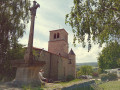
The Pic and the Cotayet

This route crosses the River Cotayet twice and offers varied scenery: low stone walls, beech groves, paths lined with hazel trees, and views over the plain and the Alps.

Details

4316733
Creation:
Last update:
Last review:
  • Walking
    Activity: Walking
  • ↔
    Distance: 3.65 mi
  • ◔
    Average duration: 2h 15 
  • ▲
    Difficulty: Easy

  • ⚐
    Back to start: Yes
  • ↗
    Ascent: + 686 ft
  • ↘
    Descent: - 666 ft

  • ▲
    Highest point: 2,635 ft
  • ▼
    Lowest point: 2,044 ft

Description of the walk

Park at Place de l’Église in the village of Bard.

(S/E) From the church car park, cross the D113. Take the small road that climbs up opposite the inn. Stay on this small road. Pass in front of the water tower.

(1) At the cross, turn onto the path on the right and pass the path on the left which leads to Les Grangères. Continue straight on, leaving the PR®1 behind, and head down to the Cotayet bridge. Head back up, cross the road (D113-2) and take the path opposite.

(2) Before reaching the Route de Contéol, turn onto the main track leading down to the right. Cross the small road at Fontroyet and continue to Moulin Palais, then follow the small road downhill for 100 metres.

(3) Just before the stone cross, turn right onto the small, flat road to reach and cross the D113-2. Follow the path opposite and cut across the D113.

(4) Head down the very rugged path opposite, cross the Cotayet again via the footbridge and head back up, veering to the left. Pass the first path on the right and continue along the flat section.

(5) Before reaching the descent, head up the path on the right and, after a steep climb, cross the D113; continue along the path straight ahead for 100 m and turn left to reach a housing estate.

(6) Walk alongside it and, just after the iron cross, head up to the right onto the small tarmac road leading to the last houses in the housing estate. Continue along a path lined with low stone walls. When you reach the flat area at the edge of the field, take the main path on the left (PR®1) and head back to the village, finishing on the small road leading downhill to the left (S/E).

Waypoints

  1. S/E : mi 0 - alt. 2,507 ft - Car park - Église Saint-Jean (Bard)
  2. 1 : mi 0.26 - alt. 2,608 ft - Cross
  3. 2 : mi 1.09 - alt. 2,549 ft - Contéol Trail
  4. 3 : mi 1.85 - alt. 2,133 ft - Moulin Palais
  5. 4 : mi 2.23 - alt. 2,116 ft - Jambin crossroads. Towards the - Moingt (rivière)
  6. 5 : mi 2.61 - alt. 2,129 ft - Malleval
  7. 6 : mi 3.06 - alt. 2,431 ft - Le Garet housing estate
  8. S/E : mi 3.65 - alt. 2,507 ft - Car park - Église Saint-Jean (Bard)

Notes

Worth a visit

Access to Pic de Bard (round trip) at (1).
In the village, you can eat at the Auberge de Bard.

Always be cautious and plan ahead when you're outdoors. Visorando and the author of this route cannot be held responsible for any accidents occurring on this route.

The GR® and PR® markings are the intellectual property of the Fédération Française de Randonnée Pédestre.

Reviews and comments

4.4 / 5
Based on 3 reviews

Reliability of the description
4.3 / 5
Ease of following the route
4.3 / 5
Route interest
4.7 / 5
guy pagat
guy pagat

Overall rating : 5 / 5

Date of your route : May 01, 2026
Reliability of the description : ★★★★★ Very good
Ease of following the route : ★★★★★ Very good
Route interest : ★★★★★ Very good
Very busy route : No

A nice little walk, though there was a bit of a climb at the end. We didn’t see a soul, apart from a viper, which quickly slithered off

Machine-translated

Martine Gourbière
Martine Gourbière

Overall rating : 4 / 5

Date of your route : Sep 08, 2024
Reliability of the description : ★★★★☆ Good
Ease of following the route : ★★★★☆ Good
Route interest : ★★★★☆ Good
Very busy route : No

A lovely, undulating walk with beautiful scenery, and very accessible for everyone.

Machine-translated

User 17086454

Overall rating : 4.3 / 5

Date of your route : Mar 28, 2023
Reliability of the description : ★★★★☆ Good
Ease of following the route : ★★★★☆ Good
Route interest : ★★★★★ Very good
Very busy route : No

A lovely, easy walk with superb views over the Forez plain

Machine-translated

Other walks in the area

For more walks, use our search engine .

The GPS track and description are the property of this route's author. Please do not copy them without permission.