Chazelles-sur-Lavieu–Verrières circular loop

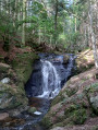
A lovely walk, partly through woodland in the Monts du Forez, passing by the Saut du Diable waterfall.

Details

39229695
Creation:
Last update:
Last review:
  • Walking
    Activity: Walking
  • ↔
    Distance: 10.34 mi
  • ◔
    Average duration: 6h 25 
  • ▲
    Difficulty: Moderate

  • ⚐
    Back to start: Yes
  • ↗
    Ascent: + 1,867 ft
  • ↘
    Descent: - 1,873 ft

  • ▲
    Highest point: 3,950 ft
  • ▼
    Lowest point: 2,628 ft

Photos

Description of the walk

Car park: in front of the cemetery, on the outskirts of the village of Chazelles-sur-Lavieu.
The route follows the GR®3 link path, signposted in red and white (sparse signposting), and the GR®3 itself, signposted in red and white.

(S/E) Walk up through the village along Route de Verrières, turn right twice and continue straight on along Route de Fortunières until you reach the last house.

(1) Take the path leading uphill to the left and join a road. Follow it to the left, then go straight on through two junctions until you reach the D102.

(2) Cross the D102, pass the cross on your left and continue along the path leading to Gumières.

(3) Cross the two roads straight ahead and walk alongside the cemetery to reach the bottom of the village at a junction.

(4) Take the road on the right (Montée de la Cascade), walk up through the village and continue straight on along the path. Follow the signposts for the waterfall. You’ll come to a Fork in the road.

(5) Leave the main path (GR®3) and follow the path on the left signposted for the waterfall. Carefully follow the edge of the stream and admire the various waterfalls. You’ll reach the last one, the Cascade du Saut du Diable.

(6) Turn back and retrace your steps to the previous Fork in the road.

(5) Take the forest track (GR®3) to the left and head towards Le Curtil.

(7) Take the road on the left before the houses, then follow the path on the left at the start of the bend to reach the hamlet of Plenafeix. Take the path on the left before the last house. Reach the road, cross it and follow theGR®3 path opposite. Reach the next road (D496) and follow it to the right for 400 m until you reach a T-junction.

(8) Turn onto the path on the left before the house and follow it for 600 m.

(9) Then leave theGR®3and take a less signposted alternative route ofthe GR®3on the right. Continue straight on through the forest, passing a few paths on the right, until you reach a T-junction (alt. 1,155 m).

(10) Turn onto the forest track on the right, then take the next one on the left. Continue straight down the slope until you reach the hamlet of Conol.

(11) Walk straight through the hamlet and carry on until you reach the road (D946). Cross the road, continue straight ahead and head for Verrières-en-Forez. Walk straight through the village.

(12) On leaving the village, take the road on the right (Chemin des Rapeaux). Head towards Les Rapeaux and continue straight on along the track. You’ll reach a road; follow it to the right until you reach the junction with the cross.

(13) Continue straight ahead and pass through Les Poizats. On leaving the hamlet, take the path on the right, head downhill and join a road.

Follow it for 100 m, then take the path leading uphill to the right. At the hamlet of Vanel, follow the road to the right, continue straight on along the path and join the road. Follow it to the right for 50 m, take the path on the left and head for Château Lapierre.

(15) Walk alongside the estate until you reach a small road. Follow it straight ahead for 400 m, then take the path on the left to reach the Chazelles cemetery (S/E).

Waypoints

  1. S/E : mi 0 - alt. 2,943 ft - Chazelles-sur-Lavieu Cemetery car park
  2. 1 : mi 0.21 - alt. 2,995 ft - Junction
  3. 2 : mi 0.42 - alt. 3,100 ft - D102. Cross
  4. 3 : mi 0.87 - alt. 2,897 ft - Gumières Cemetery
  5. 4 : mi 1.09 - alt. 2,904 ft - Gumières
  6. 5 : mi 1.86 - alt. 3,202 ft - Junction. Signposted towards the - Cascade du Saut du Diable
  7. 6 : mi 2.16 - alt. 3,271 ft - Saut du Diable Waterfall - Mare (rivière)
  8. 7 : mi 2.89 - alt. 3,399 ft - Le Curtil
  9. 8 : mi 4.05 - alt. 3,793 ft - Le Roy
  10. 9 : mi 4.46 - alt. 3,937 ft - Junction. Split between the GR3 and GR3 Variant
  11. 10 : mi 5.34 - alt. 3,793 ft - T-junction
  12. 11 : mi 6.54 - alt. 3,215 ft - Conol
  13. 12 : mi 7.83 - alt. 2,717 ft - Verrières-en-Forez
  14. 13 : mi 8.67 - alt. 2,815 ft - Les Poizats
  15. 14 : mi 9.09 - alt. 2,628 ft - Road and bridge at the - Curraize (rivière)
  16. 15 : mi 9.79 - alt. 2,782 ft - Château Lapierre
  17. S/E : mi 10.34 - alt. 2,943 ft - Chazelles-sur-Lavieu Cemetery car park

Worth a visit

- Saut du Diable Waterfall.
- Château Lapierre.

Always be cautious and plan ahead when you're outdoors. Visorando and the author of this route cannot be held responsible for any accidents occurring on this route.

The GR® and PR® markings are the intellectual property of the Fédération Française de Randonnée Pédestre.

Reviews and comments

4.5 / 5
Based on 2 reviews

Reliability of the description
4.5 / 5
Ease of following the route
4 / 5
Route interest
5 / 5
kekere
kekere

Overall rating : 5 / 5

Date of your route : Aug 12, 2024
Reliability of the description : ★★★★★ Very good
Ease of following the route : ★★★★★ Very good
Route interest : ★★★★★ Very good
Very busy route : No

A lovely walk
On this sweltering day, I set off from Verrières as there are fewer shaded areas on the way to Gumieres (and I was glad I did – early in the morning I even had the low-angling shade from the east). You can also start from Conol.

A lovely route; the sections through the woodland are varied and very refreshing!!

It’s true that the GR3 or GR3 variant markings aren’t always present, so you sometimes need to follow the route on the app or a map.

You can also combine this with a visit to Abiessence in Verrières or the “Cabinet des curiosités” convent in Chazelles.

Machine-translated

catherines
catherines

Overall rating : 4 / 5

Date of your route : Apr 08, 2024
Reliability of the description : ★★★★☆ Good
Ease of following the route : ★★★☆☆ Average
Route interest : ★★★★★ Very good
Very busy route : No

Hello

A lovely walk, mostly through the woods but also offering some lovely scenery. A GPS is essential, and there was a rather feisty stallion who got into a tussle with the dog – he jumped the fence – towards the end of the route. I really enjoyed this walk, which took 4 hours.

Machine-translated

Other walks in the area

For more walks, use our search engine .

The GPS track and description are the property of this route's author. Please do not copy them without permission.