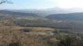
Circular route around Bénaix

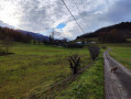
Although more than half of the route follows a tarmac road, the route is very suitable for a family walk as there is almost no traffic.

Details

4434145
Creation:
Last update:
Last review:
  • Walking
    Activity: Walking
  • ↔
    Distance: 2.66 mi
  • ◔
    Average duration: 1h 35 
  • ▲
    Difficulty: Easy

  • ⚐
    Back to start: Yes
  • ↗
    Ascent: + 371 ft
  • ↘
    Descent: - 371 ft

  • ▲
    Highest point: 2,083 ft
  • ▼
    Lowest point: 1,699 ft

Photos

Description of the walk

You can park in the car park next to the local school in Bénaix.

(S/E) Walk eastwards along the D210 towards Saint-Jean-d’Aigues-Vives and stay on the same road until you reach the hamlet of Rousseaux.

(1) Turn left. A little further on, there is a shooting range on the right. Continue to the Pas de l’Écluse.

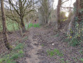
(2) Immediately after a small bridge, leave the tarmac road (marked with red and white signs) and go through a large gate. Continue along the path heading due west.

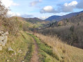
(3) At the end of the path, in a clear-cut area, turn left and you’ll reach the road at a place called Barberousse.

(4) Carry on following the signs for Benaix and Morenci until you reach the junction with the D210.

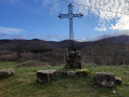
(5) Turn left at the metal cross and head for the car park next to the local school (S/E).

Waypoints

  1. S/E : mi 0 - alt. 2,070 ft - Car park next to the local school in Bénaix
  2. 1 : mi 1.23 - alt. 1,755 ft - Turn left at the hamlet of Rousseaux
  3. 2 : mi 1.45 - alt. 1,699 ft - Pas de l’Écluse
  4. 3 : mi 1.99 - alt. 1,962 ft - Turn left at the end of the path in open terrain
  5. 4 : mi 2.05 - alt. 1,985 ft - Barberousse hamlet
  6. 5 : mi 2.45 - alt. 2,034 ft - Junction with the D210 (metal cross)
  7. S/E : mi 2.66 - alt. 2,070 ft - Car park next to the local school in Bénaix

Notes

Next to the local school, there are picnic tables.

The IGN base map is not accurate at waypoint (2). The OSM base map clearly shows that theGR® continues straight ahead.

Always be cautious and plan ahead when you're outdoors. Visorando and the author of this route cannot be held responsible for any accidents occurring on this route.

The GR® and PR® markings are the intellectual property of the Fédération Française de Randonnée Pédestre.

Reviews and comments

3.8 / 5
Based on 3 reviews

Reliability of the description
4.5 / 5
Ease of following the route
4 / 5
Route interest
3 / 5
User 23791319

Overall rating : 4.3 / 5

Date of your route : Mar 25, 2026
Reliability of the description : ★★★★☆ Good
Ease of following the route : ★★★★☆ Good
Route interest : ★★★★★ Very good
Very busy route : No

The route is clearly signposted; we’re a club for senior citizens, and we didn’t get lost. The scenery is lovely, the weather was sunny, there were few cars, and the walk back along the path was most pleasant. In Benaix there are benches and tables for a picnic. We’ll be happy to come back here when the weather’s fine.

Machine-translated

User 3147545

Overall rating : 4 / 5

Date of your route : Feb 24, 2026
Reliability of the description : ★★★★★ Very good
Ease of following the route : ★★★★☆ Good
Route interest : ★★★☆☆ Average
Very busy route : No

Very limited interest. Well suited for a little exercise.

Machine-translated

Roel964
Roel964

Hello Danali31,
I see that you’ve created two routes yourself, 8 and 12 kilometres long.
Perhaps these routes are less suitable for a young family than the “Circular Route around Bénaix”?
The description clearly states: “Although more than half of the route is on a tarmac road, it is very suitable for a family walk as there is almost no traffic.”
If you don’t like this description, you’d be better off quickly moving on to a route that appeals to you rather than commenting on a route that isn’t intended for you and which you apparently haven’t even walked yourself!

Machine-translated

Danali31
Danali31

Overall rating : 1 / 5

Date of your route : Mar 01, 2022
Reliability of the description : Not used / Not applicable
Ease of following the route : Not used / Not applicable
Route interest : ★☆☆☆☆ Very disappointing
Very busy route : No

What’s the point of offering this sort of route? If you want to stick to tarmac, there are the Michelin maps; and, much to the dismay of proper hikers, Visorando is full of these tarmac routes… enough to put us off using Visorando altogether… long live Open Runner!

Machine-translated

Other walks in the area

For more walks, use our search engine .

The GPS track and description are the property of this route's author. Please do not copy them without permission.