Country:
 City:
City:


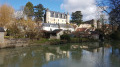
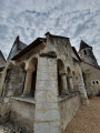
Park in the Place de l’Église Saint-Michel in Villeloin-Coulangé.
(S/E) With your back to the church, take the small alleyway leading downhill. Cross the Indrois and take the road on the right, then the next one on the left to reach the Garenne neighbourhood.
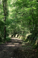
(1) Continue along the road, turning left at the three-way junction, then carry on along the path that follows it. Walk along the edge of the fields, then turn left at the right-angled crossroads. You’ll reach the hamlet of La Grange.
(2) Turn right onto the D12. Follow it for a few hundred metres, then turn sharply right at a 90° angle. Cross the Ruisseau de Rouère Hyglas at a barely marked ford. Then take thefirst path on the left. Continue along this path until you reach the Carroi de la Croix Feuillant crossroads.
(3) Turn right and take the stony track to rejoin a road near the hamlet of La Rodaine.
(4) Turn left to follow the road, pass through the hamlet of La Challerie, then turn right onto a road that turns into a track. You’ll reach a multi-way junction by a small stream.
(5) Carry on straight ahead, pass through the hamlet of Blackford and reach the D760 immediately afterwards.
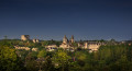
(6) Turn right onto it and proceed for a few metres, taking care. Cross the Indrois then turn immediately right onto the Chemin des Balcons de l’Indrois. Follow the river to a footbridge, cross it again and head up the road to the left to pass through part of Montrésor. You’ll reach the Crédit Agricole.
(7) Take Rue du 11 Novembre, then turn right onto Rue du 8 Mai. Pass the fire station and turn right at the next junction. Continue past the secondary school and, at the next crossroads, turn right, then immediately take thefirst path on the left to reach a three-way junction.
(8) Leave the main track and take the one on the right, continuing along the edge of the fields. You will then reach a crossroads with four arms that are almost perpendicular to one another.
(9) Turn right, walk alongside a copse and reach a small road. Take this road to the left and, a few metres further on, you’ll come to another crossroads. Take the road on the right to reach the entrance to the hamlet of Le Breuil.
(10) Leave the road and take the path opposite; follow it until you reach the Route des Perrières, then turn right onto it. You will then come to the D760; turn left onto it with care and follow it to the car park at the Place de l’Église in Villeloin-Coulangé (S/E).

 Local authority
 Moderate

 Visorando Member