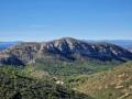
Circular Montgó starting from Port de l’Escala

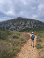
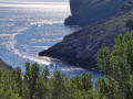
This walk will take you into the heart of the Montgrí, Illes Medes and Baix Ter Natural Park. An immersion in a landscape where nature unfolds in all its wild and untamed grandeur. Little by little, the walk transforms into a journey where the gentle coastline gives way to an almost intimidating austerity. The rocky ground, carpeted with low, prickly vegetation, offers resistance with every step. The sheer cliffs plunge vertiginously into secret coves, and the thought of approaching the void sends a shiver down your spine, reminding you that this environment remains the realm of the wild. The contrast is striking. This hike is more than just a simple walk; it is an exploration of extremes: the ruggedness of the wild terrain, the austere silence of the pine forests, and the reward of an exceptional panorama that reveals itself after every difficult stretch.

A technical and demanding hike. Please read the ‘Practical Information’ section carefully before setting out.

Details

n°65944316
Creation:
Last update:
Last review:
  • Walking
    Activity: Walking
  • ↔
    Distance: 6.66 mi
  • ◔
    Average duration: 3h 50 
  • ▲
    Difficulty: Difficult

  • ⚐
    Back to start: Yes
  • ↗
    Ascent: + 853 ft
  • ↘
    Descent: - 843 ft

  • ▲
    Highest point: 341 ft
  • ▼
    Lowest point: 0 ft

Photos

Description of the walk

Park at the Clota Grossa harbour car park.

(S/E) Passing the El Pescador restaurant and the diving club on your left, head north-east then turn right, following the red and white markings ofthe GR®9, which forms part of the Cami de Ronda.

(1) Carry on straight ahead along the coast, following the signposts, which remain clearly visible throughout.

(2) Keep left at the three-way junction to stay as close as possible to the sea and emerge onto Carrer de la Punta Montgó.

(3) Leave theGR®92and follow the road to the left until you rejoin the path along the cliff.

(4) Turn left to follow the path: for a few metres, the path is marked with white and green markings. This is a technical and exposed section where you may sometimes need to use your hands.

(5) At the end of this first section, take in the view and rejoin the path along the cliff face towards the next difficult section.

(6) This is where a second technical and exposed section begins, with parts no more than 40 cm wide. There’s no room for a misstep! Watch your step carefully and use your hands if necessary.

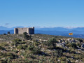
(7) Take in the 360° view whilst exploring the area around Montgó Hill before rejoining the path, which heads due south. This is a small scree slope; remain vigilant on the descent, using your hands carefully on the final stretch.

(8) Continue along the Cami de Ronda, skirting the cliff and Platja de Montgó, and rejoin theGR®92.

(9) Carry on straight ahead to finish walking along the beach, then rejoin the path: take care, as there are steep sections along the cliff face.

(10) Head up to the left behind the small abandoned hut to reach Punta del Milà.

(11) Turn back.

(10) Take the path on the left and you’ll soon reach the Punta Ventosa viewpoint, where you can see Montgó Hill from a different angle. Join the forest track.

(12) Carry on straight ahead towards the south-west until you reach a four-way junction.

(13) Leave theGR®92by following the path on the right.

(14) Leave the hiking trail and turn right to walk alongside the campsite. Join Avinguda Montgó (Montgó Avenue) and turn left, heading north-west. Take care when walking on the pavements and crossing at pedestrian crossings.

(15) Go round the roundabout on the right, continue along Avinguda del Montgó, then keep right at the three-way junction to follow Avinguda de Riells. Navigate the left-hand bend.

(16) Cut right across the nature reserve. Turn left at the junction, come out at the first car park and turn right to reach the car park you chose at the start (S/E).

Waypoints

  1. S/E : mi 0 - alt. 10 ft - El Pescador Restaurant car park
  2. 1 : mi 0.36 - alt. 16 ft - Platja del Bol Roig
  3. 2 : mi 0.74 - alt. 121 ft - Junction, turn left
  4. 3 : mi 1.2 - alt. 33 ft - Leave the GR°°®°° trail, turning left
  5. 4 : mi 1.28 - alt. 36 ft - Back on the trail
  6. 5 : mi 1.46 - alt. 59 ft - End of first technical section
  7. 6 : mi 1.57 - alt. 98 ft - Second technical section
  8. 7 : mi 1.72 - alt. 276 ft - Montgó Hill
  9. 8 : mi 2.03 - alt. 33 ft - Penya-segat Cala Montgó
  10. 9 : mi 2.35 - alt. 13 ft - Rejoining the GR°°®°°92
  11. 10 : mi 3.3 - alt. 82 ft - Punta del Mila junction
  12. 11 : mi 3.4 - alt. 13 ft - Punta del Milà
  13. 12 : mi 3.73 - alt. 213 ft - Punta del Milà viewpoint
  14. 13 : mi 4.29 - alt. 338 ft - Leave the GR°°®°° trail, turning right
  15. 14 : mi 5.42 - alt. 69 ft - Junction, on the right
  16. 15 : mi 5.86 - alt. 112 ft - Roundabout
  17. 16 : mi 6.34 - alt. 52 ft - Natural Park
  18. S/E : mi 6.66 - alt. 7 ft - El Pescador Restaurant car park

Notes

There are numerous technical and exposed sections along the cliff face. Take care between (3) and (8) and between (9) and (12).

(3) If you are not used to walking on rough terrain and are afraid of heights, you can reach the Montgó tower directly by road by following this route: turn right, then left to follow Carrer de les Cambres. Then turn right onto Carrer de la Punta Montgó, ignore the dead end on the left, turn left onto Carrer del Garbinell and rejoin the Cami de Ronda before the (7).

Adverse weather conditions (rain, the tramontana wind, high temperatures, etc.) can make the walk more difficult.

Summer months (June to September): set off on the walk very early in the morning. There is little shade along the route and temperatures start to rise from 9 am.

Make sure you take plenty of water: between 1l and 2l per person.

(7) The Torre de Montgó is an excellent vantage point for sunrises and sunsets. Allow between 45 minutes and 1 hour’s walk from the start to time your visit for the best views.

Worth a visit

  • Montgó Beach.
  • Pizzas Síbaris: the best pizza in L’Escala – Open only during the summer months.
  • Paddleboard hire on Montgó Beach: ideal for exploring the cove and the base of the cliffs
  • Anchorage area in Montgó Cove – More information here

Always be cautious and plan ahead when you're outdoors. Visorando and the author of this route cannot be held responsible for any accidents occurring on this route.

The GR® and PR® markings are the intellectual property of the Fédération Française de Randonnée Pédestre.

Reviews and comments

5 / 5
Based on 1 review

Reliability of the description
5 / 5
Ease of following the route
5 / 5
Route interest
5 / 5
TISSOTY
TISSOTY

Overall rating : 5 / 5

Date of your route : Jan 08, 2025
Reliability of the description : ★★★★★ Very good
Ease of following the route : ★★★★★ Very good
Route interest : ★★★★★ Very good
Very busy route : No

A truly beautiful walk, suitable only for experienced walkers given the rocky terrain and the sections along the cliff edges, with a particularly tricky stretch between points 5 and 6. This walk offers the chance to discover magnificent scenery as well as the lovely neighbourhood of MONTGO.

Machine-translated

Other walks in the area

For more walks, use our search engine .

The GPS track and description are the property of this route's author. Please do not copy them without permission.