From L’Estartit to Cala Calella and back

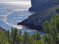
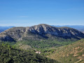
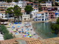
This route allows you to get away from the beaches and the hustle and bustle of the seaside resort of L’Estartit, taking you along cliffs with stunning views of Roca Maura, the Medes Islands and the rugged coastline. The stony, sometimes uneven path leads to Cala Calella, a small, beautiful cove where swimming is a pleasure.

Details

58777187
Creation:
Last update:
Last review:
  • Walking
    Activity: Walking
  • ↔
    Distance: 2.58 mi
  • ◔
    Average duration: 1h 40 
  • ▲
    Difficulty: Easy

  • ⚐
    Back to start: Yes
  • ↗
    Ascent: + 551 ft
  • ↘
    Descent: - 545 ft

  • ▲
    Highest point: 282 ft
  • ▼
    Lowest point: 0 ft

Description of the walk

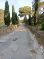
Park in the large car parks at the beaches in L’Estartit: the public car park (free) or the harbour car park (chargeable).

(S/E) Head towards the seafront promenade (Passeig Maritim) heading east. Opposite the Tourist Office, take the Passeig Maritim which runs alongside the harbour, heading east. Follow the route marked “Camí de Ronda”.

(1) Leave the Passeig Maritim on the left, passing in front of the Hotel El Volanti, and head up Carrer del Cap de la Barra (a cul-de-sac). The houses lining the seafront briefly block the view on this climb. When you reach the end of the street, take the stone steps on the right, at the signpost indicating Cap de la Barra and Cala Calella. Continue along the path heading north-east.

(2) Take the small path on the right to walk alongside the railings of the Cap de la Barra viewpoint and enjoy the panoramic view of the beaches of L’Estartit, Roca Maura mountain and the Medes Islands. Continue along the main path, heading north.

(3) Stay on the main path without taking any of the turn-offs to the left, although you can make a short detour to see the geological feature known as the Pou de la Calella, about ten metres away. Continue along the path, heading north.

(4) Do not take the path branching off to the right; instead, carry on straight ahead, heading north, staying on the Cami de Ronda. The path begins to descend through a forest of white pines, and the gradient becomes steeper as it follows a ridge leading to the cove. Walk close to the cliffs, which offer a view of Punta dels Arquets, without straying too far and taking care. You will then reach Cala Calella, where the rocky outcrops allow you to swim in shallow, crystal-clear water.

(5) Turn back and follow the same route in the opposite direction to return to the starting car park (S/E).


Waypoints

  1. S/E : mi 0 - alt. 10 ft - Car park
  2. 1 : mi 0.45 - alt. 36 ft - Carrer del Cap de la Barra - Belvédère du Cap de la Barra
  3. 2 : mi 0.86 - alt. 266 ft - Cap de la Barra viewpoint - Belvédère du Cap de la Barra
  4. 3 : mi 0.97 - alt. 282 ft - Trail junctions - Pou de la Calella
  5. 4 : mi 1.06 - alt. 269 ft - Trail junctions
  6. 5 : mi 1.28 - alt. 52 ft - Cala Calella - Cala Calella
  7. S/E : mi 2.58 - alt. 10 ft - Car park

Notes

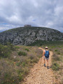
Some sections are very stony and can be uneven at times. You must wear suitable footwear. Caution: the route runs along cliffs; do not get too close to the edge.

Make sure you take plenty of water with you, especially in summer, as there are no water points along the route.

Although they are somewhat faded, white and green markings (local footpath) help you follow the route in certain sections.

Please respect the area and the environment in general, as the path is within a Nature Reserve. It is forbidden to continue along the ‘Camí de Ronda’ path beyond Cala Calella between 15 January and 15 June (these cliffs are a sensitive area where endangered species live). You must return by retracing your steps along the same route you took on the way there.

Worth a visit

Longer route: between 16 June and 14 January, it is possible to continue past Cala Calella along the path that runs along the coast and over the cliffs to Port del Falaguer.

Points of interest:
- Cap de la Barra viewpoint.
- Pou de la Calella.
- Cala Calella.

Reviews and comments

4.5 / 5
Based on 2 reviews

Reliability of the description
4.5 / 5
Ease of following the route
4 / 5
Route interest
5 / 5
User 19171245

Overall rating : 5 / 5

Date of your route : Sep 07, 2026
Reliability of the description : ★★★★★ Very good
Ease of following the route : ★★★★★ Very good
Route interest : ★★★★★ Very good
Very busy route : Yes

Hello
I use Visiorando, and it was brilliant in Spain.
Thank you

Machine-translated

Pilator
Pilator

Actually, my comment would be more applicable to a walk taking in the various coves!

Machine-translated

diggi
diggi

Pilator,
That’s exactly what I stated in my description (practical information): ‘It is forbidden to continue along the “Camí de Ronda” path beyond Cala Calella between 15 January and 15 June.’ If you come back in a month’s time, the circular route will be open.
This isn’t new, as the path passes through sensitive cliff areas where endangered species live.
My route is indeed a return journey. It’s not quite as enjoyable, but you can still make the most of this little cove!

Machine-translated

Pilator
Pilator
• Edited:

Hello Diggi,
The path leads to the first cove, but is then off-limits; however, I’m not sure if it’s permanently closed. The signposting seems to have been designed to divert walkers away from the whole area (hence the need to take an unsightly road to get up onto the plateau). Anyone keen to follow a lovely route will have to be a bit resourceful...

Machine-translated

diggi
diggi

Hello Pilator,
I had specified in my description (practical information): “It is forbidden to continue along the ‘Camí de Ronda’ path beyond Cala Calella between 15 January and 15 June (these cliffs are a sensitive area where endangered species live).”
Is the path closed earlier this year, and does this even prevent access to the first cove, ‘Cala Calella’?

Machine-translated

Pilator
Pilator
• Edited:

Overall rating : 3.5 / 5

Date of your route : Apr 29, 2025
Reliability of the description : ★★★★☆ Good
Ease of following the route : ★★★☆☆ Average
Route interest : Not used / Not applicable
Very busy route : No

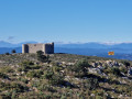
The prospect of discovering a series of rocky coves was greatly diminished by the decision to close part of the path due to nesting birds, preventing us from reaching the various coves at the start of the route. The local tourist office misled us by directing us towards the new signposting, which takes you up onto the plateau via a road...
All in all, a very mediocre walk… The plateau is rather uninspiring.

Machine-translated

Other walks in the area

For more walks, use our search engine .

The GPS track and description are the property of this route's author. Please do not copy them without permission.