Country:

 City:
City:


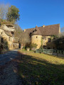
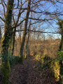
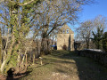
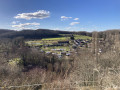
The route starts on Route de Varenne, in front of the entrance to the Econo-Musée du Papier on the D37E1, the view of which will open up towards the end of the walk. Yellow signposts.
(S/E) With your back to the car park, turn right, head towards Route de Cahors (D660) – the main road about a hundred metres away – and turn right. Walk past the town hall and, when you reach the bakery, turn left (Rue du Docteur Robert Perpérot). About 150 metres further on, take the signposted path on the right (Rue du Quartier Romain), heading uphill to a Fork in the road, opposite a street lamp and a fire hydrant.
(1) At the fork in the road, take the left-hand path past the fire hydrant and head for Rue Jean de la Salle at the next junction on the right. Continue to No. 34 and go up the path on the left, then keep to the right to reach the junction at the top of the hill.
(2) At the junction, the path is signpostedGR®6. Turn left and continue to the road at the Toutifaut Lodge. Turn left and carry on straight ahead towards Ferme Peytavit.
(3) At the crossroads, leave the road and take the path opposite. Follow this path until you reach the road, then follow the road straight on for about a hundred metres, before turning right at thefirst crossroads, just past a wooden house on your left.
(4) Turn left immediately. Continue along this road until you come to the entrance to a property directly in front of you. Then turn right to follow the Sentier des Orchidées. Walk past the picturesque wooden chalet and rejoin the road at the property known as La Truffière.
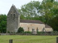
(5) Carry on to the next fork. Turn left towards “Falaise de Saint-Front” to reach the Saint-Front Chapel.
(6) After your visit, retrace your steps for a few dozen metres to take the path that descends to the left of the road (signpost and directional arrow) and joins the road below. Turn left, then right, following the road to a Fork in the road at the hamlet of Bousserand.
(7) Turn right, follow the track to the hamlet of Font-Blanque, then turn left. When you reach the edge of the forest, stay along the edge for a few dozen metres and veer right into the forest. Follow the path to the next road.
(8) Cross the road and continue straight on along this path, which runs parallel to a small road and joins it shortly afterwards. Continue along the road for about a hundred metres until you reach a junction just before the road bends to the right. A forest path starts directly in front of you, between the road and the entrance to a property.
(9) Take this forest track and continue along the edge of the woodland until you reach the next junction of paths, which you passed on the way out.
(2) Just before the junction, take the path immediately on your left, heading downhill. Please note: there are no yellow markings, just theGR®6signposted on the descent. At the road, turn right towards the church.
(10) At the junction near the church, turn left, cross the D660 (at the pedestrian crossing), cross the stream ‘le Couze’ and, about 100 metres further on, at the junction near a crucifix, turn right onto the road (Allée des Noyers) for a few dozen metres. Veer right at the foot of the cliff and follow the path (which goes round the campsite to the “l’Étendoir” exhibition hall, in front of the campsite entrance). Turn right and continue to the Stop sign by the post office.
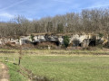
(11) Turn left. At the next junction, turn right towards the Econo-Musée, Chemin des Guillandoux, passing in front of the carved cliffs. At the Econo-Musée, cross the stream to the right via the footbridge to reach the starting car park (S/E).

 Thank you for suggesting this walk.
 Visorando Member

 Difficult
 Easy
Easy