Country:

 City:
City:


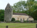
The route starts at Place Louise Mazeau, by the car park above the village church.
Please follow the signposts along the route, which consist of round discs bearing the route numbers 3 and 4. These discs may also display other numbers, which should be ignored.
(S/E) Leave the car park by turning right into Rue du Château, towards the church. At the ‘Give Way’ sign, turn left and continue to the three-way junction at the wayside cross. Follow the C201 to the right until the next fork in the road.
(1) Take the road on the left, turn right at the foot of the cliff and follow the Chemin des Hyvernats to the bridge over the Couze.
(2) Ignore the bridge and continue left towards the hamlet of Bourzac until you reach Rue du Petit Coulobre.
(3) Turn left at the fire hydrant. The road becomes a farm track.
(4) At the top of the hill, first turn right then left, join the road that passes through the hamlet of Le Bidou and continue to the next junction.
(5) Turn left and continue along the Chemin du Pech-Nadal, which runs alongside the fields. Cross the first road and head down the hill. After the second road, take care: the path becomes steep.
(6) At the bottom of the descent, turn left onto the forest track at the edge of the woods which runs alongside the Château de Lanquais and carry on until you reach the road. Turn right for 100 m at the hamlet of Bournazel and then right again onto the Route de Boyer for 100 m.
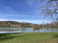
(7) Take the path on the left at the fire hydrant, which leads to the lakeside. Follow it to the next junction, then take the road towards the bridge over the Couzeau and continue for 150 metres.
(8) As you come out of the bend, enter the forest. Shortly afterwards, at the Fork in the road, take the path on the right to complete the additional 4 km circular route of the 20 km Route No. 4.
Follow the bottom of the valley and, at the cross-country track, first turn right then left. Keep the valley on your right and you’ll reach a four-way junction.
(9) Turn left and continue straight on until you reach a fence.
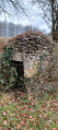
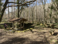
(10) Turn left and follow the track which passes a pidgeon hunting hut (elevation 137) before reaching the junction where the two routes meet.
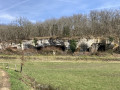
(11) At the junction, turn right. The signposts to follow are once again nos. 3 and 4. Walk for about 1 km and turn left to cross the meadows towards the clearly visible caves.
(12) Facing the cliff, turn right and follow the road for 1.2 km until you reach a right-hand bend.
(13) Leave the road by turning left, pass the Fontaine du Grand Fond washhouse and climb the clearly marked hill of the same name.
(14) At the road in the hamlet of Bouyssou, turn left and continue straight on, passing a large pylon. At the 90° left-hand bend, take the track opposite for 150 m.
(15) At a place called La Tuilière, after the electricity pylon, turn right, enter the forest and carry on to the next road.
(16) Cross with care, climb the Brouillet hill and follow the path. After the isolated cottage, continue to the left and, at the next crossroads, take the path on the right which leads back into the forest. After about a hundred metres, you’ll reach the start of a faint path that winds sharply to the right.
(17) Follow this path straight on for 2 km and you’ll reach a fork after a gentle descent (junction with route no. 2).
(18) Turn left and continue to the next road, following signposts 2, 3 and 4. Cross with care at the hamlet of Coualong and carry on straight ahead to the Route des Chênes.
(19) Turn right at the three-way junction on the road, which continues as a forest track to the Mas du Bonnet; this is a three-way junction with no Trail markers.
(20) Turn left and head down towards the bottom of the valley, following the path on the right-hand side. At the very bottom, turn left and make your way through the village of Bayac until you reach the car park at Place Louise Mazeau (DA)


 Visorando Member
 Easy
Easy 
 Moderate