Lalinde – Limeuil

The third stage follows the bends of the Dordogne, taking in the villages of Mauzac and Trémolat, before finishing in the village of Limeuil, one of the most beautiful villages in France.

This walk is part of a multi-day hike: Les méandres de la Dordogne

Details

n°1139380
Creation:
Last update:
Last review:
  • Walking
    Activity: Walking
  • ↔
    Distance: 16.34 mi
  • ◔
    Average duration: 9h 00 
  • ▲
    Difficulty: Difficult

  • ⚐
    Back to start: No
  • ↗
    Ascent: + 1,719 ft
  • ↘
    Descent: - 1,286 ft

  • ▲
    Highest point: 640 ft
  • ▼
    Lowest point: 125 ft
  • ⚐ Country: France
  • ⚐
    Area: Périgord
  • ⚐ City: Lalinde (24150)
  • ⚑
    Start: N 44.839621° / E 0.761658°
  • ⚑
    End: N 44.912539° / E 0.891449°
  • ❏
    IGN map(s): Ref. 1936ET, 1936O
  • Hour-by-hour weather

Photos

Description of the walk

(S) Set off from the Guillou campsite. Head for the right bank of the Lalinde Canal and ignore theGR®6markings; keep the path running parallel to the left bank of the canal in sight. Continue along the right bank towards Port de Badefols.

(1) Continue along theGR®6, following the Chemin des Pêcheurs to the Mauzac dam, and enter the village of Mauzac by turning left after the railway bridge. Then turn right and walk to the end of the street, continuing straight on at the next junction.

(2) Turn left and stay on theGR®6. Begin your climb towards the theatre, then walk alongside the Dordogne towards Les Combes. Follow the red and white markings to Millac.

(3) At the T-junction, go straight on and follow the shared route ofthe GR®6and theGR® de Pays Dordogne towards Périnou. Leave this hamlet via a path on the right. Join the road at a hairpin bend.

(4) Turn left at this bend onto an uphill path, then turn right towards La Veyssière.

(5) At the junction, turn right towards Lartigue Haut, then left onto a wide path through the woodland.

(6) Head down to the right along the path through the woods, following the red and white markings leading to the Cingle de Trémolat.

(7) Continue straight ahead along a wide dirt track. Turn slightly right at the crossroads. Head down towards Les Cireys and carry on towards the Croix de la Chappelle. Turn left onto the D30 as far as Trémolat church, where there is a drinking water tap.

(8) rejoin theGR®6on the D30 towards Moulin d’Amont. Continue north and you’ll soon come to another junction.

(9) Turn right towards Grèze. Then head uphill towards La Borie Haute and Peyrelevade. At the large shed, turn right then left onto the D31 towards Le Bugue. You’ll reach the houses at La Pénétie.

(10) At the farm, keep right towards Leyrat and head for these houses.

(11) Join the D31 on the right towards the Dordogne, following it at a distance along its right bank. Reach Beauregard.

(12) Opposite the Hôtel Beauregard, turn left onto theGR®6. Continue to the junction with the hamlets of Les Vignes and Pechnau.

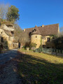
(13) In Pechnau, follow the red and white markings to pass through the magnificent village of Limeuil. Head towards the church and leave the village via the Route des Crêtes. Continue towards Campet, then Piquette, Chante Alouette and Carlux.

(14) Turn right at the Peygradou crossroads and leave the reservoir on your left. At the next hairpin bend, turn right onto the path leading down through the woods to reach the campsite in the forest (E).

Waypoints

  1. S : mi 0 - alt. 125 ft - Guillou Campsite - Dordogne (fleuve)
  2. 1 : mi 1.34 - alt. 151 ft - GR6 junction, Chemin des Pêcheurs - Canal de Lalinde
  3. 2 : mi 3.13 - alt. 164 ft - Turn left onto the GR6
  4. 3 : mi 5.04 - alt. 466 ft - Crossroads: go straight on
  5. 4 : mi 5.89 - alt. 381 ft - Crossroads, turn left
  6. 5 : mi 6.28 - alt. 614 ft - Turn right towards Lartigue
  7. 6 : mi 6.84 - alt. 545 ft - Head down to the right
  8. 7 : mi 8.01 - alt. 443 ft - Opposite, on a wide dirt track
  9. 8 : mi 9.34 - alt. 174 ft - Turn left, towards the Moulin d’Amont
  10. 9 : mi 9.97 - alt. 197 ft - Turn right towards Grèze
  11. 10 : mi 11.32 - alt. 427 ft - Turn right at the farms, towards Leyrat
  12. 11 : mi 11.89 - alt. 187 ft - D31, turn right towards Le Bugue
  13. 12 : mi 12.73 - alt. 413 ft - Hôtel Beauregard, on the left
  14. 13 : mi 13.41 - alt. 338 ft - Pechnau
  15. 14 : mi 15.74 - alt. 564 ft - Crossroads, turn right
  16. E : mi 16.34 - alt. 535 ft - Campsite

Notes

(1) Mauzac: a local grocery shop and the Banana Bar, where you can enjoy breakfast in the friendliest of atmospheres.
(8) Drinking water behind the church.
Good walking shoes.

Worth a visit

Always be cautious and plan ahead when you're outdoors. Visorando and the author of this route cannot be held responsible for any accidents occurring on this route.

The GR® and PR® markings are the intellectual property of the Fédération Française de Randonnée Pédestre.

Reviews and comments

4.3 / 5
Based on 2 reviews

Reliability of the description
4 / 5
Ease of following the route
4.5 / 5
Route interest
4.5 / 5
Mathilde B
Mathilde B

Overall rating : 4.7 / 5

Date of your route : Aug 24, 2021
Reliability of the description : ★★★★☆ Good
Ease of following the route : ★★★★★ Very good
Route interest : ★★★★★ Very good
Very busy route : No

Partially completed route: from Lalinde to Trémolat in 3 hours.
It’s not too difficult, with just a few gentle climbs, but the views over the Dordogne gorges are well worth the effort! It’s easy to find shade along the route, which is lovely when the sun is beating down.
I took a detour to visit the Trémolat Cingle viewpoint: very pretty, well worth a visit!
I regret not having started in Mauzac, as the Lalinde–Mauzac section was less interesting: you follow the canal for several kilometres, which is a bit monotonous on foot.

Machine-translated

braudjeanmarie1952
braudjeanmarie1952

Overall rating : 4 / 5

Date of your route : Oct 22, 2018
Reliability of the description : ★★★★☆ Good
Ease of following the route : ★★★★☆ Good
Route interest : ★★★★☆ Good

A lovely walk, but we had trouble finding parking spaces for the vehicle (a 71-seater coach)

Machine-translated

Other walks in the area

For more walks, use our search engine .

The GPS track and description are the property of this route's author. Please do not copy them without permission.