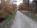
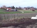
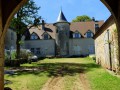
Circular path through the woods at Billet, Roset-Fluans

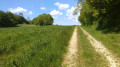
An easy family walk through a communal woodland adjoining the great Chaux Forest. Narrow paths, wide avenues and dirt tracks make up this route. In some places, you’ll need a bit of a sense of direction, as the paths are barely visible. You’ll also get a good insight into the different stages of forest management.

Details

1611478
Creation:
Last update:
Last review:
  • Walking
    Activity: Walking
  • ↔
    Distance: 4.15 mi
  • ◔
    Average duration: 2h 00 
  • ▲
    Difficulty: Easy

  • ⚐
    Back to start: Yes
  • ↗
    Ascent: + 98 ft
  • ↘
    Descent: - 102 ft

  • ▲
    Highest point: 912 ft
  • ▼
    Lowest point: 801 ft

Photos

Description of the walk

The car park for this short walk is situated at the Corne de Chaux hunting lodge, in the hamlet of Roset-Fluans on the border with the Jura department.

(S/E) Set off again at the edge of the forest, take the path on the right and continue through the coppice to reach a main track.

(1) Take the track on the right to reach a lane, which you’ll follow to the left for a few metres.

Take the first path running alongside the felling area. It may be blocked by felled tree trunks. Carry on until you reach the forest track visible 10 metres to the right.

(3) Take this forest track. Cross the county road and continue along this track until you reach a second county road (D73). Do not join it.

(4) At the ‘No Entry’ sign visible on your left, take the path leading uphill to the right along the edge of the forest. After a few short steep climbs and descents, you’ll reach a junction at the edge of a clear-cut area.

(5) Leave this lovely path and turn right onto this pleasant but very overgrown track. Carry on straight ahead until you reach a wide forest lane coming from the huts at Salans, a hamlet visible on your left. Turn right and follow it for a few dozen metres.

(6) Leave this lovely forest lane by turning left. Follow this path, and after a right-hand bend, you’ll cross a very overgrown area. You’ll reach a county road, which you cross to continue on the other side. Walk for about 250 metres until you find a red-painted marker on the ground.

(7) Then turn left onto a very faint track, marked only here and there by a narrow path between the trees or paint marks on the tree trunks. When you reach a more clearly marked forest track, follow it to the right to join the forest road. Turn left to reach the car park (S/E).


Waypoints

  1. S/E : mi 0 - alt. 889 ft - La Corne de Chaux hunting lodge
  2. 1 : mi 0.25 - alt. 899 ft - Route on the right
  3. 2 : mi 0.57 - alt. 912 ft - Path along the edge of the felling area
  4. 3 : mi 0.96 - alt. 883 ft - Forest track
  5. 4 : mi 1.64 - alt. 801 ft - Turn right
  6. 5 : mi 2.37 - alt. 892 ft - Exit the route to the right
  7. 6 : mi 2.78 - alt. 899 ft - Leave the forest track
  8. 7 : mi 3.44 - alt. 889 ft - Turn left
  9. S/E : mi 4.15 - alt. 889 ft - La Corne de Chaux hunting lodge

Reviews and comments

4.3 / 5
Based on 3 reviews

Reliability of the description
4.5 / 5
Ease of following the route
4 / 5
Route interest
4.3 / 5
pnuninger
pnuninger

Hello and thank you for your review.
It’s been about five years since this walk was first described. I imagine the vegetation has changed quite a bit, and the undergrowth must have thickened considerably, obscuring the narrow paths. I’m delighted that you enjoyed the route despite this.
Best regards. Happy hiking

Machine-translated

GRIGRI25
GRIGRI25

Overall rating : 4.3 / 5

Date of your route : Apr 28, 2026
Reliability of the description : ★★★★☆ Good
Ease of following the route : ★★★★☆ Good
Route interest : ★★★★★ Very good
Very busy route : No

A lovely walk through the woods. The sections through the coppice are difficult to follow. I wouldn’t recommend this route to anyone without a GPS.
Apart from these two sections of coppice, the walk is very pleasant and easy.

Machine-translated

pnuninger
pnuninger

Thank you for your feedback. The coppice is becoming impenetrable. With all the rain we’ve had this year, the vegetation is growing at an incredible rate.
The walks described are often just suggestions; everyone can adapt them to suit their own preferences. The important thing is to enjoy yourself.

Machine-translated

piccolopripri
piccolopripri

Overall rating : 3.5 / 5

Date of your route : Aug 21, 2024
Reliability of the description : Not used / Not applicable
Ease of following the route : ★★★★☆ Good
Route interest : ★★★☆☆ Average
Very busy route : No

Hi, the approach to the (hunting) lodge is lovely. After that, it was impossible to ‘carry on through the thickets’. So I turned back, went past the kilometre marker, and then turned left. At point 2, I decided to take the next track – a wide path that can be damp or even worse, depending on whether it’s rained recently or not. At elevation 252 on the map, I reached point 6 as I didn’t have much time, then I veered right before elevation 275 as the path was very pleasant.
A pleasant walk in summer as it’s through the forest. Nothing exceptional, but a forest with wide paths that are a pleasure to walk along.

Machine-translated

pnuninger
pnuninger

Hello. Thank you for your very positive review. I’m glad you enjoyed it. Have a lovely hike and a lovely day

Machine-translated

Ghyslain
Ghyslain

Overall rating : 5 / 5

Date of your route : May 02, 2021
Reliability of the description : ★★★★★ Very good
Ease of following the route : Not used / Not applicable
Route interest : ★★★★★ Very good
Very busy route : No

A very pleasant, peaceful walk...
No difficulty at all
I’d definitely recommend it!!

Machine-translated

Other walks in the area

For more walks, use our search engine .

The GPS track and description are the property of this route's author. Please do not copy them without permission.