Circular route from Routelle to Velesmes via the Bois des Saussottes

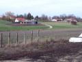
This short, easy family walk will take you through the woods from the Vaugrenans valley to Velesmes, before returning via the outskirts of Benusse and its mill.

Details

1657203
Creation:
Last update:
Last review:
  • Walking
    Activity: Walking
  • ↔
    Distance: 3.57 mi
  • ◔
    Average duration: 1h 50 
  • ▲
    Difficulty: Easy

  • ⚐
    Back to start: Yes
  • ↗
    Ascent: + 174 ft
  • ↘
    Descent: - 167 ft

  • ▲
    Highest point: 968 ft
  • ▼
    Lowest point: 751 ft
  • ⚐ Country: France
  • ⚐ City: Routelle (25410)
  • ⚑
    Start/End: N 47.179852° / E 5.858523°
  • ❏
    IGN map(s): Ref. 3323ET, 3323O
  • Hour-by-hour weather

Photos

Description of the walk

The route starts at the Vaugrenans valley in Routelle. The sign for ‘ruins’ is only visible on the map. There are no visible marks on the ground.

(S/E) Head straight on towards the woods.

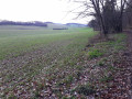
(1) At the first junction, turn right along the edge of the woodland. Continue along this pleasant path, passing a gate blocking access, and head towards the first houses of Velesmes-Essarts.

(2) Leave the white track at the junction with a path coming in from the right, between the houses, and take the path on the left directly opposite. At the junction with the main track, turn right and join a tarmac road, which you follow straight on until you reach a three-way junction.

(3) At this crossroads, take the Chemin de l’Orée du Bois on the left and head downhill. Further down, at the bend to the right, take the path on the left which enters the forest after the gate. Continue on and pass through the fir forest.

(4) At the foot of the small hill, head down to the right along a faintly marked path to reach the edge of the meadows
Go round the small pond and turn onto the forest track to the left, ignoring the path that heads off to the right towards the hamlet of Benusse.
Carry on along the pastures until you reach a turning area for timber lorries. Look for a small path through the tall grass, slightly to the left. Step over the stream and, on the wide track, head left.

(5) At the edge of the meadow, turn left to cross the stream again. Leave the white track when it starts to climb to the right. Take the path that runs alongside a damp, muddy ditch to rejoin, further on, the junction where you started.

(1) At the stone block blocking the path, turn right and return to the car park (S/E).

Waypoints

  1. S/E : mi 0 - alt. 846 ft - Ruins of Vaugrenans
  2. 1 : mi 0.15 - alt. 863 ft - Crossroads at the end of the circular loop
  3. 2 : mi 0.87 - alt. 938 ft - Path on the left
  4. 3 : mi 1.15 - alt. 938 ft - Path at the edge of the wood
  5. 4 : mi 2.08 - alt. 823 ft - Descent to the right
  6. 5 : mi 2.85 - alt. 774 ft - Crossroads on the left
  7. S/E : mi 3.57 - alt. 843 ft - Ruins of Vaugrenans

Reviews and comments

4.3 / 5
Based on 4 reviews

Reliability of the description
4.5 / 5
Ease of following the route
4.3 / 5
Route interest
4 / 5
pnuninger
pnuninger

Thank you for your comment. The vegetation must have changed quite a bit since this route was published.
Enjoy your walks

Machine-translated

jfaivre
jfaivre

Overall rating : 3.7 / 5

Date of your route : Jul 20, 2026
Reliability of the description : ★★★★☆ Good
Ease of following the route : ★★★☆☆ Average
Route interest : ★★★★☆ Good
Very busy route : No

After point 4, it’s tricky to find the path leading down to the pond.
Otherwise, there are no problems following this route. There isn’t necessarily any shade along the whole route.

Machine-translated

pnuninger
pnuninger

Thank you very much for your comment. I’m delighted you enjoyed this little walk.
Happy hiking to you

Machine-translated

père fourass
père fourass
• Edited:

Overall rating : 4 / 5

Date of your route : May 30, 2022
Reliability of the description : ★★★★☆ Good
Ease of following the route : ★★★★☆ Good
Route interest : ★★★★☆ Good
Very busy route : No

A truly pleasant, relaxing walk through woodland and along forest edges. Best done in dry weather; walking shoes or trainers are fine. Enjoy it with friends, family or colleagues… with a picnic in your basket .

Machine-translated

pnuninger
pnuninger

Thank you for your comment.
I try to offer walks of varying lengths and levels of difficulty to suit as many people as possible.
There’s a wide variety in Boussieres and the surrounding area.
Enjoy your walks.

Machine-translated

Le Garenne 25
Le Garenne 25

Overall rating : 4.7 / 5

Date of your route : Apr 05, 2021
Reliability of the description : ★★★★★ Very good
Ease of following the route : ★★★★★ Very good
Route interest : ★★★★☆ Good
Very busy route : No

A lovely little walk for the whole family, from 4 to 80 years old or older. Unlike the previous comment, I didn’t notice any hills? On an IGN map, the elevation gain is 84 metres over a distance of 5.5 km – very easy to manage. I wouldn’t recommend travelling from far afield just for this route, but for people living nearby, the two valleys are very pleasant – no traffic noise. It’s also possible to explore alternative routes as the woods are full of paths: a lovely Sunday outing for locals looking for a walk suitable for all abilities.

Machine-translated

dynou
dynou

Overall rating : 5 / 5

Date of your route : Jun 02, 2020
Reliability of the description : ★★★★★ Very good
Ease of following the route : ★★★★★ Very good
Route interest : Not used / Not applicable
Very busy route : Yes

An easy walk for the pleasure of walking together, requiring some physical effort with steep inclines and gentle descents.
The description was very clear, as I completed the route without getting lost and within the time stated.
Thank you for suggesting this walk.

Machine-translated

Other walks in the area

For more walks, use our search engine .

The GPS track and description are the property of this route's author. Please do not copy them without permission.