Around Fourg via forest tracks and paths

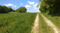
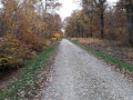
A lovely walk around Fourg, alternating between dirt tracks and forest paths. You’ll reach the site of the reconstructed old village in the forest, with huts erected for the traditional crafts festival.
After crossing some meadows, you’ll reach the highest point of this route via a short, steep climb through the forest. The return journey takes you along lovely paths through a small valley on the outskirts of the village.

Details

28727571
Creation:
Last update:
Last review:
  • Walking
    Activity: Walking
  • ↔
    Distance: 6.42 mi
  • ◔
    Average duration: 3h 30 
  • ▲
    Difficulty: Moderate

  • ⚐
    Back to start: Yes
  • ↗
    Ascent: + 640 ft
  • ↘
    Descent: - 650 ft

  • ▲
    Highest point: 1,345 ft
  • ▼
    Lowest point: 843 ft
  • ⚐ Country: France
  • ⚐ City: Fourg (25440)
  • ⚑
    Start/End: N 47.097761° / E 5.810496°
  • ❏
    IGN map(s): Ref. 3324ET
  • Hour-by-hour weather

Description of the walk

The route starts from the car park in the village square near the town hall.

(S/E) Leave the town hall on your left and walk up the main street to the junction with the Route de Byans.

(1) Turn left onto the Chemin du Bas de Chirey. At the Fork in the road, turn right. At the next Fork in the road, keep left, ignoring the paths leading off to the left and right.

(2) Enter the forest and continue straight on, skirting large sinkholes. Take the path leading uphill and you’ll reach a major junction of forest tracks.

(3) Take the path on the left heading south; it is well-marked and gravelled in places. Carry on until you reach a large clearing on a forest track.

(4) You are now at the site of the old village, which has been reconstructed for the traditional crafts festival. Look out for a lovely path leading off between two huts, heading almost back towards the path you came from. It soon turns right onto a very pretty lane. Further on, you’ll reach the hunting lodge; continue left along the tarmac forest track for about 200 m.

(5) As the road begins to curve to the left, look out for a forest track on the right. Take this to reach a pasture and walk along its right-hand side for about a hundred metres. Then turn left onto the service track to reach a dirt track.

(6) Follow the dirt track to the left for about 150 m. Turn right into the meadows onto a grassy path. At the first junction, turn left, then right at the next one, heading south-east towards the forest.

(7) In a copse, turn left onto the stony track, which you’ll soon leave to head through the middle of a hedge onto a lovely track. After a bend to the right and then to the left, continue straight up the slope for a few hundred metres until you reach a T-junction.

(8) At the top of this steep section, turn left and rejoin the tarmac forest road. Take it to the left and follow it for about 1.5 km until you reach the junction with theGR®59, with the junction with the D441 in sight.

(9) TheGR®59crosses your path; after following it for about thirty metres, turn left onto it to reach the D441. Cross the road carefully and continue along the path on the other side. At the edge of the forest, continue to your left until you reach the stony track.

(10) Then leave theGR®59by heading up this track on your left to join the D105. Turn left carefully to reach the village entrance and the junction with the D441.

(11) Take this road to the left towards Liesle, then, about 100 metres further on, turn right down Rue de l’Étang towards the village, passing by the farm. Continue along this street to reach your car park (S/E).


Waypoints

  1. S/E : mi 0 - alt. 883 ft - Village square – Town Hall
  2. 1 : mi 0.12 - alt. 899 ft - Chemin du Bas de Chirey
  3. 2 : mi 0.73 - alt. 886 ft - Entrance to the forest
  4. 3 : mi 1.2 - alt. 863 ft - Crossroads of forest tracks
  5. 4 : mi 1.56 - alt. 909 ft - Site of the old village
  6. 5 : mi 2.26 - alt. 899 ft - Forest track
  7. 6 : mi 2.54 - alt. 869 ft - Dirt track
  8. 7 : mi 3.13 - alt. 909 ft - Junction on a stony track
  9. 8 : mi 3.69 - alt. 1,207 ft - T-junction – Top of the steep slope
  10. 9 : mi 4.81 - alt. 1,060 ft - GR®59 to the left
  11. 10 : mi 5.62 - alt. 879 ft - GR®59 junction / Gravel track
  12. 11 : mi 6.14 - alt. 961 ft - On the left: Route de Liesle D441
  13. S/E : mi 6.42 - alt. 879 ft - Village square

Always be cautious and plan ahead when you're outdoors. Visorando and the author of this route cannot be held responsible for any accidents occurring on this route.

The GR® and PR® markings are the intellectual property of the Fédération Française de Randonnée Pédestre.

Reviews and comments

3.9 / 5
Based on 3 reviews

Reliability of the description
3.5 / 5
Ease of following the route
4.3 / 5
Route interest
4 / 5
cnu25
cnu25

Hello @yoko25.....thank you for your feedback on this walk – I look forward to seeing you on other routes.....have a lovely day

Machine-translated

Yoko25
Yoko25

Overall rating : 4.5 / 5

Date of your route : Mar 31, 2025
Reliability of the description : Not used / Not applicable
Ease of following the route : ★★★★☆ Good
Route interest : ★★★★★ Very good
Very busy route : No

A very pleasant walk on this spring day. Lots of flowers in the forest. The lowland forest is in good health, which is lovely to see! Not quite so much on the hillsides, but the paths are fairly well-preserved.
There’s a short stretch of tarmac to start with, but no traffic.
There are several points where you can shorten the route and head back to the village.

Machine-translated

IDEFIX25
IDEFIX25

Overall rating : 4 / 5

Date of your route : Jul 31, 2023
Reliability of the description : ★★★★☆ Good
Ease of following the route : ★★★★★ Very good
Route interest : ★★★☆☆ Average
Very busy route : No

A lovely walk overall

Machine-translated

Labourey
Labourey
• Edited:

Overall rating : 3.7 / 5

Date of your route : Jun 07, 2023
Reliability of the description : ★★★☆☆ Average
Ease of following the route : ★★★★☆ Good
Route interest : ★★★★☆ Good
Very busy route : No

Between points (7) and (9), the description is not precise enough. There are many paths, which means you end up having to navigate by guesswork. Even so, you do eventually reach point (9).

Machine-translated

Other walks in the area

For more walks, use our search engine .

The GPS track and description are the property of this route's author. Please do not copy them without permission.