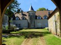
Around La Chaux-à-Fourg

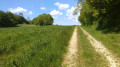
A short, easy family walk through woods and meadows around Fourg.

Details

n°20508375
Creation:
Last update:
Last review:
  • Walking
    Activity: Walking
  • ↔
    Distance: 3.53 mi
  • ◔
    Average duration: 1h 50 
  • ▲
    Difficulty: Easy

  • ⚐
    Back to start: Yes
  • ↗
    Ascent: + 240 ft
  • ↘
    Descent: - 243 ft

  • ▲
    Highest point: 1,040 ft
  • ▼
    Lowest point: 860 ft
  • ⚐ Country: France
  • ⚐ City: Fourg (25440)
  • ⚑
    Start/End: N 47.098179° / E 5.816995°
  • ❏
    IGN map(s): Ref. 3324ET
  • Hour-by-hour weather

Description of the walk

To get to the start from Fourg, follow the D105 towards Byans-sur-Doubs and, on the bend just before the end of the climb, take thefirst track on the left. Park near the old football pitch.

(S/E) Walk down to the D105 and turn left until you reach the left-hand bend in the road.

(1) Leave the D105 and carry on straight ahead along the unpaved track. This descends gently to join theGR®59, which you should follow until you reach the D105 again.

(2) Cross the departmental road with care whilst continuing straight on along theGR®59until it branches off to the right into the forest.

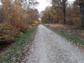
(3) Leave theGR®59and take the stony track on the left, which leads to a tarmac road.

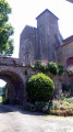
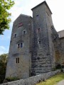
(4) Turn left and head towards the village, leaving the farm track on your left.

(5) Turn left onto the Chemin des Champs Mafraux and head uphill to the left into the woods.

(6) Take the first forest track on the right and continue through the housing estate to reach the county road. Turn left and, after 100 m, turn left again to reach the car park (S/E).


Waypoints

  1. S/E : mi 0 - alt. 1,037 ft - Car park near the old football pitch
  2. 1 : mi 0.23 - alt. 974 ft - Junction with the dirt track
  3. 2 : mi 1.02 - alt. 932 ft - Crossing the main road
  4. 3 : mi 1.61 - alt. 912 ft - Junction and end of the GR
  5. 4 : mi 1.79 - alt. 932 ft - Junction on a tarmac road
  6. 5 : mi 2.73 - alt. 906 ft - Chemin des Champs Mafraux
  7. 6 : mi 2.94 - alt. 974 ft - Junction on a forest track
  8. S/E : mi 3.53 - alt. 1,040 ft - Car park near the old football pitch

Always be cautious and plan ahead when you're outdoors. Visorando and the author of this route cannot be held responsible for any accidents occurring on this route.

The GR® and PR® markings are the intellectual property of the Fédération Française de Randonnée Pédestre.

Reviews and comments

4.2 / 5
Based on 2 reviews

Reliability of the description
4 / 5
Ease of following the route
4.5 / 5
Route interest
4 / 5
G. Philippe
G. Philippe

Overall rating : 4.3 / 5

Date of your route : Sep 08, 2024
Reliability of the description : ★★★★★ Very good
Ease of following the route : ★★★★★ Very good
Route interest : ★★★☆☆ Average
Very busy route : No

A lovely walk in the countryside. I preferred the first part, through the fields and woodland. I had no trouble following the route thanks to the map and the instructions.

Machine-translated

cnu25
cnu25

Hello, could you tell me which part isn’t explained clearly, as I’m new to writing route descriptions and this would help me with my future descriptions? Is it the map or the description of the walk? Thank you for your reply.

Machine-translated

michel.francois
michel.francois

Overall rating : 4 / 5

Date of your route : May 02, 2022
Reliability of the description : ★★★☆☆ Average
Ease of following the route : ★★★★☆ Good
Route interest : ★★★★★ Very good
Very busy route : No

A PLACE THAT IS DIFFICULT TO DESCRIBE

Machine-translated

Other walks in the area

For more walks, use our search engine .

The GPS track and description are the property of this route's author. Please do not copy them without permission.